690 Colombo Street, Christchurch Central City
12 reports on record since August 2017 · 7 with photographs. The street’s heaviest record is 794 Colombo Street — 159 reports on file. Indicative rating valuation and school zones, hazards, bin day and what stood here before.
What gets reported here
Photographed here 7 on record


Reported here
 Vandalism - General —
 Damaged sign.
 Graffiti on a fence, building or structure —
 Tagging ok. The menswear Roller shutter and Fire Escape roller shutter on Colombo st entrance of Ballantynes
 Graffiti —
 Graffiti on seat to remove
 Graffiti —
 On Colombo St, Ballantynes fire exit entrance
- Graffiti —
- Poles and Signage - General —
- Graffiti —
- Graffiti —
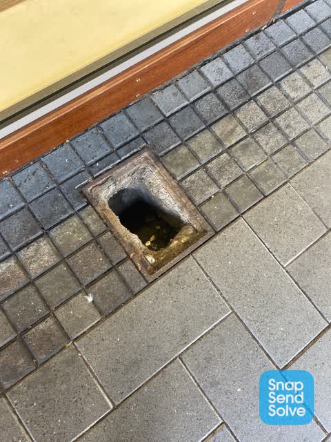
 Roading/Streets —
 Known vagrant Reagan MAINDONALD stole the metal cover at 11.32pm 28/5. Ballantynes will report this to police via Auror as Reagan is a polic
- Roading/Streets —
the pedestrian crossing activates when no one has activated them. changes every 15 seconds
Roading/Streets —
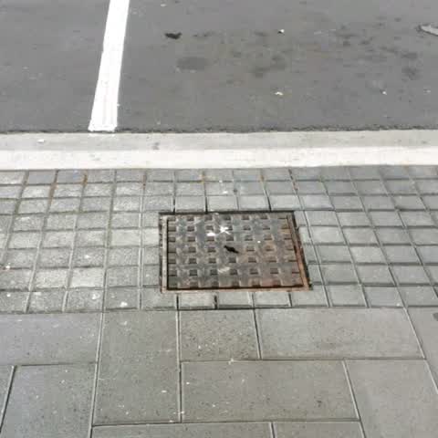
Loose SW chamber lid, needs resetting
Roading/Streets —
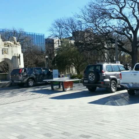
New tiled area prev used by lunchers now a car park for trucks and cars. Cannot even use table tennis. Dangerous. This was supposed to be ne
Also reported on Colombo Street
- 794 Colombo Street — 159 reports
- 673 Colombo Street — 102 reports
- 781 Colombo Street — 55 reports
- 521 Colombo Street — 46 reports
- 722 Colombo Street — 45 reports
- 569 Colombo Street — 45 reports
- 527 Colombo Street — 41 reports
- 711 Colombo Street — 38 reports
The street’s crash record
NZTA’s record names Colombo Street in 177 crashes that hurt somebody since 2006 — 1 person killed, 32 seriously hurt.
The green nearby
- City Mall — 32 m to the edge
- High Street Triangles — 85 m to the edge
- The Stewart Plaza — 116 m to the edge
- Cathedral Square — 239 m to the edge · Botanic
- Friendship Corner — 260 m to the edge · Botanic
Parks within half a kilometre, measured to the boundary — the council’s open data.
The civic shelf nearby
- Triangle — 86 m away · Car park
- Re:start - Lichfield St — 157 m away · Car park
- Turanga Library — 377 m away · Library · Cathedral Square, Christchurch
- Civic Offices — 447 m away · Council office
- Scales — 467 m away · Car park
Libraries, halls and the rest within half a kilometre — the council’s open data.
On the doorstep
- Barkers' — 10 m away · Clothing
- Workshop — 11 m away · Clothing
- Greenwood Roche — 15 m away · Business
- Modern Man Barbershop — 16 m away · Hairdressers
Businesses within four hundred metres, measured at the pin — OpenStreetMap and the council directories.
The bus nearby
- Bus Interchange (Intercity stop) — 89 m away · route 3, route 8, route 80
- Bus Interchange (Platform B) — 125 m away · route 1, route 7, route 8, route 27, route 44, route 91, route 92, route 95
The closest Metro stops, within four hundred and fifty metres.
The tracks through here
- Walk and bike track through Christchurch Central City — 201 m to the line · walk · bike
- Walk and bike track through Christchurch Central City — 235 m to the line · walk · bike
- Walk and bike track through Christchurch Central City — 237 m to the line · walk · bike
- Walk and bike track through Christchurch Central City — 247 m to the line · walk · bike
- Walk and bike track through Christchurch Central City — 276 m to the line · walk · bike
Tracks whose line passes within half a kilometre, measured to the line itself — the council’s open data.
The named ground
Named water within 500 m of this address, measured to the line or the edge; Named places within 1.5 km of this address; the council’s own structure register — bridges, boardwalks and steps standing nearby — the open map’s record.
The remembered names nearby
- Te Kiheru Wai o Tahu / the Canoe Bailer of Tahu / 2015 — 147 m away ·
Te Kiheru Wai o Tahu / The Canoe Bailer of Tahu / 2015 / (MÄori text and English translat
· 2015
Inscribed plaques within two hundred and fifty metres — the register’s pins, not surveyed spots. The whole roll is at /plaques.
Renting nearby
new bonds in Christchurch Central City ran about $508 a week — $42 below the city median of $550 — the suburb page keeps the rent record →.
What was here — Former Beaths Department Store (components)
on this spot · 201/690 Colombo Street · located to ±21 m · the place’s own record →
On the register. Nothing researched here yet.
What was here — Triangle Reserve and Setting
102 m away · 261F High Street · located to ±18 m · the place’s own record →
On the register. Nothing researched here yet.
What was here — Triangle Reserve and Setting
129 m away · 291F High Street · located to ±18 m · the place’s own record →
On the register. Nothing researched here yet.
What was here — Triangle Reserve and Setting
153 m away · 220F High Street · located to ±17 m · the place’s own record →
On the register. Nothing researched here yet.
What was here — Commercial Building and Setting
181 m away · 225 High Street · located to ±19 m · the place’s own record →
On the register. Nothing researched here yet.
The civic layer
This ground votes in Central ward — the Papanui-Innes-Central community board. Ward lines don’t always follow suburb lines; this one is measured at the pin, not the suburb’s centre.
What stood on this ground → · On the map → · From the air — the Crown’s aerials back to 1936; search the address on RetroLens →
Questions, answered briefly
12 council reports on record since August 2017 — most often graffiti (5), roading/streets (4), vandalism - general (1).
Christchurch Central City, Christchurch — on Colombo Street.
The heritage register names 5 places at or beside it — Former Beaths Department Store (components), Triangle Reserve and Setting.
City Mall — 32 m to its edge.