72 Tuam Street, Christchurch Central City
17 reports on record since October 2022 · 6 with photographs. The street’s heaviest record is 278 Tuam Street — 89 reports on file. Indicative rating valuation and school zones, hazards, bin day and what stood here before.
What gets reported here
Photographed here 6 on record



Reported here
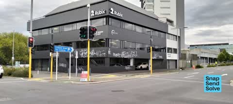
 Graffiti on a fence, building or structure —
Graffiti on building
 Graffiti on a fence, building or structure —
White paint tag on footpath barrier at 72 Tuam Street.
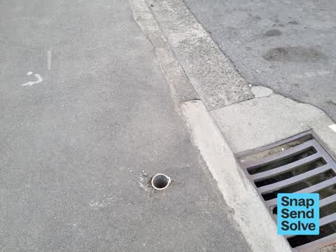
 Pavement - Damaged —
Broken glass on the footpath on Montreal Street corner of Tuam Street needs removal ASAP. OHS issue for barefoot pedestrians and animals at
 Graffiti somewhere else —
 Hazard — vehicle —
Lots of cars backed up waiting to turn left but for a red arrow and not a cyclist in site. Please could you reduce the time setting on this
 Road Signage —
Road signage uprooted. Unenforceable.
- Graffiti —
- Graffiti —
- Graffiti —
- Graffiti —
- Graffiti —
- Graffiti —
- Road Signage —
- Graffiti —
- Graffiti —
- Graffiti —
- Graffiti —
Also reported on Tuam Street
- 278 Tuam Street — 89 reports
- 286 Tuam Street — 52 reports
- 16 Tuam Street — 52 reports
- 94 Tuam Street — 47 reports
- 189 Tuam Street — 38 reports
- 322 Tuam Street — 31 reports
- 284 Tuam Street — 29 reports
- 290 Tuam Street — 28 reports
The street’s crash record
NZTA’s record names Tuam Street in 144 crashes that hurt somebody since 2006 — 18 seriously hurt, nobody killed.
The green nearby
- Tiffany Reserve — 209 m to the edge
- Friendship Corner — 291 m to the edge · Botanic
- Bridge Of Remembrance — 320 m to the edge · Botanic
- Botanic Gardens — 331 m to the edge · Botanic · 21 ha
- Nurses Memorial Chapel — 496 m to the edge · Botanic
Parks within half a kilometre, measured to the boundary — the council’s open data.
The civic shelf nearby
- Scales — 223 m away · Car park
- Civic Offices — 415 m away · Council office
- Re:start - Lichfield St — 465 m away · Car park
Libraries, halls and the rest within half a kilometre — the council’s open data.
On the doorstep
- Lexus of Christchurch — 34 m away · Car dealers
- Rubix — 44 m away · Company
- Discover Travel — 52 m away · Travel agents
- Miles Continental Volkswagen — 60 m away · Car dealers
Businesses within four hundred metres, measured at the pin — OpenStreetMap and the council directories.
The bus nearby
- St Asaph St near Montreal St — 123 m away · route 3, route 5, route 7, route 60, route 80, route 81, route 84, route 85, route 86
- Christchurch Hospital Main Stop EB — 240 m away · route 3, route 5, route 7, route 60, route 80, route 81, route 84, route 85, route 86, route 91, route 92
The closest Metro stops, within four hundred and fifty metres.
The tracks through here
- Walk and bike track through Christchurch Central City — 9 m to the line · walk · bike
- Walk and bike track through Christchurch Central City — 227 m to the line · walk · bike
- Walk and bike track through Christchurch Central City — 227 m to the line · walk · bike
- Walk and bike track through Christchurch Central City — 243 m to the line · walk · bike
- Walk and bike track through Christchurch Central City — 249 m to the line · walk · bike
Tracks whose line passes within half a kilometre, measured to the line itself — the council’s open data.
The named ground
Named water within 500 m of this address, measured to the line or the edge; Named places within 1.5 km of this address; the council’s own structure register — bridges, boardwalks and steps standing nearby — the open map’s record.
Renting nearby
new bonds in Christchurch Central City ran about $508 a week — $42 below the city median of $550 — the suburb page keeps the rent record →.
What was here — Former Dwelling and Setting
173 m away · 14 Oxford Terrace · located to ±15 m · the place’s own record →
On the register. Nothing researched here yet.
What was here — Commercial Building and Setting
185 m away · 65 Cambridge Terrace · located to ±25 m · the place’s own record →
On the register. Nothing researched here yet.
What was here — Rhododendron Island and Setting
220 m away · 78 Cambridge Terrace · located to ±37 m · the place’s own record →
On the register. Nothing researched here yet.
What was here — St Michael and All Angels Church Belfry and Setting
221 m away · 90 Oxford Terrace · located to ±5 m · the place’s own record →
On the register. Nothing researched here yet.
What was here — St. Michael and All Angels Church & Setting
231 m away · 90 Oxford Terrace · located to ±25 m · the place’s own record →
On the register. Nothing researched here yet.
The civic layer
This ground votes in Central ward — the Papanui-Innes-Central community board. Ward lines don’t always follow suburb lines; this one is measured at the pin, not the suburb’s centre.
What stood on this ground → · On the map → · From the air — the Crown’s aerials back to 1936; search the address on RetroLens →
Questions, answered briefly
17 council reports on record since October 2022 — most often graffiti (10), road signage (2), graffiti on a fence, building or structure (2).
Christchurch Central City, Christchurch — on Tuam Street.
The heritage register names 5 places at or beside it — Former Dwelling and Setting, Commercial Building and Setting.
Tiffany Reserve — 209 m to its edge.