783 Colombo Street, Christchurch Central City
30 reports on record since February 2019 · 19 with photographs. The street’s heaviest record is 794 Colombo Street — 159 reports on file. Indicative rating valuation and school zones, hazards, bin day and what stood here before.
What gets reported here
Photographed here 19 on record


Reported here
 Roads - General —
 Footpath and crossing blocked by contractor. Signage apears to ask pedestrians to cross at the signals. Pedestrians have to cross Colombo st
 Graffiti on a road, footpath or bridge —
 on lamppost by town hall. corner Colombo St and Kilmore st
 Graffiti on a road, footpath or bridge —
 on lamppost by town hall. corner Colombo St and Kilmore st
- Street Gutters / Storm Water —
building site has a discharge of a milky red colour straight into stormwater sump on Kilmore street side.
 Graffiti on a fence, building or structure —
 Temp fencing
 Hazard — vehicle —
 That is so bright .... to much Hard on the eyes
 Roads - General —
 Man hole cover makes load noise every car that goes over it This is the fourth time I have sent this with no action The issue is getting lo
 General Request —
 Man cover does not sit level every car goes over it makes a load bang This only in time makes more damage to the road This is an easy fix n
 Graffiti on a fence, building or structure —
  Graffiti on a fence, building or structure —
  Graffiti somewhere else —
  Overgrown Vegetation —
 Overgrown garden with suspected old man's beard a d large weeds. We are bot sure who's garden it is as is on the roadside. Central city team
 Graffiti on a sign, mural or public art —
 Purple paint tags on both sides of the sign by 783 Colombo Street.
 Vandalism - General —
 Both sides
 Graffiti on a sign, mural or public art —
 black graffiti on the back of a road sign
- Graffiti —
- Graffiti —
- Accessibility —
- Hazard — vehicle —
- Litter —
- Graffiti —
- Graffiti —
- Graffiti —
- Facility - General Request —
- Graffiti —
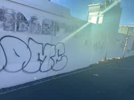 Graffiti —
 Extensive paint tags on hoarding opposite the town hall on Kilmore Street facing the footpath.
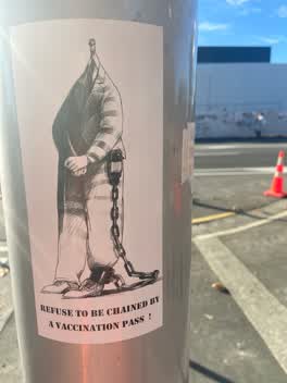 Graffiti —
 Anti vax misinformation sticky tags on steel floodlight pole on the corner of Colombo and Kilmore Streets need removal.
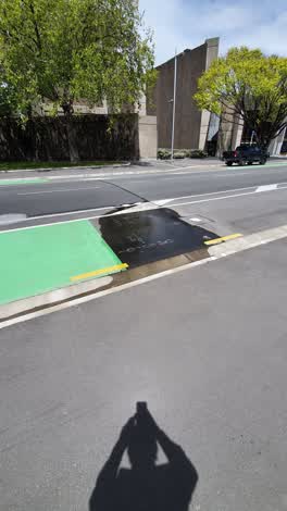 Water Leak —
 Kilmore over road from town hall. Water coming from valve
Roading/Streets —
Leaking fire hydrant corner of Kilmore and Colombo
Wastewater/Stormwater —
Pip brock
Also reported on Colombo Street
- 794 Colombo Street — 159 reports
- 673 Colombo Street — 102 reports
- 781 Colombo Street — 55 reports
- 521 Colombo Street — 46 reports
- 722 Colombo Street — 45 reports
- 569 Colombo Street — 45 reports
- 527 Colombo Street — 41 reports
- 711 Colombo Street — 38 reports
The street’s crash record
NZTA’s record names Colombo Street in 177 crashes that hurt somebody since 2006 — 1 person killed, 32 seriously hurt.
The green nearby
- Victoria Square — 76 m to the edge · Botanic · 2 ha
- Edmonds Band Rotunda — 186 m to the edge · Botanic
- Canterbury Provincial Council Reserve — 287 m to the edge · Botanic
- Victoria Triangles — 315 m to the edge
- Aldred Reserve — 355 m to the edge
Parks within half a kilometre, measured to the boundary — the council’s open data.
The civic shelf nearby
- Aldersgate — 302 m away · Car park
- Armagh St — 356 m away · Car park
- Turanga Library — 398 m away · Library · Cathedral Square, Christchurch
Libraries, halls and the rest within half a kilometre — the council’s open data.
On the doorstep
- Krung Thep Thai Street Food — 28 m away · Restaurants
- OrthoSouth — 39 m away · Dentists
- Bolina Indian Sweets and Restaurant — 82 m away · Restaurants
- Hotel 818 — 83 m away · Hotels
Businesses within four hundred metres, measured at the pin — OpenStreetMap and the council directories.
The bus nearby
- Kilmore Street Town Hall — 107 m away · route 1, route 29, route 95
- Kilmore St near Manchester St — 133 m away · route 1, route 27, route 29, route 95
The closest Metro stops, within four hundred and fifty metres.
The tracks through here
- Walk and bike track through Christchurch Central City — 228 m to the line · walk · bike
- Walk and bike track through Christchurch Central City — 242 m to the line · walk · bike
- Walk and bike track through Christchurch Central City — 256 m to the line · walk · bike
- Walk and bike track through Christchurch Central City — 268 m to the line · walk · bike
- Walk and bike track through Christchurch Central City — 287 m to the line · walk · bike
Tracks whose line passes within half a kilometre, measured to the line itself — the council’s open data.
The named ground
Named water within 500 m of this address, measured to the line or the edge; Named places within 1.5 km of this address; the council’s own structure register — bridges, boardwalks and steps standing nearby — the open map’s record.
The remembered names nearby
- Scottish Pioneer Tribute — 48 m away ·
SCOTTISH PIONEER TRIBUTE / This plaque celebrates and pays tribute to the Scottish Pioneer
- He Poupou Tohu Ahi-Kä o Ngäi Tahu — 128 m away ·
He poupou tohu ahi-kÄ o NgÄi Tahu / A mark of the long burning fires of NgÄi Tahu
· 2018 - Bowker Fountain / Unveiled 26 February 1931 — 159 m away ·
BOWKER FOUNTAIN / UNVEILED 26 FEBRUARY 1931 / REPAIRED AND RECONSTRUCTED / AFTER THE 2011
· 2018
Inscribed plaques within two hundred and fifty metres — the register’s pins, not surveyed spots. The whole roll is at /plaques.
Renting nearby
new bonds in Christchurch Central City ran about $508 a week — $42 below the city median of $550 — the suburb page keeps the rent record →.
What was here — Colombo Street Bridge and Setting
65 m away · located to ±24 m · the place’s own record →
On the register. Nothing researched here yet.
What was here — The Christchurch Town Hall and Setting
89 m away · located to ±79 m · the place’s own record →
On the register. Nothing researched here yet.
What was here — Bowker Fountain and Setting
159 m away · located to ±13 m · the place’s own record →
On the register. Nothing researched here yet.
What was here — Former Market Place Bridge/Hamish Hay Bridge and Setting
164 m away · located to ±31 m · the place’s own record →
On the register. Nothing researched here yet.
What was here — Captain James Cook Statue and Setting
174 m away · 89 Armagh Street · located to ±2 m · the place’s own record →
On the register. Nothing researched here yet.
The civic layer
This ground votes in Central ward — the Papanui-Innes-Central community board. Ward lines don’t always follow suburb lines; this one is measured at the pin, not the suburb’s centre.
What stood on this ground → · On the map → · From the air — the Crown’s aerials back to 1936; search the address on RetroLens →
Questions, answered briefly
30 council reports on record since February 2019 — most often graffiti (8), graffiti on a fence, building or structure (3), roads - general (2).
Christchurch Central City, Christchurch — on Colombo Street.
The heritage register names 5 places at or beside it — Colombo Street Bridge and Setting, The Christchurch Town Hall and Setting.
Victoria Square — 76 m to its edge, 2 ha.