77 Banks Avenue, Dallington
36 reports on record since January 2018 · 24 with photographs. The street’s heaviest record is 120 Banks Avenue — 55 reports on file. Indicative rating valuation and school zones, hazards, bin day and what stood here before.
What gets reported here
- Graffiti — 18
- Dumped Rubbish — 7
- Rubbish/Recycling — 2
- Roading/Streets — 2
- Overgrown Vegetation — 2
- Water Pollution - Sediment — 1
Photographed here 24 on record



Reported here
 Overgrown Vegetation —
 Overgrown bushes and trees blocking the footpath. Kids scooting to school opt for scooting on the road to avoid this bit of the footpath
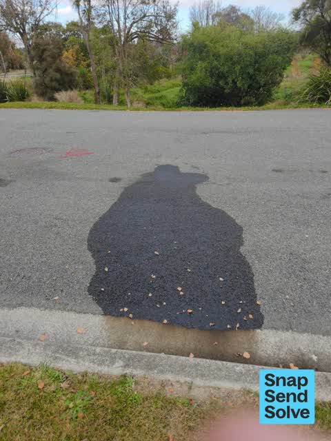
 Water Pollution - Sediment —
 Oil spill on road. 20 metres from Dudley Creek
 Graffiti on a playground or in a park —
 Public facing tagging in community garden
 Overgrown Vegetation —
 The bushes have grown fat so that you almost need to be in the middle of the road and close to the single lane to see traffic coming. There
 Dumped Rubbish —
  Dumped Rubbish —
 Inside old banks ave school grounds. Along fence line frpm old main gate. Dumped bikes bed head and other rubbish.
 Dumped Rubbish —
 Black leather chair dumped.
 Sewer - Leak / Blockage —
 Water leak from toby on footpath.
 Dumped Rubbish —
  Graffiti —
  Graffiti —
 Old banks Ave school site
- Dumped Rubbish —
- Dumped Rubbish —
- Graffiti —
- Graffiti —
- Graffiti —
- Dumped Rubbish —
- Park - General Request —
- Graffiti —
- Graffiti —
- Graffiti —
- Graffiti —
- Graffiti —
 Graffiti —
 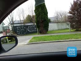 Graffiti —
  Graffiti —
 Graffiti on fence next to staff parking main entrance to ex banks ave drive bank of shed fence on empty section
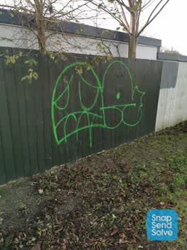 Graffiti —
 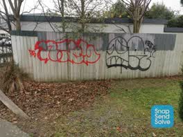 Graffiti —
 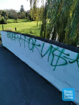 Graffiti —
 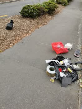 Rubbish/Recycling —
 No identity. Outside school.
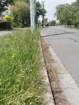 Roading/Streets —
 Berms along rrz Banks Ave not mown
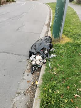 Rubbish/Recycling —
 Same mixture of chopped car parts that's been dumped on this block about 4 times within the last year
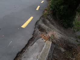 Roading/Streets —
 Road drops off at a critical area that requires giving way and sometimes pulling hard left to allow another car to pass. You can't pull har
Graffiti —
Wastewater/Stormwater —
Very strong odour from manhole
Graffiti —
School brick fence and lamppost
Also reported on Banks Avenue
- 120 Banks Avenue — 55 reports
- 96 Banks Avenue — 47 reports
- 100 Banks Avenue — 47 reports
- 104 Banks Avenue — 46 reports
- 87 Banks Avenue — 37 reports
- 81 Banks Avenue — 23 reports
- 79 Banks Avenue — 22 reports
- 31 Banks Avenue — 20 reports
The street’s crash record
NZTA’s record names Banks Avenue in 5 crashes that hurt somebody since 2006 — 0 seriously hurt, nobody killed.
The green nearby
- Avon Riverbank True Right — 132 m to the edge · 11 ha
- Sullivan Park — 238 m to the edge · 1 ha
- Richmond Park — 243 m to the edge · Sports ground · 4 ha
Parks within half a kilometre, measured to the boundary — the council’s open data.
The bus nearby
- Dallington — 421 m away · route 44
The closest Metro stops, within four hundred and fifty metres.
The tracks through here
- Walk and bike track through Dallington — 84 m to the line · walk · bike
- Walk and bike track through Dallington — 153 m to the line · walk · bike
Tracks whose line passes within half a kilometre, measured to the line itself — the council’s open data.
The named ground
Named water within 500 m of this address, measured to the line or the edge — the open map’s record.
Renting nearby
new bonds in Dallington ran about $520 a week — $30 below the city median of $550 — the suburb page keeps the rent record →.
The civic layer
This ground votes in Burwood ward — the Coastal-Burwood-Linwood community board. Ward lines don’t always follow suburb lines; this one is measured at the pin, not the suburb’s centre.
What stood on this ground → · On the map → · From the air — the Crown’s aerials back to 1936; search the address on RetroLens →
Questions, answered briefly
36 council reports on record since January 2018 — most often graffiti (18), dumped rubbish (7), rubbish/recycling (2).
Dallington, Christchurch — on Banks Avenue.
Nothing on the heritage register at this exact spot — the record around this ground →
Avon Riverbank True Right — 132 m to its edge, 11 ha.