325 Bealey Avenue, Edgeware
30 reports on record since August 2017 · 25 with photographs. The most-reported address on Bealey Avenue. Indicative rating valuation and school zones, hazards, bin day and what stood here before.
What gets reported here
Photographed here 25 on record


Reported here
 Graffiti on a fence, building or structure —
 ftp on light lamp post pole
 Graffiti on a fence, building or structure —
  Pavement - General —
 Water actively bubbling up and out and over footpath
 Graffiti on a cabinet, pole or railway asset —
 I dont know if it is helpful, but this was not there last night around 10pm but was there today around 830am
 Graffiti on a cabinet, pole or railway asset —
 Blue paint tag on anonymous radio (?) asset by the corner of Champion Street and Bealey Avenue.
 Graffiti on a cabinet, pole or railway asset —
  Graffiti on a cabinet, pole or railway asset —
  Graffiti —
  Graffiti —
  Graffiti —
  Graffiti —
 - Pavement - Damaged —
- Graffiti —
- Graffiti —
- Graffiti —
- Graffiti —
 Graffiti —
  Graffiti —
  Graffiti —
  Graffiti —
  Graffiti —
 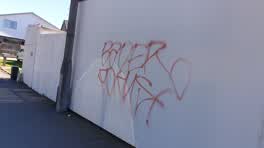 Graffiti —
 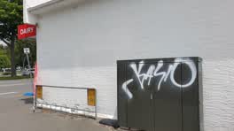 Graffiti —
 that wasnt there yesterday, so done in the last 24 hours
 Graffiti —
 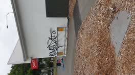 Graffiti —
 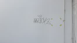 Graffiti —
 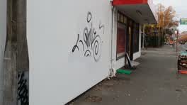 Graffiti —
 Graffiti —
Graffiti —
Graffiti —
Also reported on Bealey Avenue
- 341 Bealey Avenue — 10 reports
- 273 Bealey Avenue — 5 reports
- 329 Bealey Avenue — 4 reports
- 303 Bealey Avenue — 3 reports
- 327 Bealey Avenue — 2 reports
- 275 Bealey Avenue — 2 reports
- 324 Bealey Avenue — 1 report
- 279E Bealey Avenue — 1 report
The street’s crash record
NZTA’s record names Bealey Avenue in 6 crashes that hurt somebody since 2006 — 3 seriously hurt, nobody killed.
The green nearby
- Barbadoes Cemetery — 131 m to the edge · Botanic · 3 ha
- Avon Riverbank Central City — 271 m to the edge · 6 ha
- Walnut Tree Park — 414 m to the edge
- Moa Reserve — 424 m to the edge
- Cambridge Green — 460 m to the edge
Parks within half a kilometre, measured to the boundary — the council’s open data.
On the doorstep
- Youth Health Centre — 101 m away · Business
- Aotea Motel — 124 m away · Motels
- Avalon Court Motel — 139 m away · Motels
- John Rhind Funeral Directors — 201 m away · Funeral directors
Businesses within four hundred metres, measured at the pin — OpenStreetMap and the council directories.
The bus nearby
- Whitmore St near Bealey Ave — 119 m away · route 7
- Fitzgerald Ave near Alexandra St — 247 m away · route 7
The closest Metro stops, within four hundred and fifty metres.
The tracks through here
- Walk and bike track through Edgeware — 122 m to the line · walk · bike
- Walk and bike track through Edgeware — 234 m to the line · walk · bike
- Walk and bike track through Edgeware — 390 m to the line · walk · bike
- Walk and bike track through Edgeware — 440 m to the line · walk · bike
Tracks whose line passes within half a kilometre, measured to the line itself — the council’s open data.
The named ground
Named water within 500 m of this address, measured to the line or the edge; the council’s own structure register — bridges, boardwalks and steps standing nearby — the open map’s record.
Renting nearby
new bonds in Edgeware ran about $525 a week — $25 below the city median of $550 — the suburb page keeps the rent record →.
What was here — Dwelling and Setting
214 m away · 361 Cambridge Terrace · located to ±10 m · the place’s own record →
On the register. Nothing researched here yet.
The civic layer
This ground votes in Innes ward — the Papanui-Innes-Central community board. Ward lines don’t always follow suburb lines; this one is measured at the pin, not the suburb’s centre.
What stood on this ground → · On the map → · From the air — the Crown’s aerials back to 1936; search the address on RetroLens →
Questions, answered briefly
30 council reports on record since August 2017 — most often graffiti (22), graffiti on a cabinet, pole or railway asset (4), graffiti on a fence, building or structure (2).
Edgeware, Christchurch — on Bealey Avenue.
The heritage register names a place at or beside it — Dwelling and Setting.
Barbadoes Cemetery — 131 m to its edge, 3 ha.