67 Fendalton Road, Fendalton
13 reports on record since December 2015 · 11 with photographs. The street’s heaviest record is 69 Fendalton Road — 39 reports on file. Indicative rating valuation and school zones, hazards, bin day and what stood here before.
What gets reported here
Photographed here 11 on record




Reported here
 General Request —
 Rail corridor / walkway fence has been detached and twisted, leaving a large gap. Is probably a simple fix - mesh doesn't appear damaged.
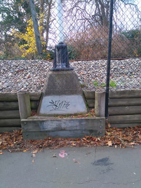
 Graffiti on a traffic light pole or cabinet, or wa —
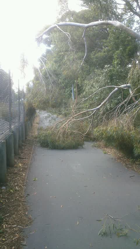
  Fallen Tree —
 The tree is actually down the cycle lane just off Fendalton Road
 Fallen Tree —
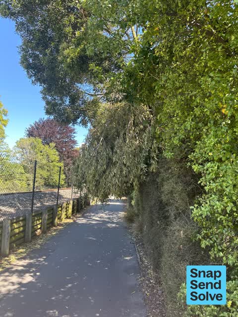
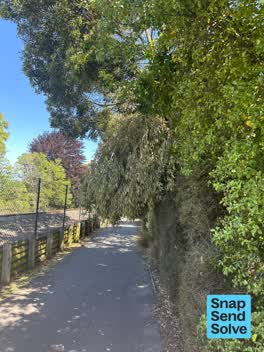
 Dangerous hanging broken branch.
 Fallen Tree —
 Actually a fallen branch hanging above the shared path beside the railway line. Looks like it needs specialist arborist services to tidy th
 Overgrown Vegetation —
 Broken branch over hanging footpath/ bike path. Head high of cyclists and also obstructs view for pedestrians
 Pavement - General —
 The tree has snapped and is hanging over the bike path. If breaks could fall on someone
- Pavement - General —
- Roading/Streets —
Trees blocking visibility of traffic lights westward travel
 Roading/Streets —
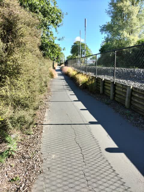
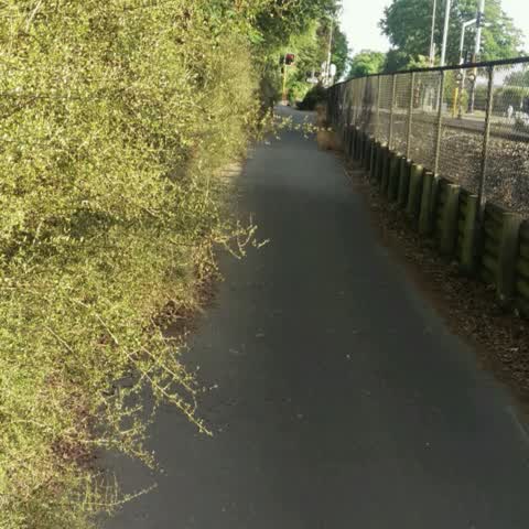
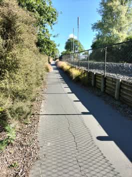
 Overgrown plants impede bidirectional traffic on cycle way
Graffiti —
KiwiRail property, accessible from the cycle-walkway along railway line between Fendalton Rd and Matai Street West.
Roading/Streets —
The cycle path is becoming overgrown, reducing the available width by up to a third.
Roading/Streets —
Cycle and foot path
Also reported on Fendalton Road
- 69 Fendalton Road — 39 reports
- 185 Fendalton Road — 17 reports
- 183 Fendalton Road — 16 reports
- 65 Fendalton Road — 14 reports
- 33A Fendalton Road — 14 reports
- 173 Fendalton Road — 12 reports
- 74 Fendalton Road — 11 reports
- 167 Fendalton Road — 11 reports
The street’s crash record
NZTA’s record names Fendalton Road in 67 crashes that hurt somebody since 2006 — 2 people killed, 14 seriously hurt.
The green nearby
- Mona Vale — 9 m to the edge · Botanic · 5 ha
- Clifford Reserve — 79 m to the edge
- Daresbury Park — 157 m to the edge
- Avon River Esplanade Reserve — 471 m to the edge
- Idris Reserve — 474 m to the edge
Parks within half a kilometre, measured to the boundary — the council’s open data.
On the doorstep
- Mona Vale Homestead and Pantry — 325 m away · Cafés
- Mona Vale Homestead & Gardens Venue — 374 m away · Cafés
Businesses within four hundred metres, measured at the pin — OpenStreetMap and the council directories.
The bus nearby
- Fendalton Rd near Mona Vale Ave — 102 m away · route 29
- Fendalton Rd near Wairarapa Tce — 144 m away · route 29
The closest Metro stops, within four hundred and fifty metres.
The tracks through here
- Walk and bike track through Fendalton — 26 m to the line · walk · bike
- Walk and bike track through Fendalton — 69 m to the line · walk · bike
- Walk and bike track through Fendalton — 111 m to the line · walk · bike
- Walk and bike track through Fendalton — 144 m to the line · walk · bike
- Walk and bike track through Fendalton — 162 m to the line · walk · bike
Tracks whose line passes within half a kilometre, measured to the line itself — the council’s open data.
The named ground
Named water within 500 m of this address, measured to the line or the edge; Named places within 1.5 km of this address; the council’s own structure register — bridges, boardwalks and steps standing nearby — the open map’s record.
The remembered names nearby
- Armillary Sphere — 81 m away ·
ARMILLARY SPHERE / The metal rings represent the Equator, Tropics, Arctic and Antarctic Ci
· 2009 - The Macleod Garden / in Memory of / Alastair John Macleod — 82 m away ·
THE MACLEOD GARDEN / IN MEMORY OF / ALASTAIR JOHN MACLEOD / M. Hort Sc (Hons) / 1959 - 198
· 2009 - The Doreen Holland / Seat for Dreaming — 142 m away ·
THE DOREEN HOLLAND / SEAT FOR DREAMING
· 2009
Inscribed plaques within two hundred and fifty metres — the register’s pins, not surveyed spots. The whole roll is at /plaques.
Renting nearby
new bonds in Fendalton ran about $618 a week — $68 above the city median of $550 — the suburb page keeps the rent record →.
What was here — Mona Vale Gatehouse and Setting
49 m away · 65 Fendalton Road · located to ±12 m · the place’s own record →
On the register. Nothing researched here yet.
What was here — Dwelling and Setting
215 m away · 5 Jacksons Road · located to ±15 m · the place’s own record →
On the register. Nothing researched here yet.
The civic layer
This ground votes in Fendalton ward — the Fendalton-Waimairi-Harewood community board. Ward lines don’t always follow suburb lines; this one is measured at the pin, not the suburb’s centre.
What stood on this ground → · On the map → · From the air — the Crown’s aerials back to 1936; search the address on RetroLens →
Questions, answered briefly
13 council reports on record since December 2015 — most often roading/streets (4), fallen tree (3), pavement - general (2).
Fendalton, Christchurch — on Fendalton Road.
The heritage register names 2 places at or beside it — Mona Vale Gatehouse and Setting, Dwelling and Setting.
Mona Vale — 9 m to its edge, 5 ha.