27 Humphreys Drive, Ferrymead
24 reports on record since January 2023 · 20 with photographs. The most-reported address on Humphreys Drive. Indicative rating valuation and school zones, hazards, bin day and what stood here before.
What gets reported here
- Dumped Rubbish — 10
- Road Signage — 3
- Roads - General — 2
- Fallen Tree — 2
- Vandalism - General — 1
- Street Cleaning — 1
Photographed here 20 on record



Reported here
 Accessibility —
 Can we get this small section of grass sealed as a path to link the often used walking track to the carpark. There is no alternative for pra
 Dumped Rubbish —
 Broken glass bottles dumped on road but now in a box that has collapsed
 Dumped Rubbish —
 Construction polystyrene over the road new reserve and waterways
 Dumped Rubbish —
 Car Seat, gib board and filled rubbish bags dumped at Ferrymead start of cycleway into Charlesworth Reserve.
 Dumped Rubbish —
 Dumped car seat
 Dumped Rubbish —
 Dumped rubbish
- Fallen Tree —
Tree on bike line - been like that for days
- Fallen Tree —
Big branch lying over bike lane and some of the west traffic lane Humphreys Drive Macrocarpa tree
 Facility - General Request —
  Dumped Rubbish —
 Dumped concrete building waste with rebar sticking out causing hazard to walkers going into charlesworth reserve near mitre 10
 Street Cleaning —
 There is loose gravel and vegetation in the shoulder/cycle lanes of Humphreys Dr. Please sweep the gravel and remove the vegetation.
 Dumped Rubbish —
 Rubbish dumped in Charlesworth Reserve
 Road Signage —
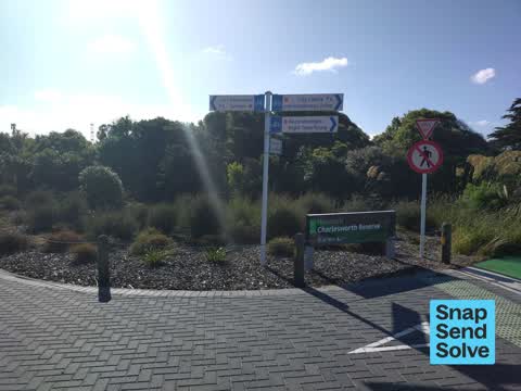
 Kia ora, The wayfinding sign is pointing the wrong direction. It needs to be spun about 90 degrees anti-clockwise so that the 'Recommended d
 Road Signage —
 Keep left arrow Sign on road island is not attached at top.
 Pavement - Damaged —
 Broken vehicle stop, looks like someone has driven over it.
 Roads - General —
 Gorse in road reserve. Also present further north in Humphreys Drive on estuary edge. Flowering. Threatens the adjoining nature reserve and
 Dumped Rubbish —
 Rubbish dumped
 Dumped Rubbish —
 Large heap of tangled wire. Dangerous ! Too large for me to take away in my Fiat 509. Please prioritise
 Vandalism - General —
  Dumped Rubbish —
  Damaged Street Sign —
 Might be good to grab this one before it's gone...
 Road Signage —
 Sign is turned and half of the pole
- Pothole —
- Roads - General —
Also reported on Humphreys Drive
- 21 Humphreys Drive — 14 reports
- 23 Humphreys Drive — 8 reports
- 9 Humphreys Drive — 7 reports
- 21-23 Humphreys Drive — 6 reports
- 27A Humphreys Drive — 5 reports
- 25R Humphreys Drive — 4 reports
- 2 Humphreys Drive — 4 reports
- 3/9 Humphreys Drive — 3 reports
The street’s crash record
NZTA’s record names Humphreys Drive in 17 crashes that hurt somebody since 2006 — 4 seriously hurt, nobody killed.
The green nearby
- Charlesworth Reserve — 14 m to the edge · Regional · 24 ha
- Windsports Park — 319 m to the edge · Regional · 4 ha
- Settlers Reserve — 434 m to the edge · 13 ha
- Ferry Esplanade Reserve — 440 m to the edge · 1 ha
Parks within half a kilometre, measured to the boundary — the council’s open data.
On the doorstep
- Columbus Coffee — 160 m away · Cafés
- Mitre 10 Mega — 168 m away · Hardware
- Genius Co-Working — 184 m away · Coworking spaces
- Cafe Metro — 194 m away · Cafés
Businesses within four hundred metres, measured at the pin — OpenStreetMap and the council directories.
The bus nearby
- Ferrymead Shops — 297 m away · route 3, route 140, route 155
- Ferrymead Shops — 316 m away · route 3, route 140, route 155
The closest Metro stops, within four hundred and fifty metres.
The tracks through here
- Walk and bike track through Ferrymead — 8 m to the line · walk · bike
- Walk and bike track through Ferrymead — 68 m to the line · walk · bike
- Walk and bike track through Ferrymead — 285 m to the line · walk · bike
- Walk and bike track through Ferrymead — 307 m to the line · walk · bike
- Walk and bike track through Ferrymead — 307 m to the line · walk · bike
Tracks whose line passes within half a kilometre, measured to the line itself — the council’s open data.
The named ground
Named water within 500 m of this address, measured to the line or the edge; the council’s own structure register — bridges, boardwalks and steps standing nearby — the open map’s record.
The civic layer
This ground votes in Heathcote ward — the Spreydon-Cashmere-Heathcote community board. Ward lines don’t always follow suburb lines; this one is measured at the pin, not the suburb’s centre.
What stood on this ground → · On the map → · From the air — the Crown’s aerials back to 1936; search the address on RetroLens →
Questions, answered briefly
24 council reports on record since January 2023 — most often dumped rubbish (10), road signage (3), roads - general (2).
Ferrymead, Christchurch — on Humphreys Drive.
Nothing on the heritage register at this exact spot — the record around this ground →
Charlesworth Reserve — 14 m to its edge, 24 ha.