Ferrymead, Christchurch
3,054 council reports since June 2015, the 48th busiest suburb in the city. 2,458 photographs on record. 1,220 people at the 2023 Census, 493 to the square kilometre across 2.5 km².
The record also holds 2023 Census snapshot· 2,458 photographs· 8 old photographs· 7 parks· 1 place of worship· 6 tracks· 6 names on the map· 44.9% of the outline mapped liquefied· 3.3% of the outline in the red zone· graded mostly TC3 in 2011· the record drew water over 63% of the outline· the mapped tsunami reach covers 73% of the outline· slope-hazard bands cover 3% of the outline· the Ngāi Tahu schedule covers 16% of the outline· ecological sites over 45% of the outline· landscape schedules over 33% of the outline· high flood hazard over 25% of the outline· setback strips over 23% of the outline· 781 SCIRT photographs filed on this ground· 16.2 km of cycleway crosses the outline· 5 remembered names on this ground· 9 drawn rules bind this ground· 8 parcels on the dangerous-work register· 24 parcels of made ground· 400 surveyed rocks· the 2019 model grades this ground mostly possible· 23 council structures on the register· 9 recreation register records· 450 trees on the register· the plan’s word on this ground· 4% of the outline reserved· the plan’s exceptions touch 4% of the outline· 1 place on the heritage schedule· 19 epicentres inside the outline· 71 injury crashes· 663 recorded victimisations· 9 bus stops· 116 businesses· the council’s fix times· 2 heritage places· 40 documents· 5 mentions on the wire
Live source links
Link-outs to the source’s own live pages, chch.live does not copy their live values or source text.
Living here rent · the ground · the day-to-day
Rent: too few new bonds lodged here for Tenancy Services to publish a median this quarter, the last figure it released was about $630 a week, and it counts this under the “Brookhaven-Ferrymead” statistical area, close to this suburb’s outline, not exactly it.
Median and quartiles of weekly rents on new private bonds, by quarter. New bonds are fresh lodgements, not the whole rental stock; under five bonds the rent is withheld, and counts are randomly rounded. Source: Tenancy Services rental bond data: provisional while the bond system migrates.
The ground: 3% of the outline went into the residential red zone; the February 2011 survey drew liquefaction over 45% of it, the rest of the watch is drawn further down.
Day to day it holds 7 parks, 1 place of worship, 6 tracks and 9 bus stops, each is counted further down.
Lately the record’s mostly graffiti & vandalism, 375 reports in the year to 13 October 2026, the newest 11 October 2026.
One for the quiz, Its busiest day on record was 1 June 2016, 18 reports in a single day.
2023 Census snapshot SA1 areas grouped here
About 1,164 people and 426 occupied private households in the “Brookhaven-Ferrymead” and “Inlets other Christchurch City” areas, grouped from 11 SA1 areas. This exact statistical-area match is close to this suburb’s outline, not exactly it.
Stats NZ’s 2023 Census uses fixed random rounding to base 3. Unavailable or confidential cells are left out, not treated as zero. individuals · households · geography · CC BY 4.0.
About the suburb
Ferrymead is a suburb south-east of Christchurch, New Zealand. It is the main thoroughfare for reaching the eastern sea suburbs such as Sumner, as well as home to a number of cliff-top residences and businesses along the estuary front. After the 2011 Canterbury earthquake, a number of prominent Christchurch businesses relocated to the Ferrymead area, making it into a secondary business hub.
As reported 2,458 on record
The suburb, back then 8 in the archive
Placed by the record’s locality join or the name in its own title, a lead, not a claim each frame stood here.
The shape of it outline © OpenStreetMap · recent reports, pinned
The record on Ferrymead
- Ferrymead enters the written record on 23 July 1853, “ELECTORAL ROLL FOR THE TOWN OF CHRISTCHURCH. July 11, 1853. (Lyttelton Times, 23 July 1853)”, Papers Past.
- “Ferrymead” appears somewhere in 165 of the archive’s records, title, description or body.
- A Papers Past search for the name surfaced 30 records, leads by provenance, not by phrase.
- The first report the feed ever carried here: parks, 7 June 2015, at 81 Ferrymead Park Dr.
- Its busiest day on record was 1 June 2016, 18 reports in a single day.
- The street that keeps coming up is Ferry Road, reported on 346 separate days.
- For elections the suburb’s centre falls inside Heathcote ward, the Spreydon-Cashmere-Heathcote community board is its local layer. The whole roll is at /wards.
Lately the newest reports




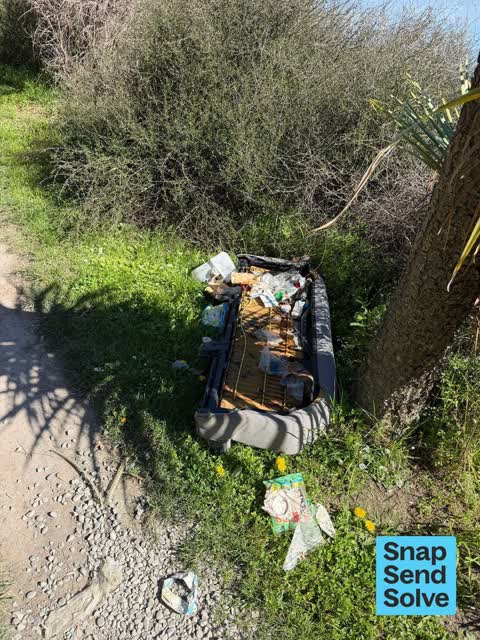
Dumped RubbishCanterbury
Dumped wooden thing. Not sure what it is called but think it’s from the horse paddocks nearby


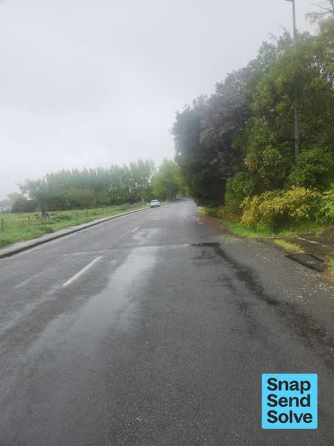
Park - General Request61R Truscotts Road
I have repeatedly reported this and it's still not fixed. the wire is there but it needs securing. it gives access to a large part of the park which Includes…

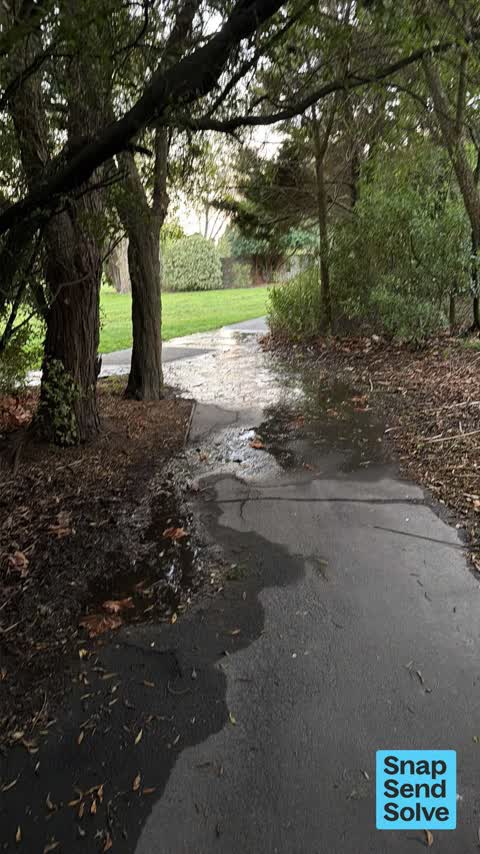
Water LeakFerrymead Reserve 285 Bridle Path Road
There is a big leak near the footpath on Bridlepath Rd, north of 281 Bridle Path Rd that goes through the trees. It extends a long way towards Ferrymead park…
Overgrown Vegetation29 Dalziel Pl
A lot of invasive weeds along verges of cycleway… cape weed, gorse, fennel, etc coming into flower and soon seeding
Reports per year down 8% 2024→2025
15
34
16
85
17
197
18
193
19
219
20
200
21
290
22
380
23
362
24
427
25
391
What gets reported
Exactly what people say
How fast the council fixes things here 2,680 finished jobs on record
The median council work order pinned in Ferrymead took 3 days to resolve, about the city-wide median (3 days). The slowest tenth waited 5 months or longer. 204 tickets are open here now, the oldest was filed 3 May 2019.
Work orders, not the resident reports above, the council’s MyCouncilTicket stream, and one job can appear in both. A median counts only finished jobs; open ones are named as open, never averaged in. The ticket roll · the whole city’s fix times.
The suburb today
Schools here
Zoned for Christchurch Adventist School · Hillview Christian School · Marian College · Middleton Grange School · St Thomas of Canterbury College · Te Aratai College · and 5 more zones, the drawn zone is indicative; the Ministry’s written scheme is the legal boundary.
The green here 7
- Ferrymead ParkRegional · 77 ha
- Settlers Reserve13 ha
- Tunnel Road Reserve3 ha
- Ferry Esplanade Reserve1 ha
- Ferrymead ReserveBotanic · 1 ha
- Roundabout Reserve
- Tunnel Road Drainage Reserve
Parks and reserves in the council’s open data, a park lands in the suburb its centre falls inside. The whole roll is at /parks.
Where the suburb worships 1
Places of worship in the open map’s record, one lands in the suburb its building stands in. The whole roll is at /worship.
The tracks through here 6
- Walk and bike track through Ferrymead6.6 km · Christchurch · walk · bike
- Walk and bike track through Ferrymead1.8 km · Christchurch · walk · bike
- Walk and bike track through Ferrymead1.4 km · Christchurch · walk · bike
- Walk and bike track through Ferrymead1.2 km · Christchurch · walk · bike
- Walk and bike track through Ferrymead1.1 km · Christchurch · walk · bike
- Walk and bike track through Ferrymead248 m · Christchurch · walk · bike
Tracks in the council’s open data, a line belongs to every suburb it passes through. The whole network is at /tracks.
The names on this ground 6
The February 2011 survey drew mapped ground failure over 44.9% of this outline, about 111 hectares. A patch is a footprint, not a finding about an address; the count for the whole city is at /liquefaction.
The Crown’s 2011 classification drew 3.3% of this outline, about 8 hectares inside the residential red zone. A mapped area files under the suburb its middle sits in, and a classification is the record of a decision, not a finding about an address; the whole line is drawn at /redzone.
The 2011 grading filed 0.8% of this outline, mostly TC3. A graded area files under the suburb its middle sits in, and a category is a verdict for a patch of ground, not a finding about an address; the grades are drawn at /technical-categories.
The flood record drew water over 62.9% of this outline, about 156 hectares, across 1 named event. A patch is one event’s observation, not a live hazard finding; the whole record is drawn at /floods.
The mapped tsunami extent covers 73% of this outline, about 180 hectares. The sea’s modelled reach, not a prediction, the plan’s inundation line, not the evacuation zones; the share is read from a sampled join. The whole extent is drawn at /tsunami.
The plan’s slope-hazard bands cover 3% of this outline, about 8 hectares, rockfall management area 1, rockfall management area 2, mass movement management area 2. The broad remaining-instability overlay covers 3% of it besides, the plan’s background watch over the hill country. Shares read from a sampled join; a management overlay, not a prediction. The whole watch is drawn at /slope.
8 parcels inside this outline sit on the hazardous-activities register, mostly cemeteries and waste recycling, treatment and disposal, chemical manufacture, application and bulk storage, vehicle refuelling, service and repair, 4 still doing the work. A listing records the work, not a soil test; the whole register is drawn at /hazards.
The files record 24 parcels of made or characterised ground inside this outline, about 45 hectares, mostly mixed fill with rubbish, gravel, silt, 11 carry fill the file can’t vouch for. A record is the file’s word on what was laid, not a fresh survey; the whole layer is drawn at /fill.
The rockfall survey mapped 400 rocks inside this outline across 174 survey pins, 326 came down, 47 still wobble easy. A pin may stand for a cluster and marks where the survey saw the rock, not where it is now; the whole survey is drawn at /boulders.
The 2019 liquefaction study put 61% of this outline in the possible class, 82% of the outline fell inside an assessed area, and 2 assessed areas here carry the free-face flag for possible lateral spreading. A class is the model’s verdict on a patch of ground, not a finding about an address; the whole study is drawn at /vulnerability.
The council’s structure register stands 23 assets on this ground, 10 bridges, 3 viewing platforms, 3 boardwalks, 3 sets of steps, sited at Ferrymead Park, Ferry Esplanade Reserve, Settlers Reserve, Tidal View And Te Awakura Tce. The register’s site names are its own labels for the ground an asset stands in; the layer is drawn at the map.
The recreation register keeps 9 records inside this outline, bookable surfaces for 5 football, 2 bmx, 1 athletics, 1 cricket. Seasons and surfaces are the register’s record, not this week’s draw; the layer is drawn at the map.
The register counts 450 living trees inside this outline, 1 carrying a protection, mostly Totara, Kahikatea, Pin Oak. The file remembers 132 trees felled here. A tree record is the register’s word on what stands or stood; the whole canopy is drawn at /trees.
The plan files 40% of this outline under Open Space Natural, the rest mostly Open Space Community Parks 12%, Open Space Water and Margins 11%. A zone is a permission, not a description, the mix is read from a sampled join of the plan’s polygons; the whole district is drawn at /zones.
The plan reserves about 11 hectares of this outline, 4%, under 3 designations, mostly movement. A designation is a claim on the ground, not a build date, the mix is read from a sampled join; the whole register is drawn at /designations.
The plan’s exceptions touch 4% of this outline, 4 qualifying matters, mostly section 6, utilities. A matter narrows how the density rule applies, it does not forbid; the mix is read from a sampled join, and the cultural-significance areas are the plan’s own unnamed ones. The whole register is drawn at /matters.
The plan’s heritage schedule protects 1 place by name in this suburb, Dwelling and Setting, Ferrymead House. A setting is the ground the item stands in, each files under the suburb holding its centroid; the whole schedule is at /heritage.
The plan’s schedule of sites significant to Ngāi Tahu covers 16% of this outline, about 40 hectares, ngā wai, ngā tūranga tūpuna. Shares read from a sampled join; a recognition overlay, not a catalogue. The whole schedule is drawn at /cultural.
The plan’s ecological schedules cover 45% of this outline, about 111 hectares across 1 scheduled site, all protected under Schedule A. Shares read from a sampled join; a recognition overlay, not a survey. The whole ledger is drawn at /ecology.
The plan’s landscape schedules cover 33% of this outline, about 81 hectares across 5 scheduled areas, and 35% of it sits inside the coastal environment. Shares read from a sampled join; a protection overlay, not a ranking of views. The kept view is drawn at /landscape.
The plan’s flood map draws 25% of this outline inside high flood hazard ground, about 63 hectares across 6 mapped areas. The broader flood-management watch covers 86% of it, Avoca Heathcote Valley, Heathcote River. Shares read from a sampled join; a model’s map, not a promise. The waiting water is drawn at /flood-hazard.
The plan’s water-margin layers cross this outline, 93 classified reaches, the plan calling Matuku Waterway and Avoca Valley Stream by name, 23% of it inside the setback strips, the widest holding 30 m off the bank, and an esplanade line holds a public edge here. The margin is the plan’s drawing, not a survey of the bank; the reaches, strips and held edges are mapped at /water-margin.
The rebuild’s cameras filed 781 photographs on this ground, 2010–2016, stormwater work mostly. Each frame is a receipt the dig left behind, a work log, not a survey of what stands now; the whole record is drawn at /rebuild.
The pedal network threads this ground, 16.2 km of cycleway crosses the outline, 0.5 km of it separated from the traffic, Heathcote Expressway, Rapanui Shag Rock, Ōpāwaho River. A segment counts under every suburb its path enters; the whole network is drawn at /cycleways.
The remembered names stand on this ground, 5 inscribed plaques, Avon And Heathcote Estuary, Ferrymead Park, First Railway Monument among the grounds. The plaque is the register’s pin, not a surveyed spot; the whole roll is kept at /plaques.
The rulebook binds this ground, 9 drawn instruments, 6 of them dog rules, 2 camping zones, a certified self-contained van can stay the night at Christchurch Urban Restricted Area; the other zone bans it outright, 1 bottle-store buffer; the outline sits inside the takiwā of Te Ngai Tuahuriri Runanga. The bylaw is the instrument, this the map of it, the whole rulebook is drawn at /rules.
GeoNet’s catalogue puts 19 magnitude-3+ epicentres inside this outline since the sequence opened, the biggest a M4.1 in 2014. An epicentre is where the instruments placed the break, not a measure of the shaking here; the whole catalogue is counted at /sequence, the live record is /quakes, and the story in plain language is the earthquakes explainer.
- Bridle Path Rdold dump · ?–1984
- East Truscotts Rdold dump · ?–1979
- Ferrymeadold dump · ?–1975
- West Truscotts Rdold dump · 1979–1988
- Matuku Lakesreservoir · Matuku
- Ōpāwaho / Heathcote Riverwaterway · 30.7 km
The named waterways, bays, headlands, monuments, summits and old sites OpenStreetMap puts inside this outline, a pin is the mapper’s own; a waterway belongs to every suburb it crosses. Every roll, counted: /geography.
The crash record 71 injury crashes
71 crashes that hurt somebody on record inside Ferrymead's outline, 3 people killed, 20 seriously hurt.
The corner that keeps appearing: Ferry Road at Humphreys Drive, 9 injury crashes.
The crime record 663 recorded victimisations
663 victimisations on the Police record inside Ferrymead’s outline, September 2022–August 2026, mostly theft, about 142 a year per 1,000 residents. Down 20% on the year before. Reported is not all, how much never reaches the record depends on the offence.
The buses through it 9 stops
9 Metro stops inside Ferrymead's outline, in ECan’s stop record, served by route 155, route 140, route 3.
- Bridle Path Rd near Cannon Hill Cres
- Bridle Path Rd near Ferrymead Park Dr near Bridle Path Rd
- Bridle Path Rd near Ferrymead Park Dr near Bridle Path Rd
- Ferry Rd near Settlers Cres near Ferry Rd
- Ferry Rd near Settlers Cres near Ferry Rd
- Ferry Rd near Waterman Pl near Ferry Rd
- Ferry Rd near Waterman Pl near Ferry Rd
- Ferrymead Shops near Ferry Rd
- Ferrymead Shops near Ferry Rd
Businesses here 116 in the directory
116 premises in Ferrymead across 38 kinds, from OpenStreetMap, the council’s licensed-premises register and its 2024 Find Christchurch directory. Each kind below opens at this suburb’s shelf.
- Restaurants27
- Cafés15
- Fast food9
- Bottle stores7
- Attractions4
- Bars & pubs4
- Delis4
- Doctors & clinics4
- Banks3
- Clothing3
- Gyms & fitness3
- Hardware2
- Mini golf2
- Supermarkets2
- Venues & events2
- Vets2
- Advertising Agency1
- Alternative1
- Audiologists1
- Bookshops1
- Car repair1
- Car washes1
- Caterers1
- Coworking spaces1
- Curtain1
- Dentists1
- Golf courses1
- Hairdressers1
- Marketplace1
- Markets1
- Motorcycle shops1
- Opticians1
- Pet shops1
- Pharmacies1
- Sports shops1
- Swimming Pool1
- Trade1
- Travel agents1
Among them, the ones the record says most about:
Before any of that
On the register here
Documents 40
What the archive’s sources say about Ferrymead, titled for it, turned up by a search for one of its places, or carrying its name in the text. These are leads and citations: the originals live at the provider, linked from each row.
301850s
461860s
71870s
21880s
71890s
41900s
31910s
31920s
31930s
31940s
51970s
31980s
152000s
372010s
62020s
ELECTORAL ROLL FOR THE TOWN OF CHRISTCHURCH. July 11, 1853. (Lyttelton Times, 23 July 1853)Lyttelton Times · Papers Past · National Library of New Zealand · · text held
Evans, Charles, Papauni Laboure (Lyttelton Times, 20 February 1856)
…labourer latter robert lyttelton merchant latter john heathcote farmer lawianee william c ferrymead gentleman leake henry lyttellou warehouseman lean alexander riverlaw stockowner le cren henry john l…Lyttelton Times · Papers Past · National Library of New Zealand · · text held
Page 8 Advertisements Column 2 (Lyttelton Times, 02 July 1859)
…who tvill receive orders and warehouse any goods or luggage without charge william reeves ferrymead june 11859 land to let on 20 or 30 years building leases in the centre of the town of christchurch o…Lyttelton Times · Papers Past · National Library of New Zealand · · text held
Page 8 Advertisements Column 2 (Lyttelton Times, 13 July 1859)
…ds and luggage from christchurchwill re main under cover for the night in the premises at ferrymead jmd be delivered early the following morning in jjyttelton all orders should be addressed to wm reev…Lyttelton Times · Papers Past · National Library of New Zealand · · text held
Page 8 Advertisements Column 2 (Lyttelton Times, 16 July 1859)
…who will receive ordei-s and warehouse any goods or luggage withoat charge william reeves ferrymead june 1 1859 i land to let j on 20 or 30 years building leases in the centre of the town of christchu…Lyttelton Times · Papers Past · National Library of New Zealand · · text held
Page 8 Advertisements Column 2 (Lyttelton Times, 30 July 1859)
…ods and luggage from chnstchurch will remain under cover ibr the night in the premises at ferrymead and be delivered early ihe following morning in lyttelton all orders should be addressed to wm reeve…Lyttelton Times · Papers Past · National Library of New Zealand · · text held
Page 8 Advertisements Column 2 (Lyttelton Times, 17 August 1859)
…ds and luggage from christchureh will remain under cover for the night in the premises at ferrymead and be delivered early the following morning in lyttelton all orders should be addressed to wm reeve…Lyttelton Times · Papers Past · National Library of New Zealand · · text held
Page 9 Advertisements Column 2 (Lyttelton Times, 20 August 1859)
…ds and luggage from christchurch will remain under cover for the night in the premises at ferrymead and-be-delivered-early ihe following morning in lyttelton all orders should be addressed to win reev…Lyttelton Times · Papers Past · National Library of New Zealand · · text held
Page 8 Advertisements Column 2 (Lyttelton Times, 24 August 1859)
…ds and luggage from christchurch will remain under cover for the night in the premises at ferrymead and be delivered early the following morning in lyttelton all orders should be addressed to wmreeves…Lyttelton Times · Papers Past · National Library of New Zealand · · text held
Page 8 Advertisements Column 2 (Lyttelton Times, 31 August 1859)
…s and luggage from christchurch will re main under cover for the night in the premises at ferrymead and be delivered early ihe following morning in lyttelton s ah orders should be addressed to wm reev…Lyttelton Times · Papers Past · National Library of New Zealand · · text held
The rest are a search away, the whole shelf, for the name →
The wire on Ferrymead 5 lately
field and button mushrooms seen — Ferrymead, Christchurch, New ZealandiNaturalist · brrosello ·
Heart-podded Hoary Cress seen — Ferrymead, Christchurch, New ZealandiNaturalist · brrosello ·
New Zealand Sacred Kingfisher seen — Ferrymead, Christchurch, New ZealandiNaturalist · adamduchac ·
I drive a 2009 Subaru Legacy and I did a calculation based on the fuel economy on the dashboard. After one test and drove from New World on Moorhouse Ave to Ferrymead in the 5pm traffic, it appeared…r/chch · sheravy ·
31 more documents came up in searches for Ferrymead's places and have not been read yet, a lead is a search result, not a fact, until somebody reads it.
Next door
Compare Ferrymead with Mount Pleasant · Heathcote Valley · Woolston · Redcliffs · Hillsborough · Bromley, same record, side by side.
Questions, answered briefly
What is Ferrymead?
Ferrymead is a suburb south-east of Christchurch, New Zealand. The public record holds 3,054 council reports for it, the first filed in June 2015.
How many people live in Ferrymead?
1,220 people at the 2023 Census, 493 per square kilometre across 2.5 km².
How many people does the 2023 Census count for Ferrymead?
About 1,164 people and 426 occupied private households: grouped from Stats NZ SA1 areas through this site’s suburb join. Indicative, not a LIM.
What gets reported in Ferrymead?
3,054 reports on record, most often graffiti & vandalism (1,114), rubbish & dumping (658), roads & footpaths (421). 375 of them in the year to 13 October 2026.
How many crashes has Ferrymead had?
71 injury crashes on the police record inside the suburb’s outline, 3 people killed, 20 seriously hurt. The suburb’s crashes, mapped →
Did earthquakes strike under Ferrymead?
GeoNet’s catalogue puts 19 magnitude-3+ epicentres inside the suburb’s mapped outline since the September 2010 mainshock, the biggest a M4.1 in 2014. An epicentre is where the instruments placed the break, not a measure of the shaking felt here. The whole sequence, counted → · The story, in plain language →
Every suburb in Christchurch → · Its decade, charted → · the whole A–Z →