701 Linwood Avenue, Ferrymead
20 reports on record since January 2022 · 11 with photographs. Indicative rating valuation and school zones, hazards, bin day and what stood here before.
What gets reported here
- Dumped Rubbish — 11
- Graffiti — 2
- Street Light Outage — 1
- Rubbish/Recycling — 1
- Parks — 1
- Overgrown Vegetation — 1
Photographed here 11 on record


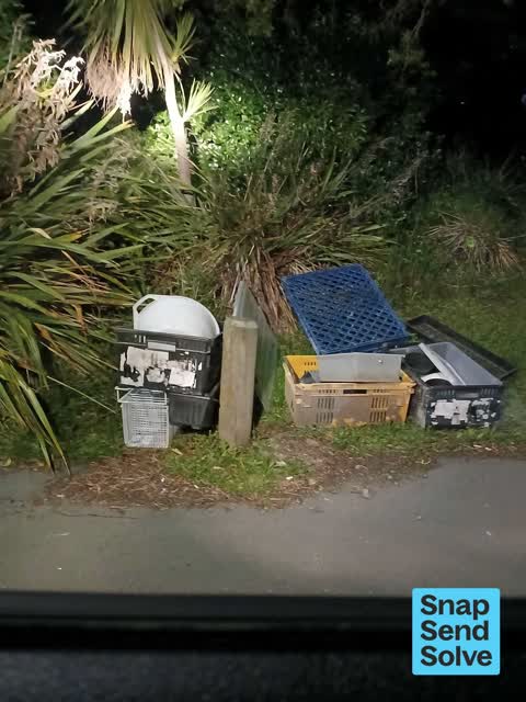


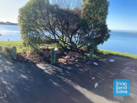
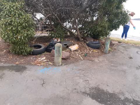
Reported here
 Dumped Rubbish —
 Dumped rubbish
 Dumped Rubbish —
  Street Light Outage —
  Dumped Rubbish —
  Dumped Rubbish —
 Dropped by Silver car QPP54
 Graffiti somewhere else —
 Same tagger has done multiple boxes
 Dumped Rubbish —
  Dumped Rubbish —
 as you can see on photos dumped rubbish to be collected please
- Hazard — vehicle —
- Graffiti —
- Dumped Rubbish —
- Dumped Rubbish —
- Dumped Rubbish —
- Dumped Rubbish —
- Graffiti —
- Litter —
- Overgrown Vegetation —
 Dumped Rubbish —
  Parks —
 Rubbish all over. I pick what can be recycled and leave the dirty rest for CCC
Rubbish/Recycling —
tyres etc
The street it is on
The street’s crash record
NZTA’s record names Linwood Avenue in 1 crash that hurt somebody since 2006 — 0 seriously hurt, nobody killed.
The green nearby
- Windsports Park — you are in it · Regional · 4 ha
- Charlesworth Reserve — 32 m to the edge · Regional · 24 ha
- Ti Rakau Reserve — 440 m to the edge · 3 ha
Parks within half a kilometre, measured to the boundary — the council’s open data.
The tracks through here
- Walk and bike track through Ferrymead — 29 m to the line · walk · bike
- Walk and bike track through Ferrymead — 118 m to the line · walk · bike
- Walk and bike track through Ferrymead — 272 m to the line · walk · bike
- Walk and bike track through Ferrymead — 274 m to the line · walk · bike
- Walk and bike track through Ferrymead — 311 m to the line · walk · bike
Tracks whose line passes within half a kilometre, measured to the line itself — the council’s open data.
The named ground
Named water within 500 m of this address, measured to the line or the edge; the council’s own structure register — bridges, boardwalks and steps standing nearby — the open map’s record.
The civic layer
This ground votes in Heathcote ward — the Spreydon-Cashmere-Heathcote community board. Ward lines don’t always follow suburb lines; this one is measured at the pin, not the suburb’s centre.
What stood on this ground → · On the map → · From the air — the Crown’s aerials back to 1936; search the address on RetroLens →
Questions, answered briefly
20 council reports on record since January 2022 — most often dumped rubbish (11), graffiti (2), street light outage (1).
Ferrymead, Christchurch — on Linwood Avenue.
Nothing on the heritage register at this exact spot — the record around this ground →
Windsports Park — the address is inside it, 4 ha.