1103 Dyers Pass Road
3 council reports since April 2022, 3 carrying a photograph. The street’s heaviest record is 561 Dyers Pass Road, 26 reports on file.
On the register here
From the air, then
Sourced from Canterbury Maps and partners. LINZ, CC BY 3.0 NZ. Each frame is cut from Environment Canterbury’s historic imagery MapServer for that decade, only where the Footprints layer names a CC BY survey (NZAM-covered spots stay out). RetroLens holds more Crown aerials →
The green nearby
- Stream Reserve, 58 m to the edge
- Reuter Park, 223 m to the edge · Regional · 23 ha
- Governors Bay Community Centre And Pool, 382 m to the edge · playground, 13 pieces
- Sandy Beach Road Reserve, 434 m to the edge
Parks within half a kilometre, measured to the boundary, the council’s open data. The whole roll is at /parks.
The named ground
Named places within 1.5 km of this address; the council’s own structure register, bridges, boardwalks and steps standing nearby, the open map’s record.
What gets reported here
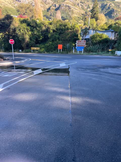
Photographed here 3 on record


What’s on record
 Flooding, 6 May 2025
 Hi there, during the rain event last week this drain was overflowing and has also popped up out of the ground. It meant I couldn't access th
 Damaged Street Sign, 26 Oct 2024
 Council workers left their sandbags and cones behind. Can someone please come collect them so they don't sit at the bottom of my driveway fo
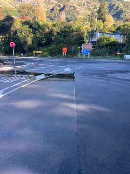 Water Leak, 13 Apr 2022
 Steady flow, busy road so needs sorted before road gets damaged or there is an accident
Elsewhere on Dyers Pass Road
- 561 Dyers Pass Road, 26 reports
- 560 Dyers Pass Road, 10 reports
- 751 Dyers Pass Road, 3 reports
- 555 Dyers Pass Road, 3 reports
- 1105 Dyers Pass Road, 3 reports
- 572 Dyers Pass Road, 2 reports
- 1091 Dyers Pass Road, 2 reports
- 963 Dyers Pass Road, 1 report
The street’s crash record
NZTA’s record names Dyers Pass Road in 21 crashes that hurt somebody since 2006, 1 person killed, 7 seriously hurt.
The civic layer
This ground votes in Banks Peninsula ward, the Banks Peninsula community board is its local layer. Ward lines don’t always follow suburb lines; this one is measured at the pin, not the suburb’s centre. The whole roll is at /wards.
Dyers Pass Road, the whole record → · Everything about Governors Bay → · What stood on this ground → · On the map → · From the air, RetroLens holds the Crown’s aerials back to 1936; search the address there →
Questions, answered briefly
3 council reports on record since April 2022, most often water leak (1), flooding (1), damaged street sign (1).
Governors Bay, Christchurch, on Dyers Pass Road.
The heritage register names a place at or beside it, Bridge/Culvert and Setting.
Stream Reserve, 58 m to its edge.