560 Dyers Pass Road
10 council reports since October 2020, 8 carrying a photograph. The street’s heaviest record is 561 Dyers Pass Road, 26 reports on file.
On the register here
- Sign of the Kiwi and Setting, 1700 Summit Road (7m)
- Sign of the Kiwi Grounds and Setting, 1700 Summit Road (15m)
From the air, then
Sourced from Canterbury Maps and partners. RNZAF, CC BY 3.0 NZ. Each frame is cut from Environment Canterbury’s historic imagery MapServer for that decade, only where the Footprints layer names a CC BY survey (NZAM-covered spots stay out). RetroLens holds more Crown aerials →
The green nearby
- Coronation Hill Reserve, you are in it · Regional · 4 ha
- Marleys Hill, 36 m to the edge · Regional · 21 ha
- Sugarloaf Reserve, 41 m to the edge · Regional · 110 ha
- Thomson Scenic Reserve, 239 m to the edge · Regional · 30 ha
- Reuter Park, 449 m to the edge · Regional · 23 ha
Parks within half a kilometre, measured to the boundary, the council’s open data. The whole roll is at /parks.
On the doorstep
- Sign of the Kiwi, 6 m away · Restaurants
Businesses within four hundred metres, measured at the pin, OpenStreetMap and the council directories.
The tracks through here
- Walk and bike track through Governors Bay, 44 m to the line · walk · bike
- Walk and bike track through Governors Bay, 55 m to the line · walk · bike
- Walk and bike track through Governors Bay, 251 m to the line · walk · bike
Tracks whose line passes within half a kilometre, the council’s open data.
The named ground
Named places within 1.5 km of this address; the council’s own structure register, bridges, boardwalks and steps standing nearby, the open map’s record.
The remembered names nearby
- Sister City Garden, 27 m away ·
Sister City Garden / (dedication text partly illegible)
· 2009
Inscribed plaques within two hundred and fifty metres, the register’s pins, not surveyed spots. The whole roll is at /plaques.
What gets reported here
Photographed here 8 on record


What’s on record
 Roads - General, 5 Dec 2023
 Debris (rocks and dead branches) within drainage channel. Is there a regular maintenance plan here? Thanks Lee at Cashmere Community Board
 Overgrown Vegetation, 5 Dec 2023
 Trees limiting visibility in places and debris in some higher trees along this route (can an arborist review the latter?) Thanks Lee Cashme
- Public Toilet, 24 Aug 2023
- Public Toilet, 23 Mar 2023
 Hazard, vehicle, 4 Sept 2022
 At sign of the kiwi the disabled park is not visible from the road and also the furtherest park from the cafe. Sitting here we’ve seen half
 Facility - General Request, 9 Aug 2022
 Black mold needs to be clean off mens toilet walls. All walls need washing ??
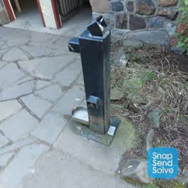 Parks, 5 Jul 2022
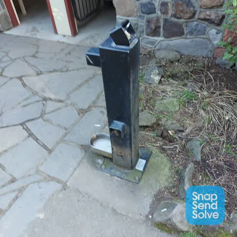
 Water fountain not working
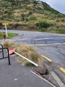 Roading/Streets, 19 Mar 2022
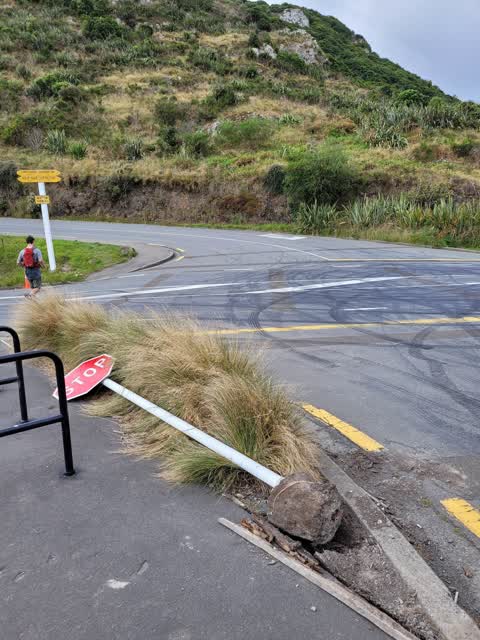
 The stop sign at the intersection of Summit Rd and Dyers Pass Road is down.
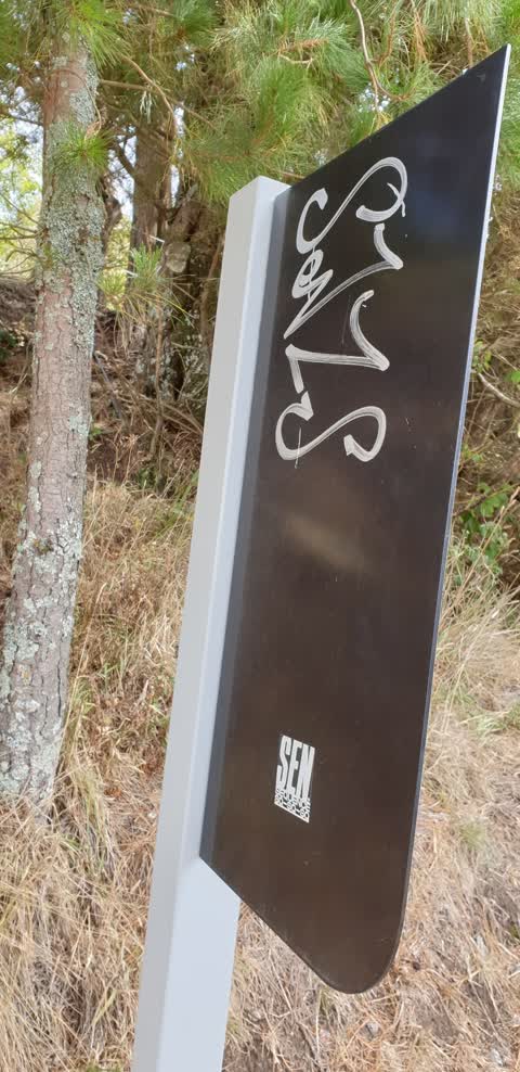
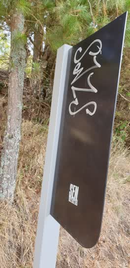 Graffiti, 21 Mar 2021
 coronation reserve track near sign of kiwo
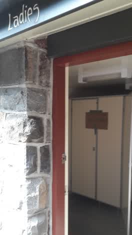 Public Toilet, 6 Oct 2020
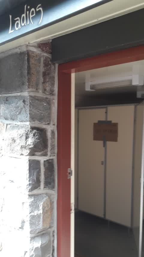
 One flusher unit in woman's toilets at Sign of the Kiwi not working. Feels like linkage broken.
Elsewhere on Dyers Pass Road
- 561 Dyers Pass Road, 26 reports
- 751 Dyers Pass Road, 3 reports
- 555 Dyers Pass Road, 3 reports
- 1105 Dyers Pass Road, 3 reports
- 1103 Dyers Pass Road, 3 reports
- 572 Dyers Pass Road, 2 reports
- 1091 Dyers Pass Road, 2 reports
- 963 Dyers Pass Road, 1 report
The street’s crash record
NZTA’s record names Dyers Pass Road in 21 crashes that hurt somebody since 2006, 1 person killed, 7 seriously hurt.
The civic layer
This ground votes in Banks Peninsula ward, the Banks Peninsula community board is its local layer. Ward lines don’t always follow suburb lines; this one is measured at the pin, not the suburb’s centre. The whole roll is at /wards.
Dyers Pass Road, the whole record → · Everything about Governors Bay → · What stood on this ground → · On the map → · From the air, RetroLens holds the Crown’s aerials back to 1936; search the address there →
Questions, answered briefly
10 council reports on record since October 2020, most often public toilet (3), roads - general (1), roading/streets (1).
Governors Bay, Christchurch, on Dyers Pass Road.
The heritage register names 2 places at or beside it, Sign of the Kiwi and Setting, Sign of the Kiwi Grounds and Setting.
Coronation Hill Reserve, the address is inside it, 4 ha.