6 John Paterson Drive, Halswell
25 reports on record since October 2022 · 14 with photographs. The street’s heaviest record is 5 John Paterson Drive — 36 reports on file. Indicative rating valuation and school zones, hazards, bin day and what stood here before.
What gets reported here
Photographed here 14 on record



Reported here
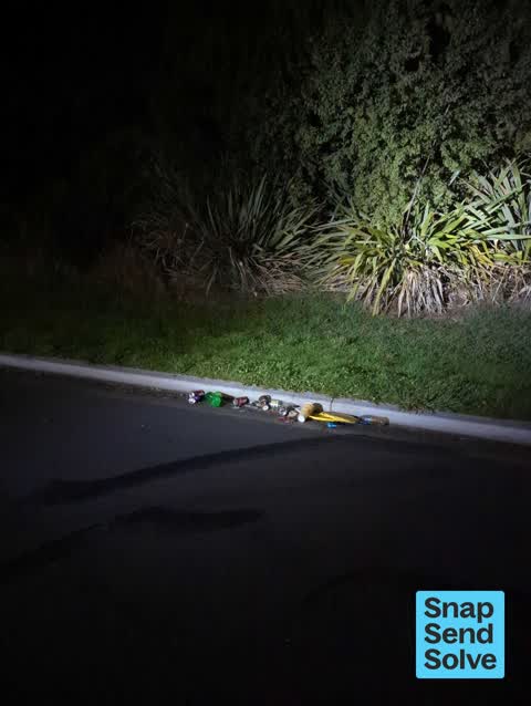
 Litter —
 NOS canisters, balloons, general takeaway rubbish, bottles/glass, cans
 Dumped Rubbish —
 Rubbish dumped on side of road at end of culdesac.
 Dumped Rubbish —
  Road Signage —
 Sign knocked over, located at western end of John Paterson Drive
 Dumped Rubbish —
 Few bags of rubbish and photo frame dumped on the boundary. There are other rubbish piles around.
 Vandalism - General —
 Damaged roadsign
 Damaged Street Sign —
  Dumped Rubbish —
 Dumped carpet underlay
 Graffiti on a sign, mural or public art —
 Graffiti on street sign "pone"
 Dumped Rubbish —
 A lot of smashed glass on the roadway posing a very high risk of damage to vehicles or injury to people
 Dumped Rubbish —
  Dumped Rubbish —
 More rubbish
 Dumped Rubbish —
 Old tent and other rubbish
 Pavement - General —
 Dumped rubbish
- Dumped Rubbish —
- Dumped Rubbish —
- Rubbish and Bins - General —
- Dumped Rubbish —
- Dumped Rubbish —
- Dumped Rubbish —
- Dumped Rubbish —
- Overgrown Vegetation —
- Overgrown Vegetation —
- Overgrown Vegetation —
- Rubbish and Bins - General —
Also reported on John Paterson Drive
- 5 John Paterson Drive — 36 reports
- 19 John Paterson Drive — 8 reports
- 26R John Paterson Drive — 7 reports
- 14 John Paterson Drive — 6 reports
- 50R John Paterson Drive — 5 reports
- 9 John Paterson Drive — 4 reports
- 17 John Paterson Drive — 4 reports
- 60b John Paterson Drive — 3 reports
The street’s crash record
NZTA’s record names John Paterson Drive in 1 crash that hurt somebody since 2006 — 0 seriously hurt, nobody killed.
The green nearby
- Springs Halswell Reserve — 450 m to the edge · 4 ha
Parks within half a kilometre, measured to the boundary — the council’s open data.
On the doorstep
- Tasman Fuels — 230 m away · Petrol stations
- Horror Maze — 259 m away · Attractions
Businesses within four hundred metres, measured at the pin — OpenStreetMap and the council directories.
The tracks through here
- Walk and bike track through Halswell — 101 m to the line · walk · bike
- Walk and bike track through Halswell — 382 m to the line · walk · bike
Tracks whose line passes within half a kilometre, measured to the line itself — the council’s open data.
Renting nearby
new bonds in Halswell ran about $697 a week — $147 above the city median of $550 — the suburb page keeps the rent record →.
The civic layer
This ground votes in Halswell ward — the Halswell-Hornby-Riccarton community board. Ward lines don’t always follow suburb lines; this one is measured at the pin, not the suburb’s centre.
What stood on this ground → · On the map → · From the air — the Crown’s aerials back to 1936; search the address on RetroLens →
Questions, answered briefly
25 council reports on record since October 2022 — most often dumped rubbish (14), overgrown vegetation (3), rubbish and bins - general (2).
Halswell, Christchurch — on John Paterson Drive.
Nothing on the heritage register at this exact spot — the record around this ground →
Springs Halswell Reserve — 450 m to its edge, 4 ha.