174 Port Hills Road, Heathcote Valley
17 reports on record since April 2019 · 16 with photographs. The street’s heaviest record is 40 Port Hills Road — 50 reports on file. Indicative rating valuation and school zones, hazards, bin day and what stood here before.
What gets reported here
Photographed here 16 on record




Reported here
 Accessibility —
 Walking to the bus stop opposite and using google maps the path it sends the user between Laing cres and Port hills road looks to me a priva
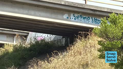
 Graffiti on a road, footpath or bridge —
 Multiple places on bridge pillars
 Graffiti on a fence, building or structure —
  Graffiti on a road, footpath or bridge —
 Reported this ages back but no action and more graffiti appearing. Pls do something
 Graffiti somewhere else —
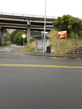
 At the bus stop. New one, the bigger one, is a few days old. Thanks.
 Water Leak —
 From meter box
 General Request —
 My neighbour, Danielle Phillips, of 14 Butts Valley Road, is selling flowers from the front of her house, which we suspect are not ‘ethicall
 Dumped Rubbish —
 Rubbish has been dumped at the bus stop on the corner of Port Hills Rd and Horotane Valley Rd.
 Graffiti on a fence, building or structure —
 Graffiti on over bridge
 Facility - General Request —
 No stop sign corner Horotane Valley road and port hills road
- Graffiti —
 Accessibility —
 Damaged fence with sharp metal edge
 Graffiti —
 Graffiti on bus shelter
 Graffiti —
 Graffiti —
Graffiti —
Graffiti —
Buy bus stop port hills rd Heathcote Valley rd
Also reported on Port Hills Road
- 40 Port Hills Road — 50 reports
- 20 Port Hills Road — 39 reports
- 237 Port Hills Road — 37 reports
- 81 Port Hills Road — 30 reports
- 220E Port Hills Road — 27 reports
- 220 Port Hills Road — 26 reports
- 83 Port Hills Road — 18 reports
- 60 Port Hills Road — 17 reports
The street’s crash record
NZTA’s record names Port Hills Road in 18 crashes that hurt somebody since 2006 — 4 seriously hurt, nobody killed.
The green nearby
- Warner Reserve — 215 m to the edge
- Scruttons Reserve — 375 m to the edge
- The Duncan Park — 399 m to the edge · 24 ha
- Laing Reserve — 486 m to the edge
Parks within half a kilometre, measured to the boundary — the council’s open data.
The bus nearby
- Port Hills Rd near Horotane Valley Rd — 29 m away · route 8
- Port Hills Rd near Horotane Valley Rd — 51 m away · route 8
The closest Metro stops, within four hundred and fifty metres.
Renting nearby
new bonds in Heathcote Valley ran about $750 a week — $200 above the city median of $550 — the suburb page keeps the rent record →.
The civic layer
This ground votes in Heathcote ward — the Spreydon-Cashmere-Heathcote community board. Ward lines don’t always follow suburb lines; this one is measured at the pin, not the suburb’s centre.
What stood on this ground → · On the map → · From the air — the Crown’s aerials back to 1936; search the address on RetroLens →
Questions, answered briefly
17 council reports on record since April 2019 — most often graffiti (6), graffiti on a road, footpath or bridge (2), graffiti on a fence, building or structure (2).
Heathcote Valley, Christchurch — on Port Hills Road.
Nothing on the heritage register at this exact spot — the record around this ground →
Warner Reserve — 215 m to its edge.