80 Martindales Road, Heathcote Valley
18 reports on record since January 2020 · 13 with photographs. The street’s heaviest record is 78 Martindales Road — 29 reports on file. Indicative rating valuation and school zones, hazards, bin day and what stood here before.
What gets reported here
Photographed here 13 on record




Reported here
 Fallen Tree —
 A few branches from last night storm, and the neighbours grass clippings that were blown across the road It would be great if you sent Tree
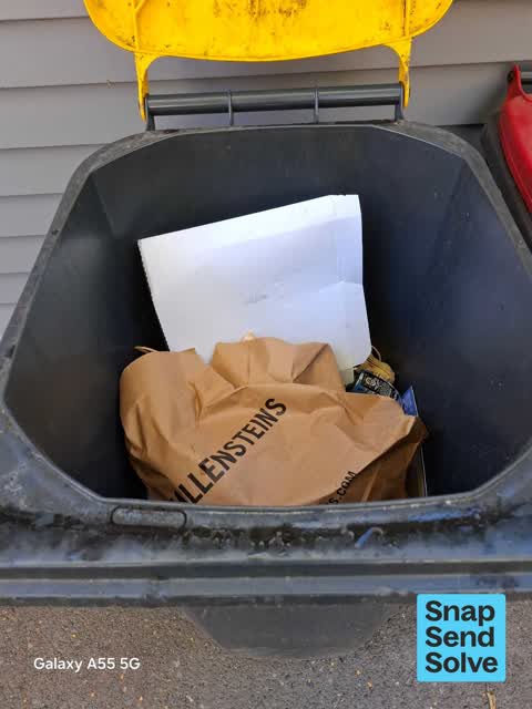
- Rubbish and Bins - General —
yellow bin has gone on the footpath for pick up this morning no bin this afternoon
 Rubbish and Bins - General —
 Bin not empty properly
 Rubbish and Bins - General —
 Bins not picked up both green and red
 Rubbish and Bins - General —
 Bin not emptied
 Rubbish and Bins - General —
 Bin halfed emptied
 Fallen Tree —
 Tree branch has fallen
 Water Leak —
 Leak please fix
 Water Leak —
 Leak can someone please come have a look at it
 Rubbish and Bins - General —
 Bins not emptied
 Rubbish and Bins - General —
 Broken lid on red bin
 Water Leak —
 - Water Leak —
- Trees - General —
- Overgrown Vegetation —
- Overgrown Vegetation —
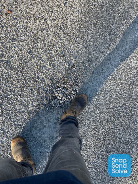
 Roading/Streets —
 Can you fix this pot hole please so it Doesn’t get bigger and expose The internet fibre wire that enable laid a few months back
Parks —
Low hanging branches making mowing difficult
Also reported on Martindales Road
- 78 Martindales Road — 29 reports
- 59 Martindales Road — 14 reports
- 2 Martindales Road — 11 reports
- 75 Martindales Road — 10 reports
- 8 Martindales Road — 8 reports
- 57 Martindales Road — 7 reports
- 31 Martindales Road — 7 reports
- 1 Martindales Road — 6 reports
The street’s crash record
NZTA’s record names Martindales Road in 1 crash that hurt somebody since 2006 — 1 person killed, 0 seriously hurt.
The green nearby
- Martindales Reserve No. 2 — 22 m to the edge
- Bridle Path Stream Reserve — 241 m to the edge
- Martindales Reserve No. 1 — 344 m to the edge
- Laing Reserve — 386 m to the edge
- Cooks Reserve — 416 m to the edge
Parks within half a kilometre, measured to the boundary — the council’s open data.
On the doorstep
- Craft Room Cafe — 269 m away · Cafés
- The Port Hills Barbershop — 275 m away · Hairdressers
- Spice Hub — 281 m away · Restaurants
- Maltworks Convenience Store — 288 m away · Dairies & convenience
Businesses within four hundred metres, measured at the pin — OpenStreetMap and the council directories.
The bus nearby
- Port Hills Rd near Stedley Pl — 50 m away · route 8
- Port Hills Rd near Martindales Rd — 63 m away · route 8
The closest Metro stops, within four hundred and fifty metres.
The named ground
Named places within 1.5 km of this address — the open map’s record.
The remembered names nearby
- Hutan Seyb 3 Railway Tee — 28 m away ·
Hutan Seyb 3 Railway Tee
· 2009
Inscribed plaques within two hundred and fifty metres — the register’s pins, not surveyed spots. The whole roll is at /plaques.
Renting nearby
new bonds in Heathcote Valley ran about $750 a week — $200 above the city median of $550 — the suburb page keeps the rent record →.
The civic layer
This ground votes in Heathcote ward — the Spreydon-Cashmere-Heathcote community board. Ward lines don’t always follow suburb lines; this one is measured at the pin, not the suburb’s centre.
What stood on this ground → · On the map → · From the air — the Crown’s aerials back to 1936; search the address on RetroLens →
Questions, answered briefly
18 council reports on record since January 2020 — most often rubbish and bins - general (7), water leak (4), overgrown vegetation (2).
Heathcote Valley, Christchurch — on Martindales Road.
Nothing on the heritage register at this exact spot — the record around this ground →
Martindales Reserve No. 2 — 22 m to its edge.