361 Port Hills Road, Hillsborough
15 reports on record since June 2022 · 7 with photographs. The most-reported address on Port Hills Road. Indicative rating valuation and school zones, hazards, bin day and what stood here before.
What gets reported here
Photographed here 7 on record


Reported here
 Trees - General —
remove dead branches off lawn
 Street Gutters / Storm Water —
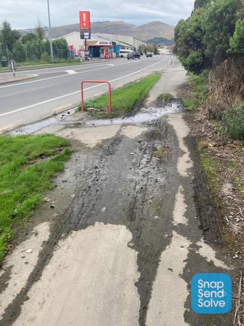
Drainage issues still not fixed. Never dry on this path.
 Water Leak —
Water leak - lots of old water sitting. Making the footpath dangerous
 Water Leak —
Water leak, appeared to be fixed but is now leaking again.
 Water Leak —
Leak has been here for months
 Pit and Equipment - General —
This lid isn’t sitting over the chamber correctly and needs to be re seated.
- Water Leak —
- Water Leak —
- Water Leak —
- Water Leak —
- Roads - General —
- Roads - General —
- Water Leak —
- Water Leak —
 Roading/Streets —
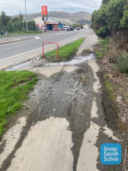
Footpath is covered in mud and water.
Also reported on Port Hills Road
- 422 Port Hills Road — 15 reports
- 340 Port Hills Road — 13 reports
- 350 Port Hills Road — 11 reports
- 333 Port Hills Road — 7 reports
- 315 Port Hills Road — 7 reports
- 321 Port Hills Road — 6 reports
- 308 Port Hills Road — 6 reports
- 301 Port Hills Road — 6 reports
The street’s crash record
NZTA’s record names Port Hills Road in 22 crashes that hurt somebody since 2006 — 6 seriously hurt, nobody killed.
The green nearby
- Curries Reserve — 203 m to the edge
- Nuttall Reserve — 288 m to the edge
- Hillsborough Park — 310 m to the edge · Sports ground · 4 ha
Parks within half a kilometre, measured to the boundary — the council’s open data.
On the doorstep
- Rocky Point — 79 m away · Petrol stations
- Rocky Auto — 88 m away · Car repair
- Fryers Tuck — 155 m away · Fast food
- Emerge Aotearoa — 321 m away · Charity
Businesses within four hundred metres, measured at the pin — OpenStreetMap and the council directories.
The bus nearby
- Port Hills Rd near Curries Rd — 82 m away · route 8
- Port Hills Rd near Curries Rd — 93 m away · route 8
The closest Metro stops, within four hundred and fifty metres.
The tracks through here
- Walk and bike track through Hillsborough — 9 m to the line · walk · bike
- Walk and bike track through Hillsborough — 69 m to the line · walk · bike
- Walk and bike track through Hillsborough — 69 m to the line · walk · bike
Tracks whose line passes within half a kilometre, measured to the line itself — the council’s open data.
Renting nearby
new bonds in Hillsborough ran about $445 a week — $105 below the city median of $550 — the suburb page keeps the rent record →.
The civic layer
This ground votes in Heathcote ward — the Spreydon-Cashmere-Heathcote community board. Ward lines don’t always follow suburb lines; this one is measured at the pin, not the suburb’s centre.
What stood on this ground → · On the map → · From the air — the Crown’s aerials back to 1936; search the address on RetroLens →
Questions, answered briefly
15 council reports on record since June 2022 — most often water leak (9), roads - general (2), trees - general (1).
Hillsborough, Christchurch — on Port Hills Road.
Nothing on the heritage register at this exact spot — the record around this ground →
Curries Reserve — 203 m to its edge.