89 Sparks Road, Hoon Hay
26 reports on record since November 2022 · 20 with photographs. The most-reported address on Sparks Road. Indicative rating valuation and school zones, hazards, bin day and what stood here before.
What gets reported here
Photographed here 20 on record




Reported here
 Graffiti on a traffic light pole or cabinet, or wa —
 Tags on signal box next to Hoon Hay school Sorry for the image busy road
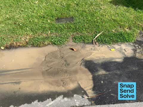
 Water Leak —
 Water leak at the entrance to Our Lady of the Assumption school
 Graffiti on a traffic light pole or cabinet, or wa —
  Water Leak —
 Water pouring out of the concrete
 Water Leak —
 Water leak at the entrance to Our Lady of the Assumption school
 Graffiti on a traffic light pole or cabinet, or wa —
 89 Sparks Rd - traffic light control box
 Graffiti on a traffic light pole or cabinet, or wa —
  Water General —
 Semi block drain
 Graffiti somewhere else —
 Blue cabinet between the two schools. Graffiti on both sides.
 Graffiti somewhere else —
  Graffiti somewhere else —
 On box between HHay School * OLA School
 Graffiti somewhere else —
 Don't know what brand this box is..
 Water General —
 Leak from previous job
 Water Leak —
 Water leak on footpath - been there since beginning of this week
 Water Leak —
 Water seems to be leaking from under the tarseal patch
 Water Leak —
 Water leak under footpath.
 Graffiti —
  Graffiti —
  Graffiti —
  Graffiti —
 - Graffiti —
- Graffiti —
- Graffiti —
- Graffiti —
- Graffiti —
- Roads - General —
Also reported on Sparks Road
- 66 Sparks Road — 25 reports
- 67 Sparks Road — 15 reports
- 89A Sparks Road — 14 reports
- 90 Sparks Road — 13 reports
- 62 Sparks Road — 12 reports
- 257 Sparks Road — 12 reports
- 87 Sparks Road — 11 reports
- 48 Sparks Road — 11 reports
The street’s crash record
NZTA’s record names Sparks Road in 37 crashes that hurt somebody since 2006 — 9 seriously hurt, nobody killed.
The green nearby
- Rydal Reserve — 123 m to the edge
- Hoon Hay Scouts Reserve — 314 m to the edge
- Centennial Park — 340 m to the edge · Sports ground · 10 ha
- Gainsborough Reserve — 400 m to the edge
Parks within half a kilometre, measured to the boundary — the council’s open data.
On the doorstep
- BP — 128 m away · Petrol stations
- Wild Bean Cafe - BP Hoon Hay — 134 m away · Cafés
- Hoon Hay Pharmacy — 230 m away · Pharmacies
- The Hoon Hay Medical Centre — 250 m away · Doctors & clinics
Businesses within four hundred metres, measured at the pin — OpenStreetMap and the council directories.
The bus nearby
The closest Metro stops, within four hundred and fifty metres.
The tracks through here
- Walk and bike track through Hoon Hay — 377 m to the line · walk · bike
Tracks whose line passes within half a kilometre, measured to the line itself — the council’s open data.
The named ground
Named water within 500 m of this address, measured to the line or the edge — the open map’s record.
Renting nearby
new bonds in Hoon Hay ran about $573 a week — $23 above the city median of $550 — the suburb page keeps the rent record →.
The civic layer
This ground votes in Spreydon ward — the Spreydon-Cashmere-Heathcote community board. Ward lines don’t always follow suburb lines; this one is measured at the pin, not the suburb’s centre.
What stood on this ground → · On the map → · From the air — the Crown’s aerials back to 1936; search the address on RetroLens →
Questions, answered briefly
26 council reports on record since November 2022 — most often graffiti (9), water leak (6), graffiti somewhere else (4).
Hoon Hay, Christchurch — on Sparks Road.
Nothing on the heritage register at this exact spot — the record around this ground →
Rydal Reserve — 123 m to its edge.