90 Sparks Road, Hoon Hay
13 reports on record since November 2019 · 9 with photographs. The street’s heaviest record is 89 Sparks Road — 26 reports on file. Indicative rating valuation and school zones, hazards, bin day and what stood here before.
What gets reported here
Photographed here 9 on record


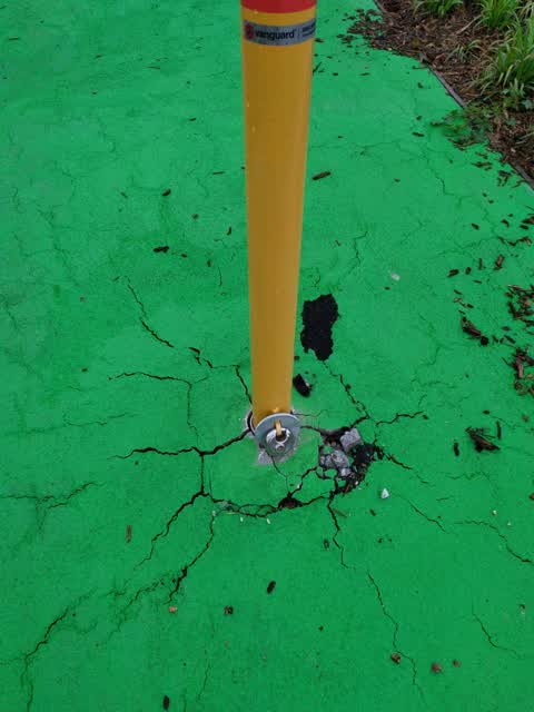
Reported here
- Pothole —
Multiple potholes appeared overnight along Sparks Rd as a result of the heavy rain - particularly the stretch roughly between Gainsborough a
 Graffiti somewhere else —
 Traffic cabinet graffitied both between school entrances.
 Graffiti on a cabinet, pole or railway asset —
 On traffic box between the schools
 Graffiti somewhere else —
  Graffiti somewhere else —
  Graffiti somewhere else —
  Water Leak —
 Water leaking from footpath/kerb
 General Request —
 On box next to traffic lights
 Graffiti —
 Outside join hay school
- Graffiti —
- Graffiti —
- Graffiti —
Roading/Streets —
Also reported on Sparks Road
- 89 Sparks Road — 26 reports
- 66 Sparks Road — 25 reports
- 67 Sparks Road — 15 reports
- 89A Sparks Road — 14 reports
- 62 Sparks Road — 12 reports
- 257 Sparks Road — 12 reports
- 87 Sparks Road — 11 reports
- 48 Sparks Road — 11 reports
The street’s crash record
NZTA’s record names Sparks Road in 37 crashes that hurt somebody since 2006 — 9 seriously hurt, nobody killed.
The green nearby
- Rydal Reserve — 110 m to the edge
- Hoon Hay Scouts Reserve — 304 m to the edge
- Centennial Park — 339 m to the edge · Sports ground · 10 ha
- Gainsborough Reserve — 410 m to the edge
Parks within half a kilometre, measured to the boundary — the council’s open data.
On the doorstep
- BP — 134 m away · Petrol stations
- Wild Bean Cafe - BP Hoon Hay — 138 m away · Cafés
- Hoon Hay Pharmacy — 226 m away · Pharmacies
- The Hoon Hay Medical Centre — 246 m away · Doctors & clinics
Businesses within four hundred metres, measured at the pin — OpenStreetMap and the council directories.
The bus nearby
The closest Metro stops, within four hundred and fifty metres.
The tracks through here
- Walk and bike track through Hoon Hay — 375 m to the line · walk · bike
Tracks whose line passes within half a kilometre, measured to the line itself — the council’s open data.
The named ground
Named water within 500 m of this address, measured to the line or the edge — the open map’s record.
Renting nearby
new bonds in Hoon Hay ran about $573 a week — $23 above the city median of $550 — the suburb page keeps the rent record →.
The civic layer
This ground votes in Spreydon ward — the Spreydon-Cashmere-Heathcote community board. Ward lines don’t always follow suburb lines; this one is measured at the pin, not the suburb’s centre.
What stood on this ground → · On the map → · From the air — the Crown’s aerials back to 1936; search the address on RetroLens →
Questions, answered briefly
13 council reports on record since November 2019 — most often graffiti somewhere else (4), graffiti (4), water leak (1).
Hoon Hay, Christchurch — on Sparks Road.
Nothing on the heritage register at this exact spot — the record around this ground →
Rydal Reserve — 110 m to its edge.