50R Wilmers Road, Hornby
14 reports on record since February 2024 · 13 with photographs. The street’s heaviest record is 4 Wilmers Road — 30 reports on file. Indicative rating valuation and school zones, hazards, bin day and what stood here before.
What gets reported here
Photographed here 13 on record


Reported here
 Pavement - General —
Halswell to Wigram on cycle path. Signs needed, maybe on the bridge, to warn cyclists that after going under the underpass you need to stop
- Street Light Outage —
Lights out in cycle underpass Southern Motorway Halswell Junction Road
 Graffiti on a traffic light pole or cabinet, or wa —
Tag on metal box, beside cycleway
 Dumped Rubbish —
 Graffiti on a fence, building or structure —
On power box, beside cycleway
 Dumped Rubbish —
 Dumped Rubbish —
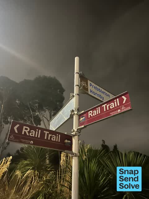
 Damaged Street Sign —
The sign has spun around again. This is maybe the fifth or more time this happened.
 Facility - General Request —
Abandoned appliance, beside cycleway and motorway. Probably fallen off vehicle
 Damaged Street Sign —
Every time I come past the signs are spun around the wrong way. A few times someone has come out to sort but then they revert again. Little
 Poles and Signage - General —
On the cycle trail. The sign pointing to Prebbleton appears to be facing the wrong way.
 Dumped Rubbish —
Dumped metal bin here since over a year. Likely fell off a truck from the state highway. Adjacent to the shared path, near the sign to go in
 Poles and Signage - General —
Multiple times the guy has come out to fix these signs. When he fixes, I check it and it looks fine then the next day or another bit if wind
 Graffiti —
Also reported on Wilmers Road
- 4 Wilmers Road — 30 reports
- 46 Wilmers Road — 20 reports
- 60 Wilmers Road — 13 reports
- 46R Wilmers Road — 13 reports
- 4R Wilmers Road — 11 reports
- 6A Wilmers Road — 10 reports
- 6 Wilmers Road — 10 reports
- 10 Wilmers Road — 9 reports
The street’s crash record
NZTA’s record names Wilmers Road in 11 crashes that hurt somebody since 2006 — 0 seriously hurt, nobody killed.
The tracks through here
- Walk and bike track through Hornby — 285 m to the line · walk · bike
Tracks whose line passes within half a kilometre, measured to the line itself — the council’s open data.
The named ground
Named places within 1.5 km of this address; the council’s own structure register — bridges, boardwalks and steps standing nearby — the open map’s record.
Renting nearby
new bonds in Hornby ran about $550 a week — about the city median — the suburb page keeps the rent record →.
The civic layer
This ground votes in Hornby ward — the Halswell-Hornby-Riccarton community board. Ward lines don’t always follow suburb lines; this one is measured at the pin, not the suburb’s centre.
What stood on this ground → · On the map → · From the air — the Crown’s aerials back to 1936; search the address on RetroLens →
Questions, answered briefly
14 council reports on record since February 2024 — most often dumped rubbish (4), poles and signage - general (2), damaged street sign (2).
Hornby, Christchurch — on Wilmers Road.
Nothing on the heritage register at this exact spot — the record around this ground →