11 Huntsbury Avenue, Huntsbury
13 reports on record since May 2020 · 11 with photographs. The street’s heaviest record is 30H Huntsbury Avenue — 16 reports on file. Indicative rating valuation and school zones, hazards, bin day and what stood here before.
What gets reported here
- Pavement - General — 6
- Street Gutters / Storm Water — 3
- Roading/Streets — 2
- Water Supply — 1
- Facility - General Request — 1
Photographed here 11 on record
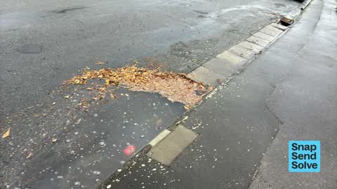


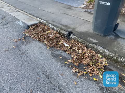
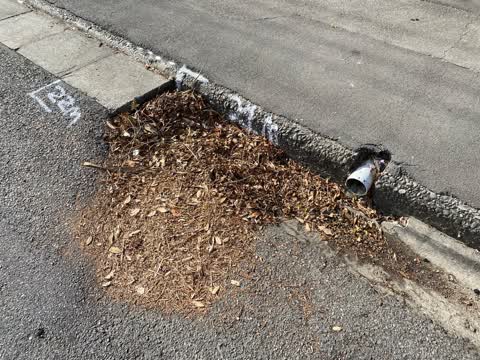
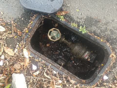
Reported here
 Street Gutters / Storm Water —
Blocked gutter bridge.
 Street Gutters / Storm Water —
I cleaned out the sump about a month ago. The Intergen sucker truck came through this morning but left the mess seen in the photos, on the r
 Street Gutters / Storm Water —
Blocked sump. I know you only cleared this yesterday…
 Pavement - General —
Storm debris on road and in gutter.
 Pavement - General —
Blocked sump with vegetation and gravel from chipseal
 Pavement - General —
Blocked sump
 Pavement - General —
Blocked sump
 Pavement - General —
Blocked sump. Excess chip from sealing.
- Facility - General Request —
- Pavement - General —
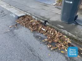 Roading/Streets —
Blocked gutter
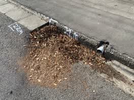 Roading/Streets —
Blocked gutter, Will cause flooding to private property.
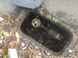 Water Supply —
leaky toby
Also reported on Huntsbury Avenue
- 30H Huntsbury Avenue — 16 reports
- 25 Huntsbury Avenue — 15 reports
- 184 Huntsbury Avenue — 15 reports
- 12C Huntsbury Avenue — 9 reports
- 9 Huntsbury Avenue — 8 reports
- 30F Huntsbury Avenue — 8 reports
- 30C Huntsbury Avenue — 8 reports
- 29 Huntsbury Avenue — 8 reports
The street’s crash record
NZTA’s record names Huntsbury Avenue in 4 crashes that hurt somebody since 2006 — 1 seriously hurt, nobody killed.
The green nearby
- Centaurus Park — 171 m to the edge · 1 ha
- Huntsbury Playground — 183 m to the edge
- Ramahana Reserve — 278 m to the edge
- Palatine Reserve — 458 m to the edge
- Heathcote Riverbank True Left — 476 m to the edge · 4 ha
Parks within half a kilometre, measured to the boundary — the council’s open data.
On the doorstep
- Kleynbos Bed & Breakfast — 312 m away · B&Bs
- Huntsbury Seafoods — 328 m away · Fast food
- Cocoa Black St Martins — 331 m away · Restaurants
- Fava Cafe — 334 m away · Cafés
Businesses within four hundred metres, measured at the pin — OpenStreetMap and the council directories.
The bus nearby
- Huntsbury Ave near Ramahana Rd — 13 m away · route 27
- Huntsbury Ave near Ramahana Rd — 26 m away · route 27
The closest Metro stops, within four hundred and fifty metres.
The tracks through here
- Walk and bike track through Huntsbury — 197 m to the line · walk · bike
- Walk and bike track through Huntsbury — 211 m to the line · walk · bike
- Walk and bike track through Huntsbury — 274 m to the line · walk · bike
- Walk and bike track through Huntsbury — 374 m to the line · walk · bike
- Walk and bike track through Huntsbury — 376 m to the line · walk · bike
Tracks whose line passes within half a kilometre, measured to the line itself — the council’s open data.
The named ground
Named water within 500 m of this address, measured to the line or the edge; Named places within 1.5 km of this address; the council’s own structure register — bridges, boardwalks and steps standing nearby — the open map’s record.
Renting nearby
new bonds in Huntsbury ran about $550 a week — about the city median — the suburb page keeps the rent record →.
The civic layer
This ground votes in Cashmere ward — the Spreydon-Cashmere-Heathcote community board. Ward lines don’t always follow suburb lines; this one is measured at the pin, not the suburb’s centre.
What stood on this ground → · On the map → · From the air — the Crown’s aerials back to 1936; search the address on RetroLens →
Questions, answered briefly
13 council reports on record since May 2020 — most often pavement - general (6), street gutters / storm water (3), roading/streets (2).
Huntsbury, Christchurch — on Huntsbury Avenue.
Nothing on the heritage register at this exact spot — the record around this ground →
Centaurus Park — 171 m to its edge, 1 ha.