184 Huntsbury Avenue, Huntsbury
15 reports on record since May 2022 · 9 with photographs. The street’s heaviest record is 30H Huntsbury Avenue — 16 reports on file. Indicative rating valuation and school zones, hazards, bin day and what stood here before.
What gets reported here
Photographed here 9 on record


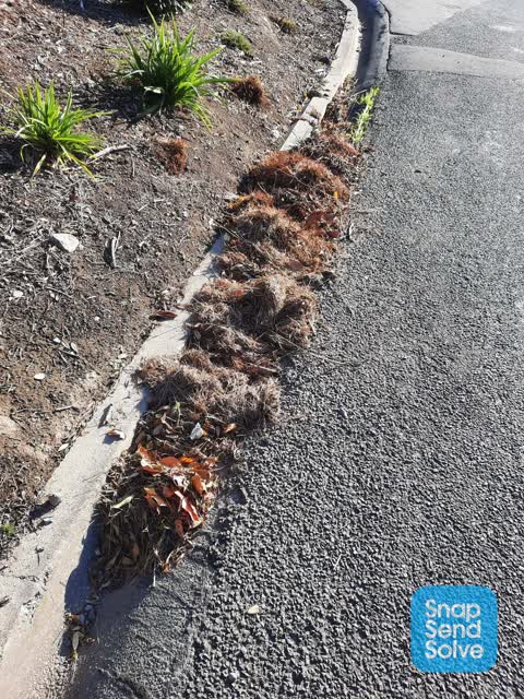
Reported here
 Street Gutters / Storm Water —
blocked drain corner Huntsbury Ave & Tiriroa Lane
 Street Gutters / Storm Water —
blocked drain needs clearing
 Street Gutters / Storm Water —
blocked drain
 Street Gutters / Storm Water —
Blocked drain
 Street Cleaning —
Two blocked drains on the corner of Huntsbury Ave & Tiroroa Place.
 Street Cleaning —
Blocked drains on the corner of Huntsbury Ave & Tiriroa Lane. Caused by lots of heavy rain washing debris & shingle from road above.
 Street Cleaning —
Blocked drain
 Street Cleaning —
Blocked drains x 2 corner of Huntsbury Ave & Tiroroa Lane. One in Huntsbury Ave & one on Tiroroa Lane.
- Rubbish and Bins - General —
- Street Cleaning —
- Street Cleaning —
- Roads - General —
- Roads - General —
- Roads - General —
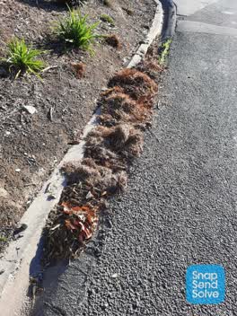 Roading/Streets —
Hi. We have a blocked drain outside our house. Can it be cleared please?
Also reported on Huntsbury Avenue
- 30H Huntsbury Avenue — 16 reports
- 25 Huntsbury Avenue — 15 reports
- 11 Huntsbury Avenue — 13 reports
- 12C Huntsbury Avenue — 9 reports
- 9 Huntsbury Avenue — 8 reports
- 30F Huntsbury Avenue — 8 reports
- 30C Huntsbury Avenue — 8 reports
- 29 Huntsbury Avenue — 8 reports
The street’s crash record
NZTA’s record names Huntsbury Avenue in 4 crashes that hurt somebody since 2006 — 1 seriously hurt, nobody killed.
The green nearby
- Huia Gilpin Reserve — 192 m to the edge · Regional · 8 ha
- Pennine Reserve — 329 m to the edge
- Kenmure Reserve — 479 m to the edge
- Coronation Reserve — 492 m to the edge · 7 ha
Parks within half a kilometre, measured to the boundary — the council’s open data.
On the doorstep
- Tussock Hill Vineyard — 265 m away · Restaurants
Businesses within four hundred metres, measured at the pin — OpenStreetMap and the council directories.
The tracks through here
- Walk and bike track through Huntsbury — 208 m to the line · walk · bike
Tracks whose line passes within half a kilometre, measured to the line itself — the council’s open data.
The named ground
Named places within 1.5 km of this address — the open map’s record.
Renting nearby
new bonds in Huntsbury ran about $550 a week — about the city median — the suburb page keeps the rent record →.
The civic layer
This ground votes in Cashmere ward — the Spreydon-Cashmere-Heathcote community board. Ward lines don’t always follow suburb lines; this one is measured at the pin, not the suburb’s centre.
What stood on this ground → · On the map → · From the air — the Crown’s aerials back to 1936; search the address on RetroLens →
Questions, answered briefly
15 council reports on record since May 2022 — most often street cleaning (6), street gutters / storm water (4), roads - general (3).
Huntsbury, Christchurch — on Huntsbury Avenue.
Nothing on the heritage register at this exact spot — the record around this ground →
Huia Gilpin Reserve — 192 m to its edge, 8 ha.