77 Ilam Road, Ilam
11 reports on record since April 2022 · 9 with photographs. The street’s heaviest record is 66 Ilam Road — 21 reports on file. Indicative rating valuation and school zones, hazards, bin day and what stood here before.
What gets reported here
- Roading/Streets — 2
- Street Gutters / Storm Water — 1
- Street Cleaning — 1
- Sign Poles — 1
- Road Signage — 1
- Hazard — vehicle — 1
Photographed here 9 on record


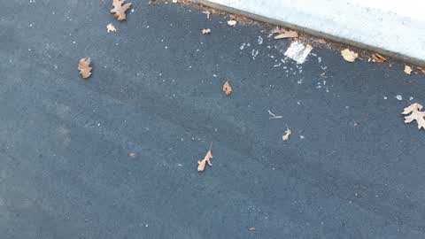
Reported here
 Damaged Road —
 guttering along roadside outside ilam school is appalling. guttering and road edge parking needs relaying. road layout for safety, school
 Damaged Street Sign —
 Traffic sign has been snapped off
 Street Gutters / Storm Water —
 gutters need fixing. for all the expenses of cycle ways this ilam rd guttering is atrocious. also the design of this outside a school entran
 Sign Poles —
 Kia ora, The P30 parking sign here has taken a slide to the ground! Thanks, Anne
- Street Cleaning —
Can we up the cycle way sweeping in and around avonhead, university and middleton etc. since the students have returned its glass glass and
 Graffiti somewhere else —
  Road Signage —
 Sign facing wrong way
 Hazard — vehicle —
 Car parked over parking line obstructing driveway Please communicate thru email Max@liftsolutions.co.nz
- Graffiti —
 Roading/Streets —
 Broken glass on cycleway
 Roading/Streets —
 Glass on cycle path
Also reported on Ilam Road
- 66 Ilam Road — 21 reports
- 90 Ilam Road — 11 reports
- 120 Ilam Road — 10 reports
- 149 Ilam Road — 7 reports
- 121 Ilam Road — 7 reports
- 158 Ilam Road — 6 reports
- 129 Ilam Road — 6 reports
- 128 Ilam Road — 6 reports
The street’s crash record
NZTA’s record names Ilam Road in 66 crashes that hurt somebody since 2006 — 11 seriously hurt, nobody killed.
The green nearby
- Siska Reserve — 374 m to the edge
- Milnebank Reserve — 459 m to the edge
Parks within half a kilometre, measured to the boundary — the council’s open data.
On the doorstep
- Zyka Indian Cuisine — 108 m away · Restaurants
- Campus Corner Dairy — 130 m away · Dairies & convenience
- Foo San — 130 m away · Restaurants
- Captain Ben's — 131 m away · Fast food
Businesses within four hundred metres, measured at the pin — OpenStreetMap and the council directories.
The bus nearby
- University - Ilam Rd — 74 m away · route 3, route 100
- Ilam Rd near Kirkwood Ave — 413 m away · route 3, route 100
The closest Metro stops, within four hundred and fifty metres.
The tracks through here
- Walk and bike track through Ilam — 3 m to the line · walk · bike
- Walk and bike track through Ilam — 56 m to the line · walk · bike
- Walk and bike track through Ilam — 210 m to the line · walk · bike
- Walk and bike track through Ilam — 479 m to the line · walk · bike
Tracks whose line passes within half a kilometre, measured to the line itself — the council’s open data.
The named ground
Named water within 500 m of this address, measured to the line or the edge — the open map’s record.
Renting nearby
new bonds in Ilam ran about $548 a week — about the city median — the suburb page keeps the rent record →.
What was here — Former Dwelling and Setting, Ilam
212 m away · 87 Ilam Road · located to ±22 m · the place’s own record →
On the register. Nothing researched here yet.
What was here — Former Ilam Gardens
239 m away · located to ±203 m · the place’s own record →
On the register. Nothing researched here yet.
The civic layer
This ground votes in Riccarton ward — the Halswell-Hornby-Riccarton community board. Ward lines don’t always follow suburb lines; this one is measured at the pin, not the suburb’s centre.
What stood on this ground → · On the map → · From the air — the Crown’s aerials back to 1936; search the address on RetroLens →
Questions, answered briefly
11 council reports on record since April 2022 — most often roading/streets (2), street gutters / storm water (1), street cleaning (1).
Ilam, Christchurch — on Ilam Road.
The heritage register names 2 places at or beside it — Former Dwelling and Setting, Ilam, Former Ilam Gardens.
Siska Reserve — 374 m to its edge.