962 Le Bons Bay Road
2 council reports since July 2024, 2 carrying a photograph. The street’s heaviest record is 960 Le Bons Bay Road, 5 reports on file.
The green nearby
- Le Bons Bay Domain, you are in it · Sports ground · 6 ha · playground, 16 pieces
Parks within half a kilometre, measured to the boundary, the council’s open data. The whole roll is at /parks.
The named ground
Named water within 500 m of this address, measured to the line or the edge; Named places within 1.5 km of this address, the open map’s record.
The remembered names nearby
- This Fence Is Erected in Memory of Gilbert Hugh Glavish, 159 m away ·
THIS FENCE IS ERECTED IN MEMORY OF GILBERT HUGH GLAVISH BY HIS WIFE & DAUGHTER
· 2008
Inscribed plaques within two hundred and fifty metres, the register’s pins, not surveyed spots. The whole roll is at /plaques.
What gets reported here
- Water Pollution - Sediment, 1
- Facility - General Request, 1
Photographed here 2 on record

What’s on record
 Water Pollution - Sediment, 16 Jul 2024
 Sea has brought in debri, and has blocked the hole for water to run through. Debri needs to be removed, sitting stagnant for last 4weeks
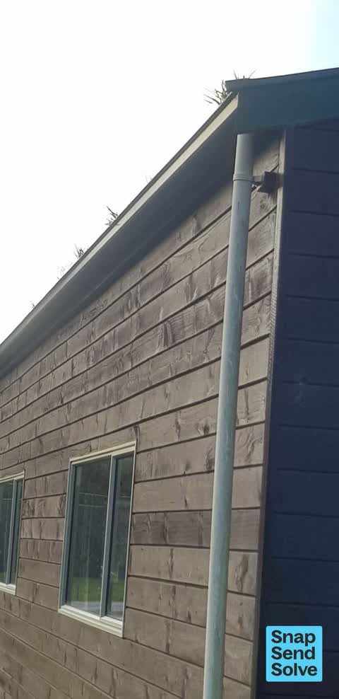
 Facility - General Request, 13 Jul 2024
 Grass in gutters of le bons bay domain hall. Prevents filling the water tank.
Elsewhere on Le Bons Bay Road
- 960 Le Bons Bay Road, 5 reports
- 568 Le Bons Bay Road, 2 reports
- 549 Le Bons Bay Road, 2 reports
- 934 Le Bons Bay Road, 1 report
- 905 Le Bons Bay Road, 1 report
- 592 Le Bons Bay Road, 1 report
- 548 Le Bons Bay Road, 1 report
The street’s crash record
NZTA’s record names Le Bons Bay Road in 1 crash that hurt somebody since 2006, 0 seriously hurt, nobody killed.
The civic layer
This ground votes in Banks Peninsula ward, the Banks Peninsula community board is its local layer. Ward lines don’t always follow suburb lines; this one is measured at the pin, not the suburb’s centre. The whole roll is at /wards.
Le Bons Bay Road, the whole record → · Everything about Le Bons Bay → · What stood on this ground → · On the map → · From the air, RetroLens holds the Crown’s aerials back to 1936; search the address there →
Questions, answered briefly
2 council reports on record since July 2024, most often water pollution - sediment (1), facility - general request (1).
Le Bons Bay, Christchurch, on Le Bons Bay Road.
Nothing on the heritage register at this exact spot, the record around this ground →
Le Bons Bay Domain, the address is inside it, 6 ha.