1D Thomas Street
1 council report since August 2026, 1 carrying a photograph. The street’s heaviest record is 17 Thomas Street, 13 reports on file.
The green nearby
- Linwood Park, 83 m to the edge · Sports ground · 9 ha · playground, 83 pieces
- Linwood Nursery, 123 m to the edge · 1 ha
- Linwood Esplanade Reserve, 348 m to the edge
Parks within half a kilometre, measured to the boundary, the council’s open data. The whole roll is at /parks.
The civic shelf nearby
- Linwood Service Centre, 276 m away · Service centre
- Linwood Library, 435 m away · Library
Libraries, halls and the rest within half a kilometre, the council’s open data.
On the doorstep
- Linwood Pool: Te Pou Toetoe, 126 m away · Sports centres
- On The Go, 230 m away · Car repair
- Linwood Ave Rotary Market, 232 m away · Markets
- KFC, 251 m away · Fast food
Businesses within four hundred metres, measured at the pin, OpenStreetMap and the council directories.
The bus nearby
- Eastgate Mall (Linwood Ave), 191 m away · route 140
- Cranley St, 333 m away · route 140
The closest Metro stops, within four hundred and fifty metres.
The tracks through here
- Walk and bike track through Linwood, 59 m to the line · walk · bike
- Walk and bike track through Linwood, 125 m to the line · walk · bike
- Walk and bike track through Linwood, 212 m to the line · walk · bike
- Walk and bike track through Linwood, 297 m to the line · walk · bike
- Walk and bike track through Linwood, 300 m to the line · walk · bike
Tracks whose line passes within half a kilometre, the council’s open data.
The named ground
the council’s own structure register, bridges, boardwalks and steps standing nearby, the open map’s record.
The remembered names nearby
- Christchurch City Council / Parks and Recreation Depot, 192 m away ·
CHRISTCHURCH CITY COUNCIL / PARKS AND RECREATION DEPOT / OFFICIALLY OPENED BY / THE MAYOR
· 1899 - This Tree Was Planted to Commemorate the Coronation, 201 m away ·
This tree was planted to commemorate the coronation of H.M. Elizabeth II 1953
· 2009
Inscribed plaques within two hundred and fifty metres, the register’s pins, not surveyed spots. The whole roll is at /plaques.
Renting nearby
new bonds in Linwood ran about $478 a week, $72 below the city median of $550, the suburb page keeps the rent record →.
What gets reported here
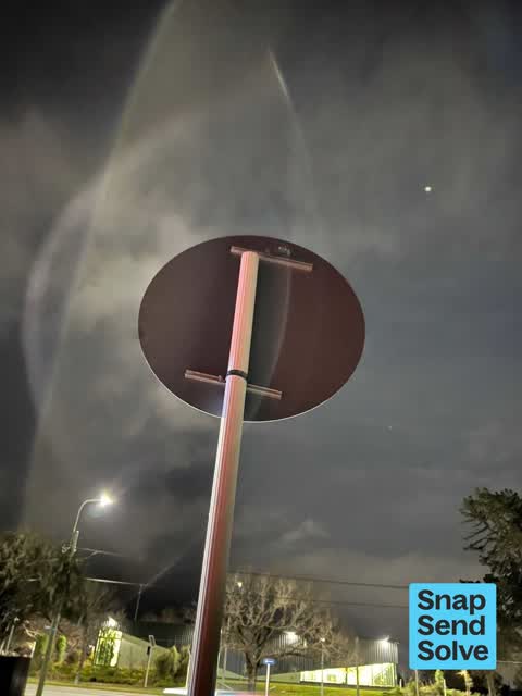
Photographed here 1 on record
What’s on record
 Damaged Street Sign, 1 Aug 2026
The 30k speed sign at the Linwood Ave end of Thomas street has come loose and is flapping badly in the wind tonight. It’s making quite a noi
Elsewhere on Thomas Street
- 17 Thomas Street, 13 reports
- 20 Thomas Street, 12 reports
- 36 Thomas Street, 8 reports
- 23 Thomas Street, 8 reports
- 11 Thomas Street, 8 reports
- 22 Thomas Street, 6 reports
- 1A Thomas Street, 5 reports
- 15 Thomas Street, 5 reports
The street’s crash record
NZTA’s record names Thomas Street in 6 crashes that hurt somebody since 2006, 1 seriously hurt, nobody killed.
The civic layer
This ground votes in Linwood ward, the Coastal-Burwood-Linwood community board is its local layer. Ward lines don’t always follow suburb lines; this one is measured at the pin, not the suburb’s centre. The whole roll is at /wards.
Thomas Street, the whole record → · Everything about Linwood → · What stood on this ground → · On the map → · Street View → · From the air, RetroLens holds the Crown’s aerials back to 1936; search the address there →
Questions, answered briefly
1 council report on record since August 2026, most often damaged street sign (1).
Linwood, Christchurch, on Thomas Street.
Nothing on the heritage register at this exact spot, the record around this ground →
Linwood Park, 83 m to its edge, 9 ha.