214 Woodham Road, Linwood
41 reports on record since June 2018 · 32 with photographs. The most-reported address on Woodham Road. Indicative rating valuation and school zones, hazards, bin day and what stood here before.
What gets reported here
- Graffiti — 20
- Graffiti on a fence, building or structure — 7
- Roading/Streets — 3
- Flooding — 3
- General Request — 2
- Water Leak — 1
Photographed here 32 on record


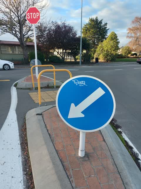
Reported here
 Graffiti on a fence, building or structure —
 graffiti on green gate and brown fence
 Graffiti on a fence, building or structure —
 graffiti on brown fence
 Graffiti on a fence, building or structure —
 graffiti on white wall
 Graffiti on a fence, building or structure —
 graffiti on both sides of store
 Graffiti on a fence, building or structure —
 graffiti on Worcester st side
 Graffiti on a fence, building or structure —
 graffiti on side
 General Request —
  Graffiti on a fence, building or structure —
 On green box
 Road Signage —
 Aoc from mop cars parking within cycle lane outside dairy. Yellow lines have been blacked out. More green paint perhaps? Safety issue as cyc
- Graffiti on a road, footpath or bridge —
In the cycle way outside the shop, the yellow lines have been painted black.
 Graffiti somewhere else —
  General Request —
 Yellow lines needed here otherwise cars park blocking the cycleway. This is dangerous to cyclists as they are forced into a deliberately nar
- Graffiti —
- Graffiti —
- Graffiti —
- Graffiti —
- Damaged Road —
- Graffiti —
- Graffiti —
- Graffiti —
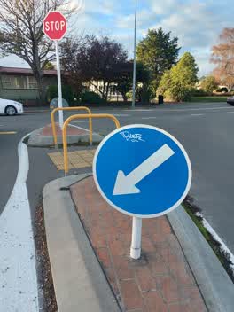 Graffiti —
 Tagging on both sides of both blue arrow signs in central reservation of Worcester St at Woodham Rd
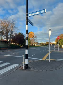 Graffiti —
 Tag on orange reflective sign outside Woodham Foodmarket on post for pedestrian crossing and also a tag on the post on opposite side of cros
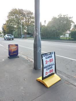 Graffiti —
 Green, black and white tags on the lamppost outside the Woodham Foodmarket on Woodham Road
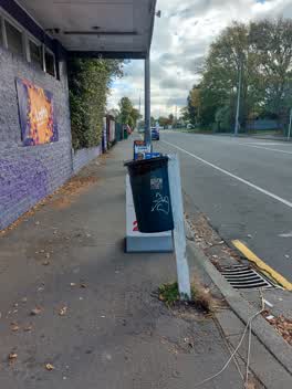 Graffiti —
 Tagging over the rubbish bin outside the Woodham Foodmarket, on Woodham Rd
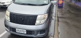 Roading/Streets —
 Abandoned car. left it for more than a week in 30ins parking area
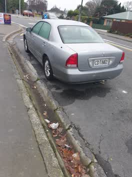 Roading/Streets —
 Abandoned car parked on corner of Worcester street and woodham road near woodham road dairy.
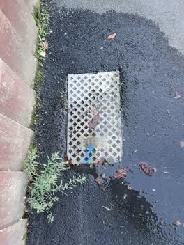 Water Leak —
 Graffiti —
can you make it urgent
Graffiti —
Graffiti —
Graffiti —
Graffiti —
Flooding —
Flooding —
Rubbish/Recycling —
Graffiti —
Roading/Streets —
Blocked drain on footpath gathering water build up
Flooding —
Graffiti —
Graffiti —
This is a duplicate report. The original report was sent on 19/06/2018.
Graffiti —
Also reported on Woodham Road
- 208 Woodham Road — 32 reports
- 166 Woodham Road — 20 reports
- 191 Woodham Road — 17 reports
- 221 Woodham Road — 15 reports
- 157 Woodham Road — 15 reports
- 251 Woodham Road — 12 reports
- 153 Woodham Road — 12 reports
- 218 Woodham Road — 11 reports
The street’s crash record
NZTA’s record names Woodham Road in 26 crashes that hurt somebody since 2006 — 1 person killed, 7 seriously hurt.
The green nearby
- Woodham Park — 290 m to the edge · Botanic · 2 ha
- Worcester Reserve — 318 m to the edge · 1 ha
- Avon Riverbank True Right — 466 m to the edge · 11 ha
- Bromley Park — 499 m to the edge · Sports ground · 4 ha
Parks within half a kilometre, measured to the boundary — the council’s open data.
On the doorstep
- Woodham Foodmarket — 4 m away · Dairies & convenience
- BP Connect — 168 m away · Dairies & convenience
- ANZ — 172 m away · ATMs
- Wild Bean Cafe - BP Dallington — 176 m away · Cafés
Businesses within four hundred metres, measured at the pin — OpenStreetMap and the council directories.
The bus nearby
- Woodham Rd near Ngarimu St — 90 m away · the Orbiter (clockwise)
- Woodham Rd near Carnarvon St — 131 m away · the Orbiter (anticlockwise)
The closest Metro stops, within four hundred and fifty metres.
The tracks through here
- Walk and bike track through Linwood — 9 m to the line · walk · bike
- Walk and bike track through Linwood — 427 m to the line · walk · bike
- Walk and bike track through Linwood — 457 m to the line · walk · bike
- Walk and bike track through Linwood — 479 m to the line · walk · bike
- Walk and bike track through Linwood — 481 m to the line · walk · bike
Tracks whose line passes within half a kilometre, measured to the line itself — the council’s open data.
The named ground
Named water within 500 m of this address, measured to the line or the edge — the open map’s record.
Renting nearby
new bonds in Linwood ran about $478 a week — $72 below the city median of $550 — the suburb page keeps the rent record →.
The civic layer
This ground votes in Linwood ward — the Coastal-Burwood-Linwood community board. Ward lines don’t always follow suburb lines; this one is measured at the pin, not the suburb’s centre.
What stood on this ground → · On the map → · From the air — the Crown’s aerials back to 1936; search the address on RetroLens →
Questions, answered briefly
41 council reports on record since June 2018 — most often graffiti (20), graffiti on a fence, building or structure (7), roading/streets (3).
Linwood, Christchurch — on Woodham Road.
Nothing on the heritage register at this exact spot — the record around this ground →
Woodham Park — 290 m to its edge, 2 ha.