339 Cashel Street, Linwood
21 reports on record since May 2022 · 11 with photographs. The street’s heaviest record is 573 Cashel Street — 70 reports on file. Indicative rating valuation and school zones, hazards, bin day and what stood here before.
What gets reported here
Photographed here 11 on record


Reported here
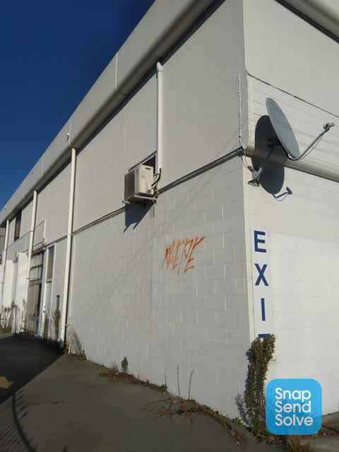
 Graffiti on a fence, building or structure —
 Graffiti on the roller door
 Dumped Rubbish —
 people been dumping rubbish on both sides of the road around 343 Cashel Street
 Graffiti on a fence, building or structure —
 graffiti on dairy roller door
 Graffiti on a fence, building or structure —
  Graffiti on a fence, building or structure —
 Graffiti on dairy door. If dairy is open speak to staff to close roller door to repaint
 Graffiti on a fence, building or structure —
 Graffiti on wall
 Rubbish and Bins - General —
 Overflowing bins almost daily. Needs a second bin put back that was removed previously as now more people around especially after the stadiu
 Graffiti somewhere else —
 All roller doors on dairy tagged
 Rubbish and Bins - General —
 Bin absolutely stinks with maggots crawling out everywhere.
- Road Signage —
Heading west from Cashel there are no arrows in the left lane.
- Roads - General —
- Graffiti —
- Damaged Road —
- Graffiti —
- Graffiti —
- Graffiti —
- Graffiti —
- Graffiti —
- Graffiti —
 Litter —
 Need rubbish bin by fish and chip shop. Always lots of rubbish around the gate/driveway their after the weekend
 Graffiti —
Also reported on Cashel Street
- 573 Cashel Street — 70 reports
- 497 Cashel Street — 44 reports
- 435 Cashel Street — 36 reports
- 393 Cashel Street — 34 reports
- 528 Cashel Street — 27 reports
- 442 Cashel Street — 27 reports
- 446 Cashel Street — 25 reports
- 529 Cashel Street — 24 reports
The street’s crash record
NZTA’s record names Cashel Street in 23 crashes that hurt somebody since 2006 — 1 person killed, 1 seriously hurt.
The green nearby
- Raglan Reserve — 205 m to the edge
- Worcester Pump Station Park — 281 m to the edge
Parks within half a kilometre, measured to the boundary — the council’s open data.
On the doorstep
- Kebab & Grill Corner Linwood — 7 m away · Fast food
- Cashel Street Foodmarket — 9 m away · Dairies & convenience
- Cashel Street Takeways — 12 m away · Fast food
- Bohemian Bakery — 93 m away · Bakeries
Businesses within four hundred metres, measured at the pin — OpenStreetMap and the council directories.
The bus nearby
The closest Metro stops, within four hundred and fifty metres.
The tracks through here
- Walk and bike track through Linwood — 29 m to the line · walk · bike
- Walk and bike track through Linwood — 29 m to the line · walk · bike
- Walk and bike track through Linwood — 255 m to the line · walk · bike
- Walk and bike track through Linwood — 478 m to the line · walk · bike
- Walk and bike track through Linwood — 479 m to the line · walk · bike
Tracks whose line passes within half a kilometre, measured to the line itself — the council’s open data.
The named ground
Named places within 1.5 km of this address — the open map’s record.
Renting nearby
new bonds in Linwood ran about $478 a week — $72 below the city median of $550 — the suburb page keeps the rent record →.
What was here — Dwelling/Commercial Building and Setting
143 m away · 147 Fitzgerald Avenue · located to ±12 m · the place’s own record →
On the register. Nothing researched here yet.
The civic layer
This ground votes in Central ward — the Papanui-Innes-Central community board. Ward lines don’t always follow suburb lines; this one is measured at the pin, not the suburb’s centre.
What stood on this ground → · On the map → · From the air — the Crown’s aerials back to 1936; search the address on RetroLens →
Questions, answered briefly
21 council reports on record since May 2022 — most often graffiti (8), graffiti on a fence, building or structure (5), rubbish and bins - general (2).
Linwood, Christchurch — on Cashel Street.
The heritage register names a place at or beside it — Dwelling/Commercial Building and Setting.
Raglan Reserve — 205 m to its edge.