398 Worcester Street, Linwood
48 reports on record since October 2019 · 37 with photographs. The street’s heaviest record is 298 Worcester Street — 79 reports on file. Indicative rating valuation and school zones, hazards, bin day and what stood here before.
What gets reported here
- Graffiti — 22
- Dumped Rubbish — 6
- Public Toilet — 3
- Parks — 3
- Vandalism - General — 2
- Roading/Streets — 2
Photographed here 37 on record




Reported here
 Graffiti on a bus stop or public toilet —
 Graffiti on side of public facilities
 Public Toilet —
 No soap Dispenser dry as an old bone
 Public Toilet —
 Graffiti inside males toilets
 Pavement - Damaged —
 Old pole needs taking right down to footpath level at 398 Worcester Street . It’s an OHS issue for pedestrians safety at present.
 Dumped Rubbish —
 Old wooden pallet dumped on the footpath by 398 Worcester Street needs removal.
 Graffiti on a fence, building or structure —
 Graffiti inside both sides of the toilets
 Vandalism - General —
 Males toilets have this white spillage all over the floor and sink. Will keep locked.
 Dumped Rubbish —
 Toilets Worcester St full with rubbish
 Dumped Rubbish —
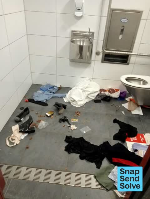
 Clothes and rubbish dumped outside Worcester St toilet
 Graffiti on a fence, building or structure —
 Graffiti inside both unisex toilets Worcester St
 Sewer General —
 Toilet is completely blocked filled up with poo. Will keep locked.
 Graffiti somewhere else —
  Vandalism - General —
 Both toilets are in need of a clean. Clothes and rubbish throughout due to the homeless people
 Graffiti —
 Graffiti and general uncleanliness inside the right side toilet
 Public Toilet —
 Damage to bollard at Linwood Community Arts Centre toilets
 Graffiti —
 Graffitti on the left side of Worcester St Toilets. Still some white chalk graffiti on the inside door of the right side toilet
 Dumped Rubbish —
 - Overgrown Vegetation —
- Dumped Rubbish —
- Graffiti —
- Graffiti —
- Graffiti —
- Graffiti —
- Graffiti —
- Graffiti —
- Graffiti —
- Graffiti —
- Graffiti —
 Dumped Rubbish —
 great idea to provide tools.
 Graffiti —
  Facility - General Request —
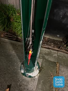
 Tools cut off on the bike repair stand near the toilets on Worcester/Hereford St
 Graffiti —
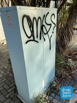
 OMK black paint tag on QTC traffic controller on the corner of Worcester Street and Stanmore Road.
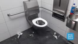 Graffiti —
 Toilet is nasty, cigarette butts and rubbish in it. Smells bad, like someone's been smoking in there
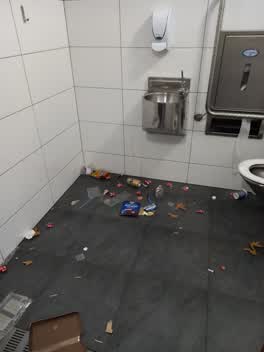 Graffiti —
 Rubbish
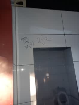 Graffiti —
 Write on wall and mirrors
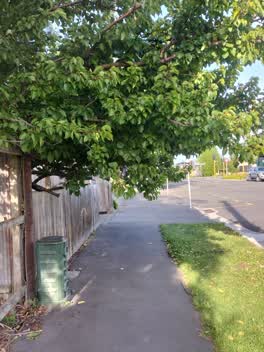 Roading/Streets —
 Tree obstructing footpath again. Have to bend double to get under it. 3rd time I've had to complain about their tree obstructing access. The
 Graffiti —
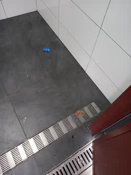
 Bloody used condom found in Worcester St male toilet
 Graffiti —
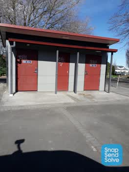
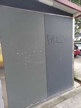
 Graffiti on both toilets at 398 Worcester St
 Graffiti —
 Worcester st toilets near Stanmore rd
 Graffiti —
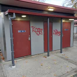
 This is on multiple locations in this spot.
 Water Leak —
 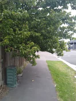 Roading/Streets —
 overgrown trees blocking footpath from waist height. Owner needs to be instructed to trim trees back. 398 Worcester St Linwood is the addres
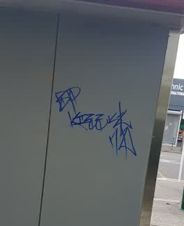 Graffiti —
 This is on the back of the public toilets on Worcester St by Stanmore Rd.
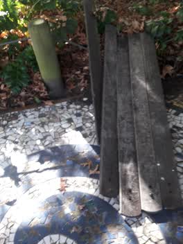 Parks —
 Doris Lusk Reserve planks have been dumped
Parks —
Doris Lusk Park a dead tree, path needs grasses and rose bushes trimmed off path near seat.Also a self seeded rose bush needs to come out ne
Rubbish/Recycling —
Empty section next door to 398 Worcester Street. People have discovered the empty section and are dumping household rubbish. section is over
Parks —
Doris Lusk Park illegal dumping
Graffiti —
This is on the toilet block on Worcester St near Stanmore Rd.
Also reported on Worcester Street
- 298 Worcester Street — 79 reports
- 573 Worcester Street — 52 reports
- 646 Worcester Street — 36 reports
- 475 Worcester Street — 35 reports
- 411 Worcester Street — 33 reports
- 506B Worcester Street — 28 reports
- 507 Worcester Street — 23 reports
- 560 Worcester Street — 21 reports
The street’s crash record
NZTA’s record names Worcester Street in 50 crashes that hurt somebody since 2006 — 1 person killed, 11 seriously hurt.
The green nearby
- Doris Lusk Corner — 17 m to the edge
- Hereford Playground — 276 m to the edge
- Raglan Reserve — 390 m to the edge
- Worcester Pump Station Park — 401 m to the edge
- Beverley Park — 442 m to the edge · 3 ha
Parks within half a kilometre, measured to the boundary — the council’s open data.
On the doorstep
- Ethnic Market - International Food Store — 20 m away · Supermarkets
- Worcester Discounter — 21 m away · Dairies & convenience
- Linwood Village Market — 38 m away · Markets
- Eastside Gallery Linwood Community Arts Centre — 39 m away · Galleries
Businesses within four hundred metres, measured at the pin — OpenStreetMap and the council directories.
The bus nearby
- Stanmore Rd near Worcester St — 59 m away · route 60
- Stanmore Rd near Gloucester St — 99 m away · route 60
The closest Metro stops, within four hundred and fifty metres.
The tracks through here
- Walk and bike track through Linwood — 51 m to the line · walk · bike
- Walk and bike track through Linwood — 268 m to the line · walk · bike
- Walk and bike track through Linwood — 278 m to the line · walk · bike
- Walk and bike track through Linwood — 363 m to the line · walk · bike
- Walk and bike track through Linwood — 363 m to the line · walk · bike
Tracks whose line passes within half a kilometre, measured to the line itself — the council’s open data.
The named ground
the council’s own structure register — bridges, boardwalks and steps standing nearby — the open map’s record.
The remembered names nearby
- Doris Lusk Corner plaque — 32 m away · 2024
- Plaque no. 311001 — 72 m away · 2024
Inscribed plaques within two hundred and fifty metres — the register’s pins, not surveyed spots. The whole roll is at /plaques.
Renting nearby
new bonds in Linwood ran about $478 a week — $72 below the city median of $550 — the suburb page keeps the rent record →.
What was here — Former Linwood Town Board Offices and Setting
34 m away · 388 Worcester Street · located to ±14 m · the place’s own record →
On the register. Nothing researched here yet.
The civic layer
This ground votes in Central ward — the Papanui-Innes-Central community board. Ward lines don’t always follow suburb lines; this one is measured at the pin, not the suburb’s centre.
What stood on this ground → · On the map → · From the air — the Crown’s aerials back to 1936; search the address on RetroLens →
Questions, answered briefly
48 council reports on record since October 2019 — most often graffiti (22), dumped rubbish (6), public toilet (3).
Linwood, Christchurch — on Worcester Street.
The heritage register names a place at or beside it — Former Linwood Town Board Offices and Setting.
Doris Lusk Corner — 17 m to its edge.