48 Buckleys Road, Linwood
16 reports on record since January 2020 · 12 with photographs. The street’s heaviest record is 170 Buckleys Road — 215 reports on file. Indicative rating valuation and school zones, hazards, bin day and what stood here before.
What gets reported here
Photographed here 12 on record


Reported here
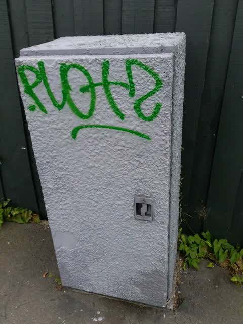
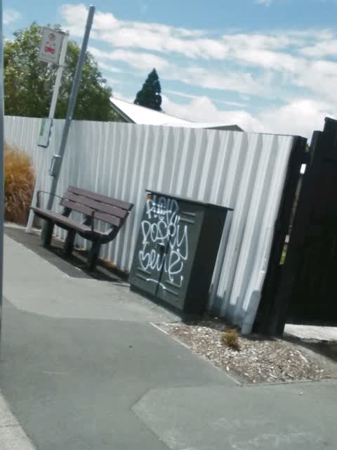
 Graffiti on a traffic light pole or cabinet, or wa —
 graffiti on traffic control cabinet
 Graffiti on a traffic light pole or cabinet, or wa —
 graffiti on traffic control cabinet
 Graffiti on a traffic light pole or cabinet, or wa —
 graffiti on traffic control cabinet
- Poles and Signage - General —
Orange light not working on traffic lights. Going from Russell St into Buckleys.
 Graffiti on a traffic light pole or cabinet, or wa —
 Graffiti on traffic control cabinet
 Traffic Signals —
 Green light not working
 Traffic Signals —
 Just flashing orange, proper signals not working
 Graffiti somewhere else —
 - Graffiti —
Tall blue traffic control cabinet on this corner has graffiti on it
- Graffiti —
- Street Light Outage —
 Graffiti —
 Utility box tagged at 48 Buckleys
 Graffiti —
 Fence at 48 Buckleys tagged
 Graffiti —
 Russell St boundary of 48 Buckleys - telecommunications box tagged
Graffiti —
Graffiti —
by bus stop outside 32 Woodham road
Also reported on Buckleys Road
- 170 Buckleys Road — 215 reports
- 161 Buckleys Road — 28 reports
- 202 Buckleys Road — 25 reports
- 141 Buckleys Road — 16 reports
- 5 Buckleys Road — 15 reports
- 20 Buckleys Road — 13 reports
- 149 Buckleys Road — 13 reports
- 115 Buckleys Road — 12 reports
The street’s crash record
NZTA’s record names Buckleys Road in 93 crashes that hurt somebody since 2006 — 18 seriously hurt, nobody killed.
The green nearby
- Worcester Reserve — 262 m to the edge · 1 ha
- Bromley Park — 391 m to the edge · Sports ground · 4 ha
- Linwood Park — 451 m to the edge · Sports ground · 9 ha
Parks within half a kilometre, measured to the boundary — the council’s open data.
The civic shelf nearby
- Linwood Library — 149 m away · Library · First Floor, Eastgate Mall, Buckleys Rd, Christchurch 8062
- Linwood Service Centre — 310 m away · Service centre
Libraries, halls and the rest within half a kilometre — the council’s open data.
On the doorstep
- PDF Services — 80 m away · Company
- Phatt Phillip - Eastgate — 94 m away · Fast food
- Warehouse Stationery — 105 m away · Stationery
- Hillyers Eastgate — 111 m away · Business
Businesses within four hundred metres, measured at the pin — OpenStreetMap and the council directories.
The bus nearby
- Buckleys Rd near Rhona St — 72 m away · route 5, route 80, route 155, the Orbiter (anticlockwise)
- Buckleys Rd near Pamela St — 110 m away · route 5, route 80, route 155, the Orbiter (clockwise)
The closest Metro stops, within four hundred and fifty metres.
The tracks through here
- Walk and bike track through Linwood — 18 m to the line · walk · bike
- Walk and bike track through Linwood — 363 m to the line · walk · bike
- Walk and bike track through Linwood — 364 m to the line · walk · bike
- Walk and bike track through Linwood — 382 m to the line · walk · bike
Tracks whose line passes within half a kilometre, measured to the line itself — the council’s open data.
The named ground
the council’s own structure register — bridges, boardwalks and steps standing nearby — the open map’s record.
Renting nearby
new bonds in Linwood ran about $478 a week — $72 below the city median of $550 — the suburb page keeps the rent record →.
The civic layer
This ground votes in Linwood ward — the Coastal-Burwood-Linwood community board. Ward lines don’t always follow suburb lines; this one is measured at the pin, not the suburb’s centre.
What stood on this ground → · On the map → · From the air — the Crown’s aerials back to 1936; search the address on RetroLens →
Questions, answered briefly
16 council reports on record since January 2020 — most often graffiti (7), graffiti on a traffic light pole or cabinet, or wa (4), traffic signals (2).
Linwood, Christchurch — on Buckleys Road.
Nothing on the heritage register at this exact spot — the record around this ground →
Worcester Reserve — 262 m to its edge, 1 ha.