4451 Christchurch-Akaroa Road
3 council reports since May 2025, 3 carrying a photograph. The street’s heaviest record is 4235A Christchurch Akaroa Road, 40 reports on file.
The green nearby
- Little River Education House, 193 m to the edge · 1 ha
- Little River Esplanade Reserve, 320 m to the edge
Parks within half a kilometre, measured to the boundary, the council’s open data. The whole roll is at /parks.
The civic shelf nearby
- Little River Cemetery, 376 m away · Cemetery
Libraries, halls and the rest within half a kilometre, the council’s open data.
On the doorstep
- Allied, 56 m away · Petrol stations
Businesses within four hundred metres, measured at the pin, OpenStreetMap and the council directories.
The named ground
Named water within 500 m of this address, measured to the line or the edge, the open map’s record.
What gets reported here
Photographed here 3 on record


What’s on record
 Water Pollution - Sediment, 5 Nov 2025
 The river is not in flood it is low flow but full of sediment. We haven’t had rain for quite a few days.
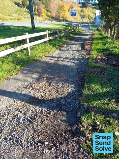
 Pavement - Damaged, 5 May 2025
 The recent rains scoured out the new footpath that runs by SH75 in Cooptown. The to layer of grit ended up in my paddock. This is just one o
 Pavement - Damaged, 4 May 2025
 Water damage to Cooptown walk/ Cycleway after recent rain event.
Elsewhere on Christchurch-Akaroa Road
- 4235A Christchurch Akaroa Road, 40 reports
- 4313 Christchurch Akaroa Road, 10 reports
- 4238 Christchurch Akaroa Road, 9 reports
- 4310 Christchurch Akaroa Road, 8 reports
- 4235 Christchurch Akaroa Road, 6 reports
- 4267 Christchurch Akaroa Road, 5 reports
- 4190 Christchurch Akaroa Road, 5 reports
- 4236 Christchurch Akaroa Road, 4 reports
The street’s crash record
NZTA’s record names Christchurch-Akaroa Road in 28 crashes that hurt somebody since 2006, 3 people killed, 14 seriously hurt.
The civic layer
This ground votes in Banks Peninsula ward, the Banks Peninsula community board is its local layer. Ward lines don’t always follow suburb lines; this one is measured at the pin, not the suburb’s centre. The whole roll is at /wards.
Christchurch-Akaroa Road, the whole record → · Everything about Little River → · What stood on this ground → · On the map → · From the air, RetroLens holds the Crown’s aerials back to 1936; search the address there →
Questions, answered briefly
3 council reports on record since May 2025, most often pavement - damaged (2), water pollution - sediment (1).
Little River, Christchurch, on Christchurch-Akaroa Road.
Nothing on the heritage register at this exact spot, the record around this ground →
Little River Education House, 193 m to its edge, 1 ha.