10 Bridle Path
8 council reports since January 2021, 7 carrying a photograph. The street’s heaviest record is 25 Bridle Path, 9 reports on file.
On the register here
- Dwelling and Setting, 2 Cunningham Terrace (50m)
- Dwelling and Setting, Islay Cottage, 1 Ticehurst Road (104m)
- Dwelling and Setting, 6 Godley Quay (211m)
- Dwelling and Setting, 7 Coleridge Terrace (246m)
From the air, then
Sourced from Canterbury Maps and partners. RNZAF, CC BY 3.0 NZ. Each frame is cut from Environment Canterbury’s historic imagery MapServer for that decade, only where the Footprints layer names a CC BY survey (NZAM-covered spots stay out). RetroLens holds more Crown aerials →
The green nearby
- Lyttelton War Memorial, 77 m to the edge
- Simeon Quay Reserve, 86 m to the edge
- Sutton Reserve, 242 m to the edge · Botanic
- Whakaraupo Reserve, 317 m to the edge · Regional · 88 ha
- Shackleton Reserve, 388 m to the edge
Parks within half a kilometre, measured to the boundary, the council’s open data. The whole roll is at /parks.
The civic shelf nearby
- Lyttelton Library, 454 m away · Library
- Lyttelton Service Centre, 478 m away · Service centre
Libraries, halls and the rest within half a kilometre, the council’s open data.
On the doorstep
- Ground Food Tours, 177 m away · Attractions
- Tissiman House Repairs, 182 m away · Carpenters
- Te Ana Marina Office, 224 m away · Business
- Opening Soon: Te Ūaka The Lyttelton Museum, 227 m away · Attractions
Businesses within four hundred metres, measured at the pin, OpenStreetMap and the council directories.
The bus nearby
- Dublin St near Norwich Qy, 235 m away · route 8, route 155
- Brittan Tce near Simeon Qy, 277 m away · route 8
The closest Metro stops, within four hundred and fifty metres.
The tracks through here
- Walk and bike track through Lyttelton, 181 m to the line · walk · bike
Tracks whose line passes within half a kilometre, the council’s open data.
The named ground
Named places within 1.5 km of this address; the council’s own structure register, bridges, boardwalks and steps standing nearby, the open map’s record.
The remembered names nearby
- In Memory of John Richard Webb, 106 m away ·
IN MEMORY OF JOHN RICHARD WEBB
· 2000
Inscribed plaques within two hundred and fifty metres, the register’s pins, not surveyed spots. The whole roll is at /plaques.
Renting nearby
new bonds in Lyttelton ran about $600 a week, $50 above the city median of $550, the suburb page keeps the rent record →.
What gets reported here
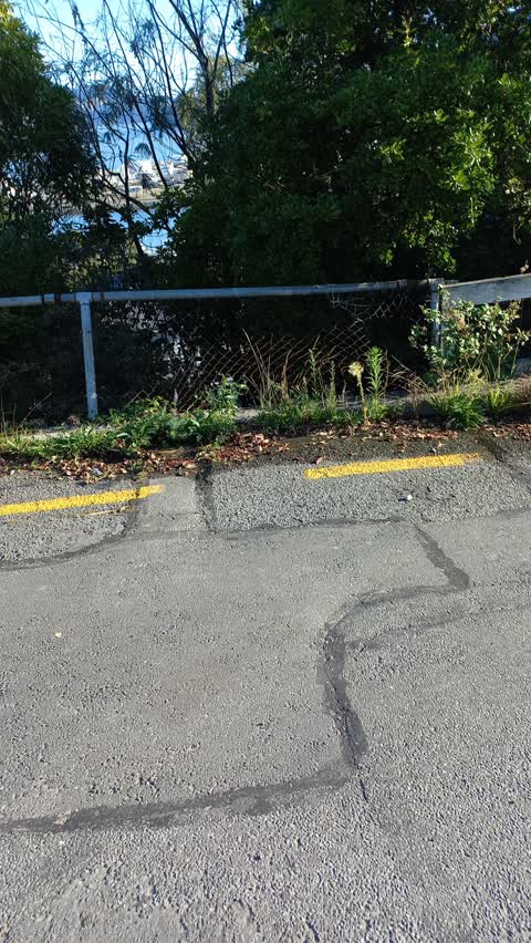
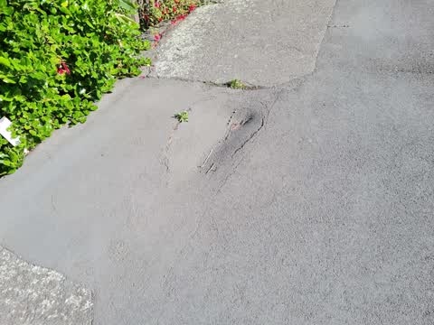
Photographed here 7 on record


What’s on record
 Pavement - General, 13 Jul 2026
 Hello Line has come down - not sure electrical or telegraph etc. may pose risk, especially to children as in reaching distance.
 Roads - General, 5 Feb 2026
 New chip seal has been done to a poor quality and loose material will go in essential drain. The project team should probably go check the n
 Water Leak, 23 Oct 2025
 Under road water leak at intersection of Bridle path and Dudley road. It's been leaking all day , looks like fresh water
 Pothole, 15 Mar 2025
 Large hole in road. Dangerous.
 Damaged Road, 5 Jul 2024
 Can we please have the blocks left over from the earth quakes on the bridle path reviewed? They are and eyesore and reminder of the earthqua
 Water Leak, 27 Mar 2022
- Water Leak, 5 Mar 2022
Mayor water leak on Bridle Path Rd by Dudley Road, hundreds of litres getting wasted.
 Street Light Outage, 29 Jan 2021
 trip hazard footpath
Elsewhere on Bridle Path
- 25 Bridle Path, 9 reports
- 6 Bridle Path, 8 reports
- 30 Bridle Path, 7 reports
- 16 Bridle Path, 5 reports
- 14 Bridle Path, 5 reports
- 24 Bridle Path, 4 reports
- 23 Bridle Path, 4 reports
- 21 Bridle Path, 4 reports
The street’s crash record
NZTA’s record names Bridle Path in 2 crashes that hurt somebody since 2006, 1 seriously hurt, nobody killed.
The civic layer
This ground votes in Banks Peninsula ward, the Banks Peninsula community board is its local layer. Ward lines don’t always follow suburb lines; this one is measured at the pin, not the suburb’s centre. The whole roll is at /wards.
Bridle Path, the whole record → · Everything about Lyttelton → · What stood on this ground → · On the map → · From the air, RetroLens holds the Crown’s aerials back to 1936; search the address there →
Questions, answered briefly
8 council reports on record since January 2021, most often water leak (3), street light outage (1), roads - general (1).
Lyttelton, Christchurch, on Bridle Path.
The heritage register names 4 places at or beside it, Dwelling and Setting, Dwelling and Setting, Islay Cottage.
Lyttelton War Memorial, 77 m to its edge.