27 Cashin Quay, Lyttelton
19 reports on record since October 2022 · 15 with photographs. The most-reported address on Cashin Quay. Indicative rating valuation and school zones, hazards, bin day and what stood here before.
What gets reported here
Photographed here 15 on record




Reported here
 Graffiti on a fence, building or structure —
 all the safety railings from the lookout to the bottom are tagged multiple times along them
 Graffiti on a fence, building or structure —
 white pen on fence railings
 Pavement - General —
 Please attach some form of netting to these rails at the lookout points. Toddlers can fit their heads, and therefore bodies through the gaps
 Water Pollution - Sediment —
 the reclaimation is causing sediment beyond the booms, due to onshore wind and area they have decided to work today.
 Graffiti on a fence, building or structure —
  Graffiti on a fence, building or structure —
 Taggingpn the lookout wall
 Graffiti on a fence, building or structure —
 White paint on railing
 Graffiti on a fence, building or structure —
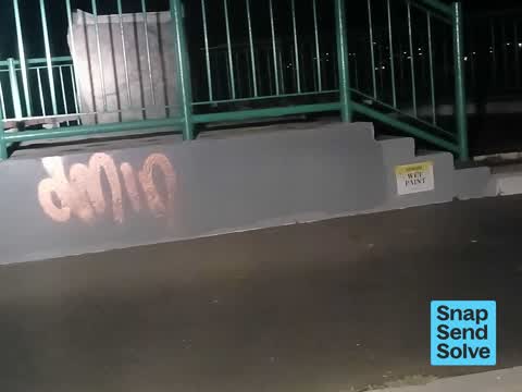
 White paint on Grey wall at the look out
 Graffiti somewhere else —
 NOT Cashin Quay, it's Windy Point lookout. Sumner Road. A few misc stickers and the roadsign behind (separate job). Could almost do with a
 Graffiti somewhere else —
 Ignore the system generated address. It's wrong. This is the Windy Point car park, Sumner Rd.
 Graffiti on a fence, building or structure —
 Graffiti on wall at lookout & on sign to left.
 Graffiti —
 Graffiti is also in the viewing plinth.
 Pavement - General —
 The lookout over Lyttelton Port is not accessible for walking frames or wheelchairs. It'd be great to have a wee ramp.
 Rubbish and Bins - General —
 There are no bins for people to put there rubbish and looks like people are throwing it over the fence, a sign is not enough.
 Graffiti —
 My main problem is that the peak labeled Mount Herbert is in fact Mount Bradley (flat top) I assume that is the correct Maori name. Mount He
- Graffiti —
- Graffiti —
- Graffiti —
- Graffiti —
Also reported on Cashin Quay
- 6 Cashin Quay — 1 report
- 2 Cashin Quay — 1 report
- 13 Cashin Quay — 1 report
- 10 Cashin Quay — 1 report
The green nearby
- Urumau Reserve — 9 m to the edge · Regional · 26 ha
Parks within half a kilometre, measured to the boundary — the council’s open data.
On the doorstep
- Straddle Carrier Wash Bay — 165 m away · Car washes
- Timeball-Keepers Foundations — 360 m away · Attractions
Businesses within four hundred metres, measured at the pin — OpenStreetMap and the council directories.
The named ground
Named places within 1.5 km of this address — the open map’s record.
Renting nearby
new bonds in Lyttelton ran about $600 a week — $50 above the city median of $550 — the suburb page keeps the rent record →.
The civic layer
This ground votes in Banks Peninsula ward — the Banks Peninsula community board. Ward lines don’t always follow suburb lines; this one is measured at the pin, not the suburb’s centre.
What stood on this ground → · On the map → · From the air — the Crown’s aerials back to 1936; search the address on RetroLens →
Questions, answered briefly
19 council reports on record since October 2022 — most often graffiti on a fence, building or structure (7), graffiti (6), pavement - general (2).
Lyttelton, Christchurch — on Cashin Quay.
Nothing on the heritage register at this exact spot — the record around this ground →
Urumau Reserve — 9 m to its edge, 26 ha.