28 Jacksons Road
9 council reports since October 2015, 7 carrying a photograph. The most-reported address on Jacksons Road.
On the register here
- Dwelling and Setting, 2 Coleridge Terrace (45m)
- Dwelling and Setting, 47 Jacksons Road (48m)
- Dwelling and Setting, 3 Coleridge Terrace (51m)
- Dwelling and Setting, 6 Coleridge Terrace (87m)
- Dwelling and Setting, 32 Dublin Street (99m)
From the air, then
Sourced from Canterbury Maps and partners. RNZAF, CC BY 3.0 NZ. Each frame is cut from Environment Canterbury’s historic imagery MapServer for that decade, only where the Footprints layer names a CC BY survey (NZAM-covered spots stay out). RetroLens holds more Crown aerials →
The green nearby
- Shackleton Reserve, 138 m to the edge
- Albion Square, 223 m to the edge · Botanic · playground, 2 pieces
- Sutton Reserve, 303 m to the edge · Botanic
- Lyttelton War Memorial, 322 m to the edge
- Whakaraupo Reserve, 389 m to the edge · Regional · 88 ha
Parks within half a kilometre, measured to the boundary, the council’s open data. The whole roll is at /parks.
The civic shelf nearby
- Lyttelton Library, 319 m away · Library
- Lyttelton Service Centre, 340 m away · Service centre
- Lyttelton Anglican Cemetery, 368 m away · Cemetery
Libraries, halls and the rest within half a kilometre, the council’s open data.
On the doorstep
- Harbour Lodge, 77 m away · Guest houses
- Armadillo's Lyttelton, 90 m away · Bars & pubs
- The Lyttelton Club, 96 m away · Clubs
- Lyttelton Engineering Aluminium Workshop, 151 m away · Metal Construction
Businesses within four hundred metres, measured at the pin, OpenStreetMap and the council directories.
The bus nearby
- Winchester St near Coleridge Tce, 130 m away · route 8, route 155
- Dublin St near Norwich Qy, 246 m away · route 8, route 155
The closest Metro stops, within four hundred and fifty metres.
The tracks through here
- Walk and bike track through Lyttelton, 344 m to the line · walk · bike
Tracks whose line passes within half a kilometre, the council’s open data.
The named ground
Named places within 1.5 km of this address; the council’s own structure register, bridges, boardwalks and steps standing nearby, the open map’s record.
Renting nearby
new bonds in Lyttelton ran about $600 a week, $50 above the city median of $550, the suburb page keeps the rent record →.
What gets reported here
Photographed here 7 on record



What’s on record
 Street Gutters / Storm Water, 8 Jun 2026
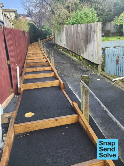
 Kenners Lane Walkway drains are filling up with leaves and rubble. Appears to be similar build up around drains from Jackson's Rd to Dublin
 Street Gutters / Storm Water, 8 Oct 2025
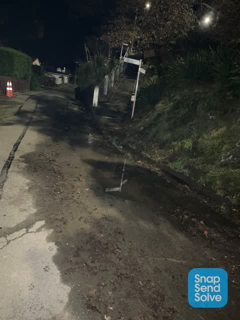
 This leak is on Lower Jackson's Rd at the top of Kenners track. It has been leaking for about a month now. Very wet area
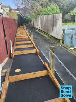 Vandalism - General, 11 Aug 2025
 Handrail is damaged down kenners lane
 Pavement - General, 25 Jun 2024
 Drainage sump too high and lack of guttering (needs approximately 12m) resulting in deep ponding and mud build up, adjacent gutter also bloc
- Trees - General, 6 Nov 2023
- Street Gutters / Storm Water, 31 Jul 2023
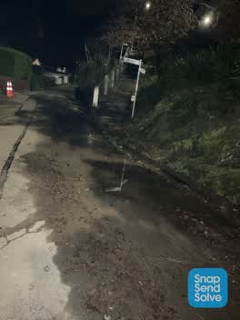 Roading/Streets, 3 Jun 2022
 Water pooling on road due to blocked gutter, also making footpath (Kenners Lane) difficult to use
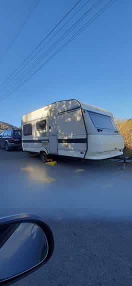 Roading/Streets, 20 Sept 2021
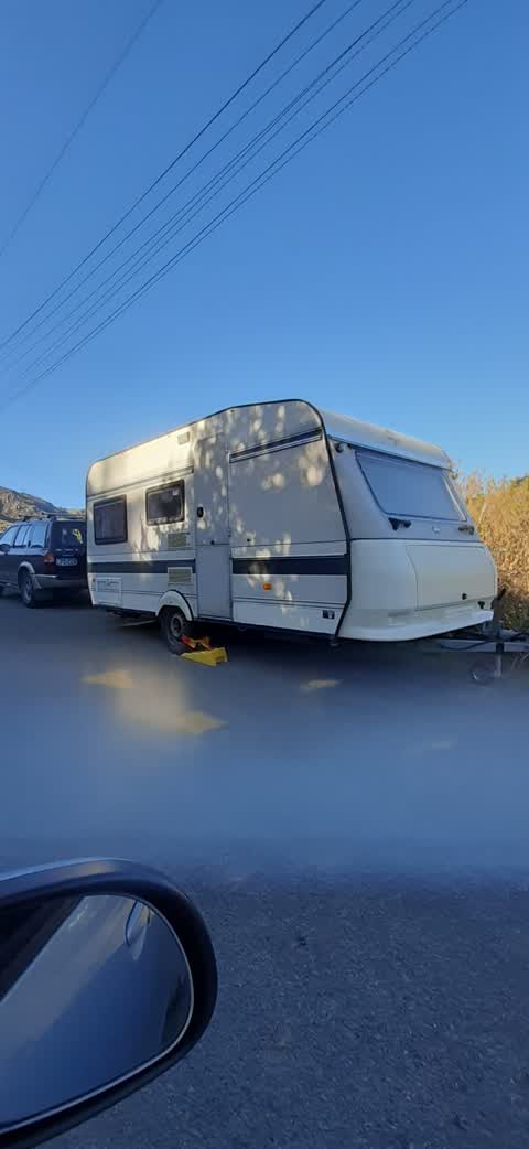
 Permanently parked in dangerous place
Roading/Streets, 8 Oct 2015
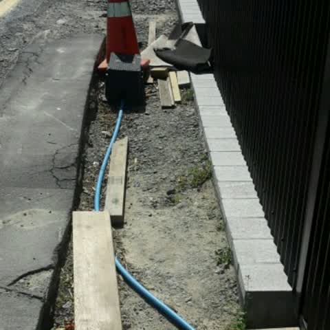
Footpath requires reinstatement after house rebuild. Water supply exposed.
Elsewhere on Jacksons Road
- 34 Jacksons Road, 8 reports
- 20 Jacksons Road, 8 reports
- 57 Jacksons Road, 7 reports
- 55 Jacksons Road, 6 reports
- 50 Jacksons Road, 4 reports
- 32 Jacksons Road, 4 reports
- 93 Jacksons Road, 3 reports
- 35 Jacksons Road, 3 reports
The street’s crash record
NZTA’s record names Jacksons Road in 2 crashes that hurt somebody since 2006, 0 seriously hurt, nobody killed.
The civic layer
This ground votes in Banks Peninsula ward, the Banks Peninsula community board is its local layer. Ward lines don’t always follow suburb lines; this one is measured at the pin, not the suburb’s centre. The whole roll is at /wards.
Jacksons Road, the whole record → · Everything about Lyttelton → · What stood on this ground → · On the map → · From the air, RetroLens holds the Crown’s aerials back to 1936; search the address there →
Questions, answered briefly
9 council reports on record since October 2015, most often street gutters / storm water (3), roading/streets (3), vandalism - general (1).
Lyttelton, Christchurch, on Jacksons Road.
The heritage register names 5 places at or beside it, Dwelling and Setting, Dwelling and Setting.
Shackleton Reserve, 138 m to its edge.