58 Norwich Quay, Lyttelton
25 reports on record since September 2021 · 20 with photographs. The most-reported address on Norwich Quay. Indicative rating valuation and school zones, hazards, bin day and what stood here before.
What gets reported here
Photographed here 20 on record


Reported here
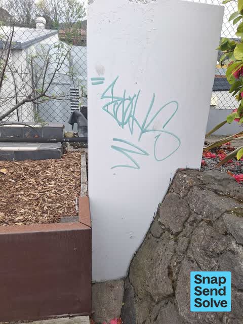
 Graffiti on a fence, building or structure —
  Graffiti on a fence, building or structure —
  Graffiti on a road, footpath or bridge —
 Graffiti. Sutton Quay. Downhill from Sutton Reserve. Best Access / Parking, Sutton Quay.
 Graffiti on a traffic light pole or cabinet, or wa —
 Graffiti on light pole
 Pavement - Damaged —
 Broken concrete guttering on driveway. Concrete is loose. Very dangerous. Trip hazard. Damage to vehicles. Urgent please.
 Pavement - General —
 Kerb breaking up, had to put piece of loose concrete back in place. Please replace section of kerb
 Pavement - Damaged —
 The kerb crossing point at 58 Norwich Quay is heavily damaged and is starting to break up. Can you please arrange for this to be repaired?
 Pavement - Damaged —
 Pothole at junction of Sutton quay and Norwich quay. Asphalt also badly cracked and starting to break up along top Sutton quay contact paul
 Overgrown Vegetation —
 Hi there - We have done a clean up on the reserve next to the Fishermans Wharf. There is alot of garden trimmings to be cleared away. Cath
 Dumped Rubbish —
 Garden rubbish dumped onto verge next to footpath
 Graffiti somewhere else —
 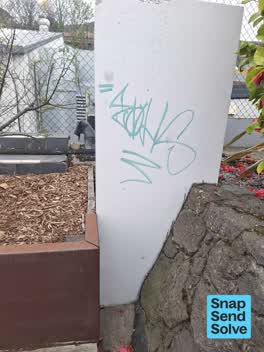 Graffiti on a road, footpath or bridge —
  Graffiti somewhere else —
 Light standard
 Overgrown Vegetation —
 This may need replanting, it could be a lovely area to sit but is very overgrown and unkempt
 Graffiti on a fence, building or structure —
  Water Leak —
 Leaking fire hydrant
- Graffiti —
- Graffiti —
- Graffiti —
- Pavement - General —
- Graffiti —
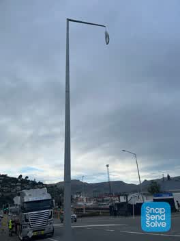 Street Light Outage —
 Light dangling
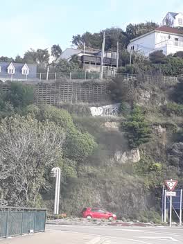 Graffiti —
 See on hill. Repainted
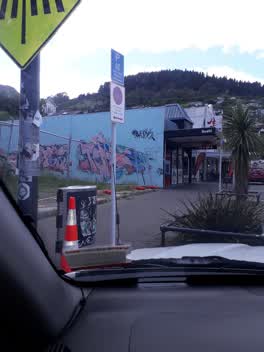 Graffiti —
 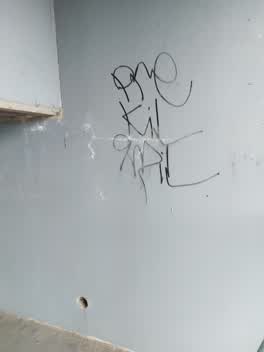 Graffiti —
 Graffiti under bridge
Also reported on Norwich Quay
- 20 Norwich Quay — 18 reports
- 5 Norwich Quay — 16 reports
- 11 Norwich Quay — 13 reports
- 25 Norwich Quay — 11 reports
- 40 Norwich Quay — 10 reports
- 7 Norwich Quay — 9 reports
- 6 Norwich Quay — 9 reports
- 5C Norwich Quay — 8 reports
The street’s crash record
NZTA’s record names Norwich Quay in 4 crashes that hurt somebody since 2006 — 6 seriously hurt, nobody killed.
The green nearby
- Sutton Reserve — 9 m to the edge · Botanic
- Lyttelton War Memorial — 136 m to the edge
- Albion Square — 183 m to the edge · Botanic
- Simeon Quay Reserve — 246 m to the edge
- Baden Norris Reserve — 356 m to the edge
Parks within half a kilometre, measured to the boundary — the council’s open data.
The civic shelf nearby
- Lyttelton Library — 203 m away · Library · 29 Winchester St, Lyttelton 8082
- Lyttelton Service Centre — 225 m away · Service centre
Libraries, halls and the rest within half a kilometre — the council’s open data.
On the doorstep
- Fisherman's Wharf — 64 m away · Restaurants
- Marinetec Engineering — 73 m away · Metal Construction
- Maritime Specialist Services — 88 m away · Boat Repair
- Stark Brothers Engineering — 93 m away · Boatbuilder
Businesses within four hundred metres, measured at the pin — OpenStreetMap and the council directories.
The bus nearby
- Dublin St near Norwich Qy — 57 m away · route 8, route 155
- Norwich Qy near Dublin St — 59 m away · route 8, route 155
The closest Metro stops, within four hundred and fifty metres.
The tracks through here
- Walk and bike track through Lyttelton — 405 m to the line · walk · bike
Tracks whose line passes within half a kilometre, measured to the line itself — the council’s open data.
The named ground
Named places within 1.5 km of this address; the council’s own structure register — bridges, boardwalks and steps standing nearby — the open map’s record.
The remembered names nearby
- In Memory of Stanley James Helms 1947 - 1997 in Recognition — 16 m away ·
IN MEMORY OF STANLEY JAMES HELMS 1947 - 1997 IN RECOGNITION OF STAN'S LIFELONG COMMITMENT
· 2008 - In Memory — 22 m away ·
IN MEMORY OF (TEXT PARTIALLY OBSCURED)
· 2008 - ‘ohinehou’ / This Carving Represents ‘hinehouroko’ — 29 m away ·
‘Ohinehou’ / This carving represents ‘Hinehouroko’. / She along with her people inhabited
· 2012
Inscribed plaques within two hundred and fifty metres — the register’s pins, not surveyed spots. The whole roll is at /plaques.
Renting nearby
new bonds in Lyttelton ran about $600 a week — $50 above the city median of $550 — the suburb page keeps the rent record →.
What was here — Dwelling and Setting
148 m away · 66 London Street · located to ±9 m · the place’s own record →
On the register. Nothing researched here yet.
What was here — Dwelling and Setting
150 m away · 64 London Street · located to ±11 m · the place’s own record →
On the register. Nothing researched here yet.
What was here — Dwelling and Setting, Islay Cottage
162 m away · 1 Ticehurst Road · located to ±9 m · the place’s own record →
On the register. Nothing researched here yet.
What was here — Dwelling and Setting
162 m away · 62 London Street · located to ±13 m · the place’s own record →
On the register. Nothing researched here yet.
What was here — Commercial Building and Setting
174 m away · 47 London Street · located to ±16 m · the place’s own record →
On the register. Nothing researched here yet.
The civic layer
This ground votes in Banks Peninsula ward — the Banks Peninsula community board. Ward lines don’t always follow suburb lines; this one is measured at the pin, not the suburb’s centre.
What stood on this ground → · On the map → · From the air — the Crown’s aerials back to 1936; search the address on RetroLens →
Questions, answered briefly
25 council reports on record since September 2021 — most often graffiti (7), pavement - damaged (3), graffiti on a fence, building or structure (3).
Lyttelton, Christchurch — on Norwich Quay.
The heritage register names 5 places at or beside it — Dwelling and Setting, Dwelling and Setting.
Sutton Reserve — 9 m to its edge.