3 Te Rau A Kaka Street
7 council reports since May 2022, 3 carrying a photograph. The street’s heaviest record is 5 Te Rau A Kaka Street, 15 reports on file.
From the air, then
Sourced from Canterbury Maps and partners. LINZ, CC BY 3.0 NZ. Each frame is cut from Environment Canterbury’s historic imagery MapServer for that decade, only where the Footprints layer names a CC BY survey (NZAM-covered spots stay out). RetroLens holds more Crown aerials →
The green nearby
- Janet Stewart Reserve, 453 m to the edge · 3 ha
Parks within half a kilometre, measured to the boundary, the council’s open data. The whole roll is at /parks.
On the doorstep
- Flax Bar & Eatery, 398 m away · Restaurants
Businesses within four hundred metres, measured at the pin, OpenStreetMap and the council directories.
The bus nearby
- Prestons (Te Korari St), 152 m away · route 135
- Prestons (Te Korari St), 156 m away · route 135
The closest Metro stops, within four hundred and fifty metres.
The named ground
Named water within 500 m of this address, measured to the line or the edge; the council’s own structure register, bridges, boardwalks and steps standing nearby, the open map’s record.
The remembered names nearby
- Polish Settlers Place / 1872-2017, 129 m away ·
POLISH SETTLERS PLACE/ 1872-2017/ Dedicated to Early Polish Settlers, from faraway land of
Inscribed plaques within two hundred and fifty metres, the register’s pins, not surveyed spots. The whole roll is at /plaques.
Renting nearby
new bonds in Marshland ran about $689 a week, $139 above the city median of $550, the suburb page keeps the rent record →.
What gets reported here
- Overgrown Vegetation, 4
- Rubbish/Recycling, 1
- Roading/Streets, 1
- General Request, 1
Photographed here 3 on record

What’s on record
 General Request, 2 Jan 2024
 Flax for removal from wetlands drainage pond corner entrance Te Rito and Rua A Kaka St. Thankyou
- Overgrown Vegetation, 28 Nov 2023
- Overgrown Vegetation, 19 Apr 2023
- Overgrown Vegetation, 8 Dec 2022
- Overgrown Vegetation, 26 Nov 2022
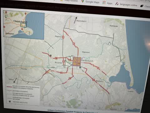
 Roading/Streets, 14 May 2022
 Please update your website. We were keen to go cycling today but have no idea from your website how to access the northern motorway cycle tr
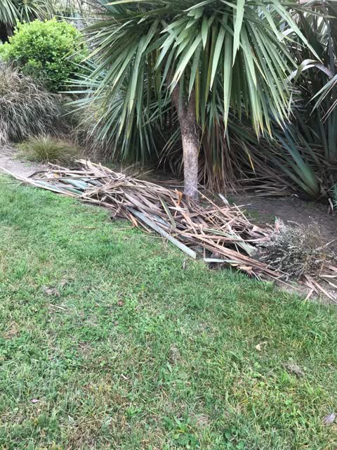
 Rubbish/Recycling, 1 May 2022
 Cleaned up dead flax and cabbage tree fronds beside the lake. Please come and remove. Cheers.
Elsewhere on Te Rau A Kaka Street
- 5 Te Rau A Kaka Street, 15 reports
The civic layer
This ground votes in Burwood ward, the Coastal-Burwood-Linwood community board is its local layer. Ward lines don’t always follow suburb lines; this one is measured at the pin, not the suburb’s centre. The whole roll is at /wards.
Te Rau A Kaka Street, the whole record → · Everything about Marshland → · What stood on this ground → · On the map → · From the air, RetroLens holds the Crown’s aerials back to 1936; search the address there →
Questions, answered briefly
7 council reports on record since May 2022, most often overgrown vegetation (4), rubbish/recycling (1), roading/streets (1).
Marshland, Christchurch, on Te Rau A Kaka Street.
Nothing on the heritage register at this exact spot, the record around this ground →
Janet Stewart Reserve, 453 m to its edge, 3 ha.