Styx River
A stream of the city, 19.8 km as the open map draws it, crossing 9 suburbs. Also recorded as “Pūharakekenui”.
A live gauge sits on this water, Styx / Pūharakekenui on /rivers, from Environment Canterbury every few minutes.
Where it runs
The centre of the water as OpenStreetMap draws it, centrelines, not banks, and not every reach carries water year-round. The faint outlines are suburbs.
The suburbs on its banks
Belfast · Bottle Lake · Brooklands · Casebrook · Marshland · Northwood · Ouruhia · Redwood · Spencerville
The reports along it
1,925 council reports pinned within 150 m of the line, most often Rubbish & dumping and Trees & parks, 1,505 with a photograph. A pin is where a reporter stood, not a claim about the place itself.
 Dumped Rubbish
 General Request
 Public Toilet
 Dumped Rubbish
 Graffiti on a sign, mural or public art
 Street Gutters / Storm Water
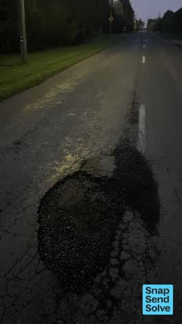 Pothole
 Water Leak
 Pavement - Damaged
 Pothole
 Graffiti on a fence, building or structure
 Graffiti on a sign, mural or public art
Questions, answered briefly
19.8 km as mapped, 4 ways in the open map, crossing 9 suburbs.
Belfast, Bottle Lake, Brooklands, Casebrook, and 5 more.
The map also records “Pūharakekenui”, the page answers to all of them.
It’s the centreline, the middle of the water as mapped on OpenStreetMap, not its banks. A line says where it runs, not how wide it is or whether it carries water today.
The record behind this
The line is OpenStreetMap’s, every named way tagged river, stream, drain or canal inside the city boundary, merged by name (ODbL). A line says where a waterway runs, not how wide it is; the live gauges are instruments, kept on /rivers.
This page as markdown: /river/styx-river.md · every waterway as data: /waterways.geojson · /waterways.json · every roll, counted: /geography.