12 Muritai Terrace
5 council reports since January 2021, 5 carrying a photograph. The most-reported address on Muritai Terrace.
From the air, then
Sourced from Canterbury Maps and partners. RNZAF, CC BY 3.0 NZ. Each frame is cut from Environment Canterbury’s historic imagery MapServer for that decade, only where the Footprints layer names a CC BY survey (NZAM-covered spots stay out). RetroLens holds more Crown aerials →
The green nearby
- Old School Reserve, 150 m to the edge · 3 ha · playground, 66 pieces
- Heathcote Quarry Reserve, 281 m to the edge · Regional · 8 ha
- Major Hornbrook Reserve, 285 m to the edge
- Cannon Hill Reserve, 328 m to the edge · 3 ha
- Cresswell Reserve, 329 m to the edge
Parks within half a kilometre, measured to the boundary, the council’s open data. The whole roll is at /parks.
The bus nearby
- Major Hornbrook Rd near Muritai Tce, 164 m away · route 140
- Major Hornbrook Rd near Belleview Tce, 186 m away · route 140
The closest Metro stops, within four hundred and fifty metres.
The named ground
the council’s own structure register, bridges, boardwalks and steps standing nearby, the open map’s record.
The remembered names nearby
- In Loving Memory of My Mother Grace Greaves, 219 m away ·
In Loving Memory of my mother GRACE GREAVES 9.5.1929 – 8.10.2003 and her faithful Labrador
· 2009 - 1934, 226 m away ·
1934 (engraved stone)
· 2009
Inscribed plaques within two hundred and fifty metres, the register’s pins, not surveyed spots. The whole roll is at /plaques.
Renting nearby
new bonds in Mount Pleasant ran about $700 a week, $150 above the city median of $550, the suburb page keeps the rent record →.
What gets reported here
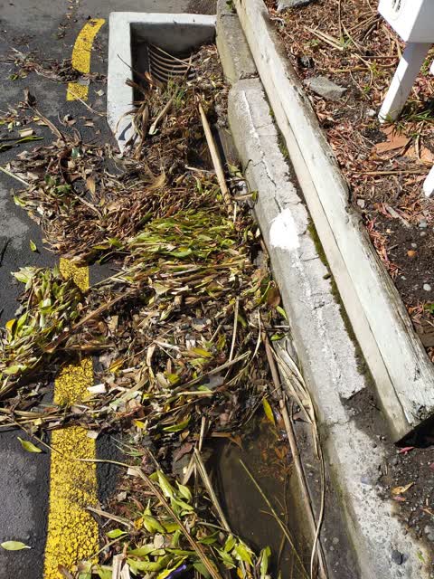
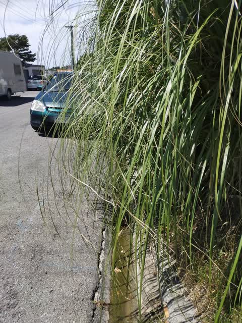
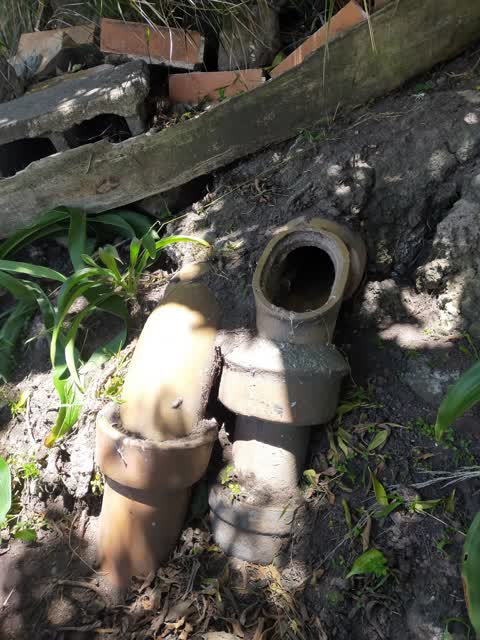
Photographed here 5 on record


What’s on record
 Overgrown Vegetation, 13 Sept 2026
 The 4 metre wide council reserve at 12 Muritai Tce is overgrown, never maintained by the Councils contractors, with large clumps of pampas g
 Damaged Road, 13 Sept 2026
 Muritai Terrace has a turning bay, however every vehicle that uses it needs to pull into the driveway at 12 Muritai Terrace in order to mano
 Wastewater/Stormwater, 10 Feb 2021
 after the rain last night the drain is blocked by all the weeds and unstable land which is council reserve. This is an ongoing problem as t
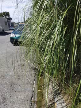 Parks, 18 Jan 2021
 the council reserve land in front of 12 Muritai Tce, is very overgrown, weeds and toi toi hang over the road making parking difficult in the
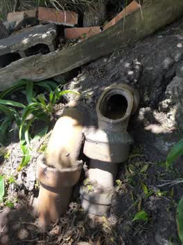 Wastewater/Stormwater, 18 Jan 2021
 inspection cover is missing from drainage pipe located on the council reserve in front of 12 Muritai Terrace
Elsewhere on Muritai Terrace
- 13 Muritai Terrace, 2 reports
- 3R Muritai Terrace, 1 report
- 3 Muritai Terrace, 1 report
- 21 Muritai Terrace, 1 report
- 17B Muritai Terrace, 1 report
- 12-14 Muritai Terrace, 1 report
- 10 Muritai Terrace, 1 report
The civic layer
This ground votes in Heathcote ward, the Spreydon-Cashmere-Heathcote community board is its local layer. Ward lines don’t always follow suburb lines; this one is measured at the pin, not the suburb’s centre. The whole roll is at /wards.
Muritai Terrace, the whole record → · Everything about Mount Pleasant → · What stood on this ground → · On the map → · From the air, RetroLens holds the Crown’s aerials back to 1936; search the address there →
Questions, answered briefly
5 council reports on record since January 2021, most often wastewater/stormwater (2), parks (1), overgrown vegetation (1).
Mount Pleasant, Christchurch, on Muritai Terrace.
Nothing on the heritage register at this exact spot, the record around this ground →
Old School Reserve, 150 m to its edge, 3 ha.