
Dumped Rubbish40 McCormacks Bay Rd
Yesterday 9th Oct witnessed driver off loading this rubbish on the side of Mc Cormacks bay road in broad daylight about 3.30pm. Then took of quickly and as I…
3,486 council reports since June 2015, the 42nd busiest suburb in the city. 2,536 photographs on record. 4,050 people at the 2023 Census, 1,094 to the square kilometre across 3.7 km².
The record also holds about $700 a week to rent· 2023 Census snapshot· 2,536 photographs· 7 old photographs· 1 school· 17 parks· 1 place of worship· 4 tracks· 1 name on the map· 2.6% of the outline mapped liquefied· 0.3% of the outline in the red zone· graded mostly TC2 in 2011· the record drew water over 1% of the outline· the mapped tsunami reach covers 3% of the outline· slope-hazard bands cover 1% of the outline· the Ngāi Tahu schedule covers 84% of the outline· ecological sites over 1% of the outline· landscape schedules over 25% of the outline· setback strips over 8% of the outline· 5,077 SCIRT photographs filed on this ground· 7.7 km of cycleway crosses the outline· 9 remembered names on this ground· 13 drawn rules bind this ground· 152 parcels of made ground· 1,000 surveyed rocks· the 2019 model grades this ground mostly unlikely· 3 engineered defences· 19 council structures on the register· 5 recreation register records· 514 trees on the register· the plan’s word on this ground· 1% of the outline reserved· 2 places on the heritage schedule· 33 epicentres inside the outline· 54 injury crashes· 357 recorded victimisations· 44 bus stops· 9 businesses· the council’s fix times· 2 heritage places· 40 documents· 5 mentions on the wire
Link-outs to the source’s own live pages, chch.live does not copy their live values or source text.
New bonds here ran at about $700 a week in the April–June 2026 quarter, the middle half of them between $610 and $800, across 15 bonds lodged, down 3% on a year ago. That’s about $150 a week above the city’s own quarter median of $550. Tenancy Services counts these under the “Mount Pleasant” statistical area, close to this suburb’s outline, not exactly it.
Median and quartiles of weekly rents on new private bonds, by quarter. New bonds are fresh lodgements, not the whole rental stock; under five bonds the rent is withheld, and counts are randomly rounded. Source: Tenancy Services rental bond data: provisional while the bond system migrates.
The ground: 0% of the outline went into the residential red zone; the February 2011 survey drew liquefaction over 3% of it, the rest of the watch is drawn further down.
Day to day it holds 1 school, 17 parks, 1 place of worship, 4 tracks and 44 bus stops, each is counted further down.
Lately the record’s mostly water & drains, 401 reports in the year to 12 October 2026, the newest 10 October 2026.
One for the quiz, Its busiest day on record was 10 October 2022, 45 reports in a single day.
About 3,909 people and 1,572 occupied private households in the “Mount Pleasant” statistical area, grouped from 26 SA1 areas. This exact statistical-area match is close to this suburb’s outline, not exactly it.
Ethnicity is a multiple-response measure, so those percentages are not meant to add to 100%.
Stats NZ’s 2023 Census uses fixed random rounding to base 3. Unavailable or confidential cells are left out, not treated as zero. individuals · households · geography · CC BY 4.0.
Mount Pleasant (Tauhinukorokio) is a coastal suburb of Christchurch, New Zealand. The suburb is located on the northern flank of the mountain Tauhinukorokio/Mount Pleasant in the Port Hills. It takes its name from the English version of the mountain's name.
Placed by the record’s locality join or the name in its own title, a lead, not a claim each frame stood here.
Yesterday 9th Oct witnessed driver off loading this rubbish on the side of Mc Cormacks bay road in broad daylight about 3.30pm. Then took of quickly and as I…
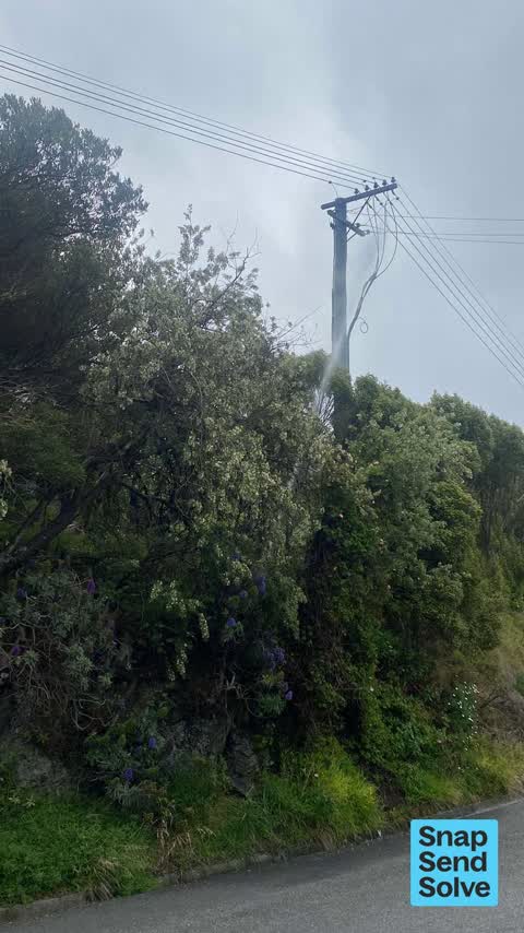

This CCC water meter is leaking, and it has created an under-runner and is causing subsidence in our property

A neighbour is repeatedly parking on the grass berm directly outside our property. We live at 105 major hornbrook with no kerb, and driving onto and reversing…

A sink hole has appeared in the footpath outside 23 Basil Place. It seems to have been caused by the trench that was dug several years ago by the fibre…


Our red bins were not emptied today, affects all the bins put out along the side of our road I checked. Perhaps the driver forgot us due to the water works…

Political party advertising billboard obscuring a council street sign

Silt from building work coming through stormwater from property up the hill at 38 Santa Maria ave

Two half broken dead branches which could fall on top of someone or something especially in strong winds

storm water drain and underground outlet is full of gravel and can't drain properly. please can a vacuum truck empty the sump and clear the outlet pipe to…

this drain is full or gravel and overflows with each rain event. could a vacuum truck pass clear it out and upstream and downstream pipes
The median council work order pinned in Mount Pleasant took 6 days to resolve, the city-wide median is 3 days, so this ground runs slower than the city as a whole. The slowest tenth waited 4 months or longer. 171 tickets are open here now, the oldest was filed 18 September 2020.
Work orders, not the resident reports above, the council’s MyCouncilTicket stream, and one job can appear in both. A median counts only finished jobs; open ones are named as open, never averaged in. The ticket roll · the whole city’s fix times.
One sensitive site stands here, Mt Pleasant School, and the Local Alcohol Policy restricts new off-licences within 200 m of it.
The council’s bylaw zones and the Local Alcohol Policy’s buffer list, read from the Regulatory open-data service. A ban rules drinking in public places; it says nothing about whether a premises may sell, that is the licence register’s job.
Zoned for Christchurch Adventist School · Hillview Christian School · Marian College · Middleton Grange School · St Thomas of Canterbury College · Te Aratai College · and 3 more zones, the drawn zone is indicative; the Ministry’s written scheme is the legal boundary.
Decile and EQI describe the community a school draws from, not how well it teaches.
The first eight of 17, Parks and reserves in the council’s open data, a park lands in the suburb its centre falls inside. The whole roll is at /parks.
Places of worship in the open map’s record, one lands in the suburb its building stands in. The whole roll is at /worship.
Tracks in the council’s open data, a line belongs to every suburb it passes through. The whole network is at /tracks.
The February 2011 survey drew mapped ground failure over 2.6% of this outline, about 10 hectares. A patch is a footprint, not a finding about an address; the count for the whole city is at /liquefaction.
The Crown’s 2011 classification drew 0.3% of this outline inside the residential red zone. A mapped area files under the suburb its middle sits in, and a classification is the record of a decision, not a finding about an address; the whole line is drawn at /redzone.
The 2011 grading filed 2.8% of this outline, about 10 hectares, mostly TC2. A graded area files under the suburb its middle sits in, and a category is a verdict for a patch of ground, not a finding about an address; the grades are drawn at /technical-categories.
The flood record drew water over 0.8% of this outline, across 1 named event. A patch is one event’s observation, not a live hazard finding; the whole record is drawn at /floods.
The mapped tsunami extent covers 3% of this outline, about 9 hectares. The sea’s modelled reach, not a prediction, the plan’s inundation line, not the evacuation zones; the share is read from a sampled join. The whole extent is drawn at /tsunami.
The plan’s slope-hazard bands cover 1% of this outline, rockfall management area 1, mass movement management area 2. The broad remaining-instability overlay covers 92% of it besides, the plan’s background watch over the hill country. Shares read from a sampled join; a management overlay, not a prediction. The whole watch is drawn at /slope.
The files record 152 parcels of made or characterised ground inside this outline, about 23 hectares, mostly loess, engineered fill, compacted hardfill, 4 carry fill the file can’t vouch for. A record is the file’s word on what was laid, not a fresh survey; the whole layer is drawn at /fill.
The rockfall survey mapped 1,000 rocks inside this outline across 176 survey pins, 823 came down, 34 still wobble easy. A pin may stand for a cluster and marks where the survey saw the rock, not where it is now; the whole survey is drawn at /boulders.
The 2019 liquefaction study put 94% of this outline in the "unlikely" class. A class is the model’s verdict on a patch of ground, not a finding about an address; the whole study is drawn at /vulnerability.
The register puts 3 engineered rockfall defences inside this outline, 2 mesh drapes, 1 rock cable. Nearly all are the emergency works the quake years left standing; the whole register is drawn at /defences.
The council’s structure register stands 19 assets on this ground, 7 boardwalks, 5 sets of steps, 4 bridges, 1 ramp, sited at Drayton Reserve, Mccormacks Bay, Ridgeview Reserve, King Park. The register’s site names are its own labels for the ground an asset stands in; the layer is drawn at the map.
The recreation register keeps 5 records inside this outline, bookable surfaces for 3 tennis, 1 basketball, 1 rugby. Seasons and surfaces are the register’s record, not this week’s draw; the layer is drawn at the map.
The register counts 514 living trees inside this outline, 2 veterans among them, 20 carrying a protection, mostly Pohutukawa, Cabbage tree, Kowhai. The file remembers 261 trees felled here. A tree record is the register’s word on what stands or stood; the whole canopy is drawn at /trees.
The plan files 48% of this outline under Residential Hills, 59% residential, the rest mostly Transport 14%, Open Space Natural 11%. A zone is a permission, not a description, the mix is read from a sampled join of the plan’s polygons; the whole district is drawn at /zones.
The plan reserves about 2 hectares of this outline, 1%, under 1 designation, mostly learning. A designation is a claim on the ground, not a build date, the mix is read from a sampled join; the whole register is drawn at /designations.
The plan’s heritage schedule protects 2 places by name in this suburb, Dwelling and Setting, Former Dwelling and Setting. A setting is the ground the item stands in, each files under the suburb holding its centroid; the whole schedule is at /heritage.
The plan’s schedule of sites significant to Ngāi Tahu covers 84% of this outline, about 309 hectares, ngā tūranga tūpuna. Shares read from a sampled join; a recognition overlay, not a catalogue. The whole schedule is drawn at /cultural.
The plan’s ecological schedules cover 1% of this outline across 1 scheduled site, all protected under Schedule A. Shares read from a sampled join; a recognition overlay, not a survey. The whole ledger is drawn at /ecology.
The plan’s landscape schedules cover 25% of this outline, about 94 hectares across 2 scheduled areas, 22% of it outstanding, the plan’s strongest landscape standing, and 15% of it sits inside the coastal environment. Shares read from a sampled join; a protection overlay, not a ranking of views. The kept view is drawn at /landscape.
No high-hazard flood area covers this outline. The broader flood-management watch covers 3% of it, McCormacks Bay. Shares read from a sampled join; a model’s map, not a promise. The waiting water is drawn at /flood-hazard.
The plan’s water-margin layers cross this outline, 61 classified reaches, the plan calling Mt Pleasant Waterway and Mt Pleasant Waterway Branch by name, 8% of it inside the setback strips, the widest holding 20 m off the bank, and an esplanade line holds a public edge here. The margin is the plan’s drawing, not a survey of the bank; the reaches, strips and held edges are mapped at /water-margin.
The rebuild’s cameras filed 5,077 photographs on this ground, 2010–2016, stormwater work mostly. Each frame is a receipt the dig left behind, a work log, not a survey of what stands now; the whole record is drawn at /rebuild.
The pedal network threads this ground, 7.7 km of cycleway crosses the outline, Rapanui Shag Rock, Te Ara Ihutai Coastal Pathway. A segment counts under every suburb its path enters; the whole network is drawn at /cycleways.
The remembered names stand on this ground, 9 inscribed plaques, Mccormacks Bay, Old School Reserve, The Brae among the grounds. The plaque is the register’s pin, not a surveyed spot; the whole roll is kept at /plaques.
The rulebook binds this ground, 13 drawn instruments, 11 of them dog rules, 2 bottle-store buffers; the outline sits inside the takiwā of Te Ngai Tuahuriri Runanga. The bylaw is the instrument, this the map of it, the whole rulebook is drawn at /rules.
GeoNet’s catalogue puts 33 magnitude-3+ epicentres inside this outline since the sequence opened, the biggest a M4.1 in 2011. An epicentre is where the instruments placed the break, not a measure of the shaking here; the whole catalogue is counted at /sequence, the live record is /quakes, and the story in plain language is the earthquakes explainer.
The named waterways, bays, headlands, monuments, summits and old sites OpenStreetMap puts inside this outline, a pin is the mapper’s own; a waterway belongs to every suburb it crosses. Every roll, counted: /geography.
54 crashes that hurt somebody on record inside Mount Pleasant's outline, 1 person killed, 15 seriously hurt.
The corner that keeps appearing: Main Road at McCormacks Bay Road, 8 injury crashes.
357 victimisations on the Police record inside Mount Pleasant’s outline, September 2022–August 2026, mostly theft, about 23 a year per 1,000 residents. Down 14% on the year before. Reported is not all, how much never reaches the record depends on the offence.
44 Metro stops inside Mount Pleasant's outline, in ECan’s stop record, served by route 140, route 3.
9 premises in Mount Pleasant across 6 kinds, from OpenStreetMap, the council’s licensed-premises register and its 2024 Find Christchurch directory. Each kind below opens at this suburb’s shelf.
Among them, the ones the record says most about:
What the archive’s sources say about Mount Pleasant, titled for it, turned up by a search for one of its places, or carrying its name in the text. These are leads and citations: the originals live at the provider, linked from each row.
…wo blocks ovjyj commencing at the top of the bridle path then along the ridge eastward to mount pleasant and northward down the slope towards the ferry bounded on the west by the bridle path apply to…Lyttelton Times · Papers Past · National Library of New Zealand · · text held
…e or two blocks commencing at the top of the bridle path then along the ridge eastward to mount pleasant and northward down the slope towards the ferry bounded on the west by the bridle path apply to…Lyttelton Times · Papers Past · National Library of New Zealand · · text held
…e or two blocks commencing at the top of the bridle path then along the ridge eastward to mount pleasant and northward down the slope towards the ferry bounded on thewest by the bridle path apply to m…Lyttelton Times · Papers Past · National Library of New Zealand · · text held
…rd thomas governor bay carpenter howieson thomas riccarton road labourer hornbrook alfred mount pleasant stockholder hornbrook william mount pleasant stockholder hughes john burnt bush station surveyo…Lyttelton Times · Papers Past · National Library of New Zealand · · text held
…ffice of this paper or at mr gould store christchurch reward strayed from jollies bush or mount pleasant a dark red three-yearling heifer cross-bred ayreshire branded k on the off rump and was forward…Lyttelton Times · Papers Past · National Library of New Zealand · · text held
…persons are in the practice of driving cattle from off my run known as edney valley near mount pleasant and taking with tliem cattle belonging to roe or in my chargel hereby give notice that in futur…Lyttelton Times · Papers Past · National Library of New Zealand · · text held
…man campbell john christchurch land surveyor campion john ferry road laborer capel george mount pleasant near lyttelton shepherd carew walter john piraki gentleman carlett stephen ham farm farmer carn…Lyttelton Times · Papers Past · National Library of New Zealand · · text held
…at the two last there is plenty of water and wood can be brought down with bullocks from mount pleasant bush at a small expense store at sumner 66 the association store at sumner is not adapted for a…Lyttelton Times · Papers Past · National Library of New Zealand · · text held
…vtotice is hereby given that th p l country on both sides of the bridle m extending from mount pleasant to the d bush is infected with scab and that ineasur have been taken to maintain a way for s i…Lyttelton Times · Papers Past · National Library of New Zealand · · text held
…votice is hereby given that the j country on both sides of the bridle-path extending from mount pleasant to the dry bush is infected with scab and that measures have been taken to maintain a way for s…Lyttelton Times · Papers Past · National Library of New Zealand · · text held
The rest are a search away, the whole shelf, for the name →
22 more documents came up in searches for Mount Pleasant's places and have not been read yet, a lead is a search result, not a fact, until somebody reads it.
Compare Mount Pleasant with Ferrymead · Redcliffs · Heathcote Valley · Moncks Bay · Clifton · Southshore, same record, side by side.
Mount Pleasant (Tauhinukorokio) is a coastal suburb of Christchurch, New Zealand. The public record holds 3,486 council reports for it, the first filed in June 2015.
4,050 people at the 2023 Census, 1,094 per square kilometre across 3.7 km².
About 3,909 people and 1,572 occupied private households: grouped from Stats NZ SA1 areas through this site’s suburb join. Indicative, not a LIM.
3,486 reports on record, most often water & drains (993), roads & footpaths (878), trees & parks (671). 401 of them in the year to 12 October 2026.
54 injury crashes on the police record inside the suburb’s outline, 1 person killed, 15 seriously hurt. The suburb’s crashes, mapped →
GeoNet’s catalogue puts 33 magnitude-3+ epicentres inside the suburb’s mapped outline since the September 2010 mainshock, the biggest a M4.1 in 2011. An epicentre is where the instruments placed the break, not a measure of the shaking felt here. The whole sequence, counted → · The story, in plain language →
Every suburb in Christchurch → · Its decade, charted → · the whole A–Z →
Work orders, not the resident reports above, the council’s MyCouncilTicket stream, and one job can appear in both. A median counts only finished jobs; open ones are named as open, never averaged in. The ticket roll · the whole city’s fix times.
The council’s bylaw zones and the Local Alcohol Policy’s buffer list, read from the Regulatory open-data service. A ban rules drinking in public places; it says nothing about whether a premises may sell, that is the licence register’s job.
Ministry of Education directory, the final decile and the current Equity Index describe the community a school draws from, not how well it teaches. Zones are indicative; the written enrolment scheme rules.
Parks and reserves in the council’s open data, the park lands in the suburb its centre falls inside; one that straddles the line keeps its own address.
Libraries, halls, cemeteries and the rest in the council’s open data, a facility lands in the suburb its point or centre falls inside.
Places of worship in the open map’s record, one lands in the suburb its building stands in. The whole roll is at /worship.
Marae in the region’s roll, a marae stands where it stands; the join names the suburb the roll files it under. The whole roll is at /maraes.
Walking, biking, horse and off-road tracks in the council’s open data, a line belongs to every suburb it passes through.
OpenStreetMap’s own record, inside this outline, a pin is the mapper’s; a waterway belongs to every suburb it crosses. Every roll, counted: /geography.
Heritage places the council’s district plan or Heritage New Zealand list inside this suburb, each with what is known about it and the document it is known from.
The register’s era records for places in this suburb, what stood on the ground, and when.
Each of these is a decade of reports, the heritage places on the register, what is known about them, and the documents behind it, everything the archive holds about the part of the city it names.