15 Beresford Street, New Brighton
20 reports on record since June 2017 · 19 with photographs. The street’s heaviest record is 37 Beresford Street — 58 reports on file. Indicative rating valuation and school zones, hazards, bin day and what stood here before.
What gets reported here
Photographed here 19 on record


Reported here
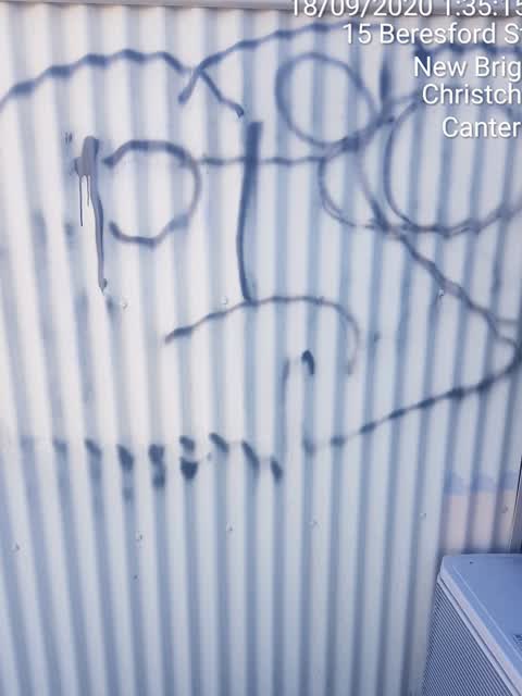
 Graffiti on a fence, building or structure —
  Graffiti on a bus stop or public toilet —
 graffiti on side of bus shelter
 Graffiti on a bus stop or public toilet —
 graffiti on bus stop
 Graffiti on a bus stop or public toilet —
 graffiti on bus shelter
 Bus Shelter Issue —
 Broken glass on a bus time device which needs its glass replacing because it is hard to see.
 Bus Shelter Issue —
 Smashed bus info sign
 Graffiti on a bus stop or public toilet —
 Graffiti
 Graffiti on a fence, building or structure —
 graffiti tin fence east facing
 Bus Shelter Issue —
  Graffiti on a bus stop or public toilet —
  Graffiti on a bus stop or public toilet —
 - Overgrown Vegetation —
 Graffiti —
 painted out by Peeep Trust
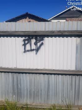 Graffiti —
 painted out by Peeep Trust
Graffiti —
Graffiti —
Graffiti —
Graffiti —
Graffiti —
Graffiti —
Also reported on Beresford Street
- 37 Beresford Street — 58 reports
- 10 Beresford Street — 32 reports
- 58 Beresford Street — 30 reports
- 61 Beresford Street — 25 reports
- 3 Beresford Street — 21 reports
- 28 Beresford Street — 13 reports
- 21 Beresford Street — 13 reports
- 82 Beresford Street — 11 reports
The street’s crash record
NZTA’s record names Beresford Street in 17 crashes that hurt somebody since 2006 — 2 seriously hurt, nobody killed.
The green nearby
- New Brighton Mall Playground — 74 m to the edge
- New Brighton Beach Developed — 98 m to the edge · Regional · 2 ha
- New Brighton Beach — 138 m to the edge · Regional · 10 ha
- Withells Island Reserve — 363 m to the edge · 4 ha
Parks within half a kilometre, measured to the boundary — the council’s open data.
The civic shelf nearby
- New Brighton Library — 154 m away · Library · 60 Brighton Mall, New Brighton, Christchurch 8061
Libraries, halls and the rest within half a kilometre — the council’s open data.
On the doorstep
- Ezee Mart — 6 m away · Dairies & convenience
- Super Liquor — 18 m away · Bottle stores
- Kebab Palace — 57 m away · Fast food
- Sushi Ya - New Brighton — 65 m away · Fast food
Businesses within four hundred metres, measured at the pin — OpenStreetMap and the council directories.
The bus nearby
- New Brighton (Oram Ave) — 18 m away · route 5, route 60, route 110, route 135
- New Brighton (Oram Ave) — 39 m away · route 5, route 60, route 110, route 135
The closest Metro stops, within four hundred and fifty metres.
The tracks through here
- Walk and bike track through New Brighton — 347 m to the line · walk · bike
Tracks whose line passes within half a kilometre, measured to the line itself — the council’s open data.
The named ground
Named places within 1.5 km of this address; the council’s own structure register — bridges, boardwalks and steps standing nearby — the open map’s record.
The remembered names nearby
- This Seat Is Dedicated to / Frances M. Sands — 114 m away ·
This seat is Dedicated to / Frances M. Sands / In Memory of her service to / the New Brigh
· 2003 - This Seat Is Dedicated to / Jim & Yvonne Read — 124 m away ·
This seat is Dedicated to / Jim & Yvonne Read / in appreciation of their service / to the
· 2004 - Plaque no. 311010 — 132 m away
Inscribed plaques within two hundred and fifty metres — the register’s pins, not surveyed spots. The whole roll is at /plaques.
Renting nearby
new bonds in New Brighton ran about $520 a week — $30 below the city median of $550 — the suburb page keeps the rent record →.
What was here — New Brighton War Memorial & Amphitheatre
118 m away · located to ±20 m · the place’s own record →
On the register. Nothing researched here yet.
What was here — New Brighton Clock Tower and Setting
156 m away · located to ±3 m · the place’s own record →
On the register. Nothing researched here yet.
The civic layer
This ground votes in Coastal ward — the Coastal-Burwood-Linwood community board. Ward lines don’t always follow suburb lines; this one is measured at the pin, not the suburb’s centre.
What stood on this ground → · On the map → · From the air — the Crown’s aerials back to 1936; search the address on RetroLens →
Questions, answered briefly
20 council reports on record since June 2017 — most often graffiti (8), graffiti on a bus stop or public toilet (6), bus shelter issue (3).
New Brighton, Christchurch — on Beresford Street.
The heritage register names 2 places at or beside it — New Brighton War Memorial & Amphitheatre, New Brighton Clock Tower and Setting.
New Brighton Mall Playground — 74 m to its edge.