37 Beresford Street, New Brighton
58 reports on record since July 2016 · 51 with photographs. The most-reported address on Beresford Street. Indicative rating valuation and school zones, hazards, bin day and what stood here before.
What gets reported here
Photographed here 51 on record


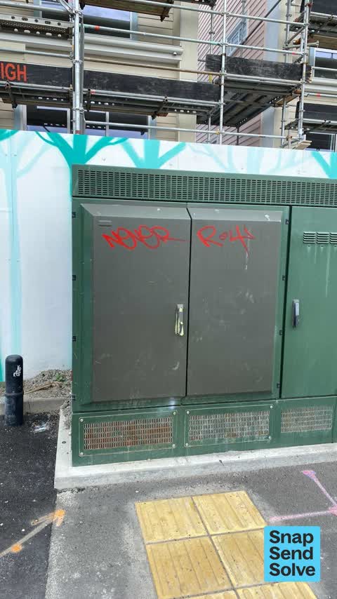


Reported here
 Graffiti on a fence, building or structure —
 fresh
 Street Gutters / Storm Water —
 grating needs to be lifted up, cleaned out so it sits flush with the road. it is outside a bus stop, so trip hazard an issue
 Poles and Signage - General —
 sign frame on ground behind power box, needs to be picked up.
 Bus Shelter Issue —
 bus shelter, rear leg rusted out and detached from Bracket
 Graffiti on a bus stop or public toilet —
 Graffiti pn bus stop 18889
 Graffiti somewhere else —
 On water box and lots more along Beresford St also.
 Graffiti on a cabinet, pole or railway asset —
  Litter —
  Trees - General —
 Cabbage trees looking sad .. dead branches near new townhouses, on island in middle of Beresford St, New Brighton (sea end). Whole road isl
 Graffiti on a fence, building or structure —
  Graffiti on a sign, mural or public art —
  Poles and Signage - General —
 Bus timetable removed when bus stops changed. Please out back.
 Graffiti somewhere else —
  Vandalism - General —
  Graffiti somewhere else —
  Graffiti on a fence, building or structure —
 Re report plus additional
 Graffiti on a fence, building or structure —
  Graffiti on a fence, building or structure —
 Re reporting plus additional
 Graffiti somewhere else —
  Graffiti somewhere else —
  Graffiti —
  Graffiti —
 - Graffiti —
- Dumped Rubbish —
- Graffiti —
- Graffiti —
- Graffiti —
- Graffiti —
- Graffiti —
 Graffiti —
  Graffiti —
  Graffiti —
 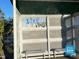 Graffiti —
 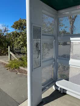 Graffiti —
 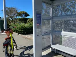 Graffiti —
 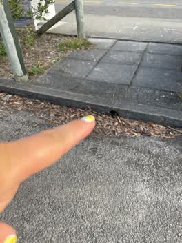 Wastewater/Stormwater —
 When it rains a this floods blocking the path
Graffiti —
Roading/Streets —
Deep ditch where drain is in garden. Next to bus stop.
Graffiti —
Just across the road from Quick silver is two 40ft containers that have graffiti on at lest one of them on Beresford street in New Brighton.
Graffiti —
Graffiti —
Graffiti —
Graffiti —
Graffiti —
Graffiti —
Graffiti —
Graffiti —
Graffiti —
Graffiti —
Graffiti —
Graffiti —
Graffiti —
Graffiti —
Graffiti —
Graffiti —
Graffiti —
Graffiti —
Graffiti —
Also reported on Beresford Street
- 10 Beresford Street — 32 reports
- 58 Beresford Street — 30 reports
- 61 Beresford Street — 25 reports
- 3 Beresford Street — 21 reports
- 15 Beresford Street — 20 reports
- 28 Beresford Street — 13 reports
- 21 Beresford Street — 13 reports
- 82 Beresford Street — 11 reports
The street’s crash record
NZTA’s record names Beresford Street in 17 crashes that hurt somebody since 2006 — 2 seriously hurt, nobody killed.
The green nearby
- New Brighton Mall Playground — 150 m to the edge
- New Brighton Beach Developed — 267 m to the edge · Regional · 2 ha
- Withells Island Reserve — 289 m to the edge · 4 ha
- New Brighton Beach — 308 m to the edge · Regional · 10 ha
- Rawhiti Domain — 476 m to the edge · Sports ground · 61 ha
Parks within half a kilometre, measured to the boundary — the council’s open data.
The civic shelf nearby
- New Brighton Library — 308 m away · Library · 60 Brighton Mall, New Brighton, Christchurch 8061
Libraries, halls and the rest within half a kilometre — the council’s open data.
On the doorstep
- SBA Small Business Accounting — 59 m away · Accountants
- Cafe Calypso — 65 m away · Cafés
- Point Break Café — 67 m away · Cafés
- Happy Feet — 67 m away · Shoe repair
Businesses within four hundred metres, measured at the pin — OpenStreetMap and the council directories.
The bus nearby
- Beresford St — 19 m away · route 5, route 110
- New Brighton (Beresford St) — 77 m away · route 5, route 110
The closest Metro stops, within four hundred and fifty metres.
The tracks through here
- Walk and bike track through New Brighton — 232 m to the line · walk · bike
- Walk and bike track through New Brighton — 370 m to the line · walk · bike
- Walk and bike track through New Brighton — 375 m to the line · walk · bike
- Walk and bike track through New Brighton — 432 m to the line · walk · bike
Tracks whose line passes within half a kilometre, measured to the line itself — the council’s open data.
The named ground
Named water within 500 m of this address, measured to the line or the edge; Named places within 1.5 km of this address; the council’s own structure register — bridges, boardwalks and steps standing nearby — the open map’s record.
Renting nearby
new bonds in New Brighton ran about $520 a week — $30 below the city median of $550 — the suburb page keeps the rent record →.
What was here — St Faith's Church and Setting
228 m away · 50 Hawke Street · located to ±19 m · the place’s own record →
On the register. Nothing researched here yet.
The civic layer
This ground votes in Coastal ward — the Coastal-Burwood-Linwood community board. Ward lines don’t always follow suburb lines; this one is measured at the pin, not the suburb’s centre.
What stood on this ground → · On the map → · From the air — the Crown’s aerials back to 1936; search the address on RetroLens →
Questions, answered briefly
58 council reports on record since July 2016 — most often graffiti (35), graffiti somewhere else (5), graffiti on a fence, building or structure (5).
New Brighton, Christchurch — on Beresford Street.
The heritage register names a place at or beside it — St Faith's Church and Setting.
New Brighton Mall Playground — 150 m to its edge.