19 Evans Avenue, New Brighton
25 reports on record since December 2017 · 16 with photographs. The most-reported address on Evans Avenue. Indicative rating valuation and school zones, hazards, bin day and what stood here before.
What gets reported here
Photographed here 16 on record


Reported here
 Water General —
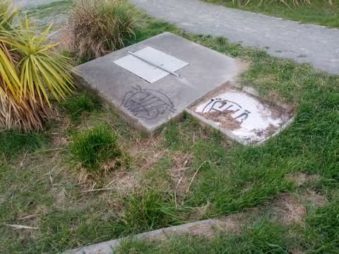
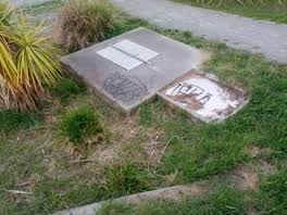
 I think these are big storm water drains. At end of Evans Ave by river. They normally have big metal covers. The covers are gone. Large enou
 Water General —
 Someone has stolen the cover off this water/sewage pipe. It is full of water and seems dangerous that people or animals could fall in. This
 Graffiti somewhere else —
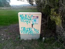
 Citycare Water box by the river
 Graffiti somewhere else —
 On the wooden and concrete sign by the river
 Graffiti somewhere else —
 On the Citycare Water box
 Graffiti somewhere else —
 On the Citycare Water box
 Graffiti on a cabinet, pole or railway asset —
  Graffiti on a cabinet, pole or railway asset —
  Graffiti —
 On the water box again
 Graffiti —
 On the Citycare Water box again, down by the river
 Graffiti —
 On the box at the very end of the street by the river
- Graffiti —
- Graffiti —
- Graffiti —
- Graffiti —
- Graffiti —
- Graffiti —
- Graffiti —
- Graffiti —
- Graffiti —
 Graffiti —
  Graffiti —
 Wastewater/Stormwater —
Cabinet left open
Graffiti —
Graffiti —
Two wooden bollards by river at entrance to blighs garden walkway near Evans way with black and green spray paint graffiti.
Also reported on Evans Avenue
- 17 Evans Avenue — 5 reports
- 15 Evans Avenue — 4 reports
- 1 Evans Avenue — 4 reports
- 9 Evans Avenue — 3 reports
- 3 Evans Avenue — 3 reports
- 24 Evans Avenue — 3 reports
- 16 Evans Avenue — 3 reports
- 13 Evans Avenue — 3 reports
The street’s crash record
NZTA’s record names Evans Avenue in 1 crash that hurt somebody since 2006 — 0 seriously hurt, nobody killed.
The green nearby
- Blighs Garden — 1 m to the edge · 6 ha
- Bexley Wetland — 80 m to the edge · Regional · 15 ha
- Withells Island Reserve — 163 m to the edge · 4 ha
- Harold Henry Park — 313 m to the edge
Parks within half a kilometre, measured to the boundary — the council’s open data.
The bus nearby
- Union St near Mountbatten St — 300 m away · route 60
- Union St near Mountbatten St — 344 m away · route 60
The closest Metro stops, within four hundred and fifty metres.
The tracks through here
- Walk and bike track through New Brighton — 12 m to the line · walk · bike
- Walk and bike track through New Brighton — 81 m to the line · walk · bike
- Walk and bike track through New Brighton — 239 m to the line · walk · bike
- Walk and bike track through New Brighton — 468 m to the line · walk · bike
Tracks whose line passes within half a kilometre, measured to the line itself — the council’s open data.
The named ground
Named water within 500 m of this address, measured to the line or the edge; Named places within 1.5 km of this address; the council’s own structure register — bridges, boardwalks and steps standing nearby — the open map’s record.
Renting nearby
new bonds in New Brighton ran about $520 a week — $30 below the city median of $550 — the suburb page keeps the rent record →.
The civic layer
This ground votes in Coastal ward — the Coastal-Burwood-Linwood community board. Ward lines don’t always follow suburb lines; this one is measured at the pin, not the suburb’s centre.
What stood on this ground → · On the map → · From the air — the Crown’s aerials back to 1936; search the address on RetroLens →
Questions, answered briefly
25 council reports on record since December 2017 — most often graffiti (16), graffiti somewhere else (4), water general (2).
New Brighton, Christchurch — on Evans Avenue.
Nothing on the heritage register at this exact spot — the record around this ground →
Blighs Garden — 1 m to its edge, 6 ha.