67 Hawke Street, New Brighton
18 reports on record since May 2018 · 15 with photographs. The street’s heaviest record is 55 Hawke Street — 61 reports on file. Indicative rating valuation and school zones, hazards, bin day and what stood here before.
What gets reported here
Photographed here 15 on record


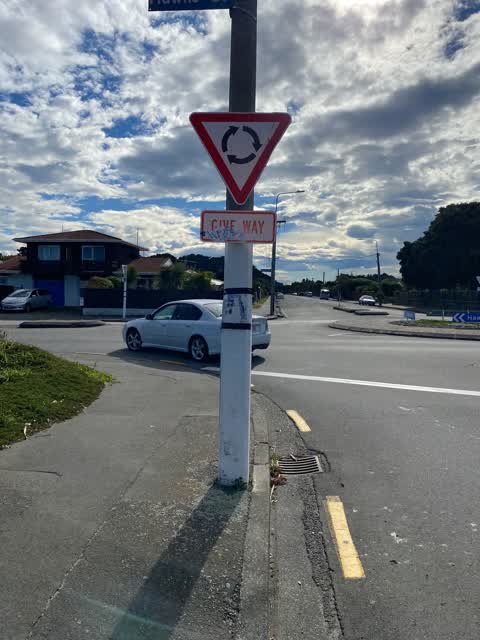
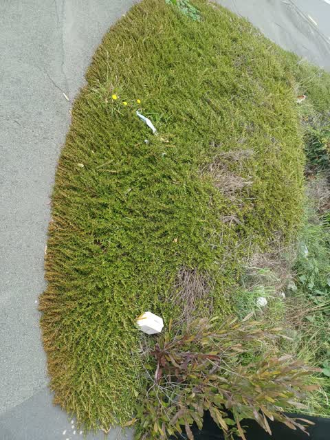
Reported here
 Graffiti on a fence, building or structure —
  Graffiti on a fence, building or structure —
 graffiti on blue fence large carpark
 Overgrown Vegetation —
 Weeds have overtaken and are now seeding neighbouring properties. Last few years Council sorted this out. Hopefully the same can happen agai
 Graffiti on a fence, building or structure —
  Graffiti somewhere else —
  Graffiti somewhere else —
 On corner
- Overgrown Vegetation —
Car Park cnr Hawke St and Shaw Ave. Owner needs to cut grass surrounding the car park or does it belong to the council...
 Graffiti somewhere else —
 Parking area correct address
 Public Toilet —
 Water flowing out of ladies toilet out onto the footpath and road
 Graffiti somewhere else —
  Graffiti somewhere else —
 - Graffiti —
- Graffiti —
 Graffiti —
  Roading/Streets —
 Over grown gardens/weeds and littered with rubbish
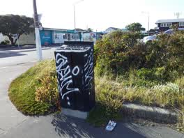 Graffiti —
 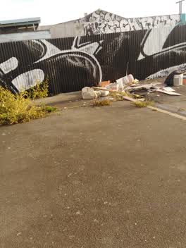 Rubbish/Recycling —
 Carpark... cnr Hawke St and Shaw Ave. Plus a smashed up car in carpark. SILVER/GREY 4wheel drive.
Graffiti —
Also reported on Hawke Street
- 55 Hawke Street — 61 reports
- 43 Hawke Street — 56 reports
- 44 Hawke Street — 21 reports
- 120 Hawke Street — 16 reports
- 69 Hawke Street — 14 reports
- 40 Hawke Street — 14 reports
- 57 Hawke Street — 11 reports
- 150 Hawke Street — 11 reports
The street’s crash record
NZTA’s record names Hawke Street in 31 crashes that hurt somebody since 2006 — 1 person killed, 7 seriously hurt.
The green nearby
- New Brighton Mall Playground — 263 m to the edge
- Rawhiti Domain — 271 m to the edge · Sports ground · 61 ha
- New Brighton Beach Developed — 371 m to the edge · Regional · 2 ha
- New Brighton Beach — 413 m to the edge · Regional · 10 ha
- Withells Island Reserve — 435 m to the edge · 4 ha
Parks within half a kilometre, measured to the boundary — the council’s open data.
The civic shelf nearby
- New Brighton Library — 419 m away · Library · 60 Brighton Mall, New Brighton, Christchurch 8061
Libraries, halls and the rest within half a kilometre — the council’s open data.
On the doorstep
- Coupland's Bakeries - New Brighton — 29 m away · Business
- Unichem — 43 m away · Pharmacies
- Pier Law Lawyers — 57 m away · Lawyers
- Luxury Nails & Beauty — 67 m away · Beauty
Businesses within four hundred metres, measured at the pin — OpenStreetMap and the council directories.
The bus nearby
The closest Metro stops, within four hundred and fifty metres.
The tracks through here
- Walk and bike track through New Brighton — 38 m to the line · walk · bike
- Walk and bike track through New Brighton — 316 m to the line · walk · bike
- Walk and bike track through New Brighton — 350 m to the line · walk · bike
- Walk and bike track through New Brighton — 413 m to the line · walk · bike
- Walk and bike track through New Brighton — 441 m to the line · walk · bike
Tracks whose line passes within half a kilometre, measured to the line itself — the council’s open data.
The named ground
Named water within 500 m of this address, measured to the line or the edge; Named places within 1.5 km of this address — the open map’s record.
Renting nearby
new bonds in New Brighton ran about $520 a week — $30 below the city median of $550 — the suburb page keeps the rent record →.
What was here — St Faith's Church and Setting
65 m away · 50 Hawke Street · located to ±19 m · the place’s own record →
On the register. Nothing researched here yet.
The civic layer
This ground votes in Coastal ward — the Coastal-Burwood-Linwood community board. Ward lines don’t always follow suburb lines; this one is measured at the pin, not the suburb’s centre.
What stood on this ground → · On the map → · From the air — the Crown’s aerials back to 1936; search the address on RetroLens →
Questions, answered briefly
18 council reports on record since May 2018 — most often graffiti somewhere else (5), graffiti (5), graffiti on a fence, building or structure (3).
New Brighton, Christchurch — on Hawke Street.
The heritage register names a place at or beside it — St Faith's Church and Setting.
New Brighton Mall Playground — 263 m to its edge.