15 Ford Road, Opawa
20 reports on record since April 2016 · 13 with photographs. The street’s heaviest record is 46 Ford Road — 61 reports on file. Indicative rating valuation and school zones, hazards, bin day and what stood here before.
What gets reported here
- Vandalism - General — 5
- Playground Equipment — 3
- Graffiti — 3
- Parks — 2
- Park - General Request — 2
- Trees - General — 1
Photographed here 13 on record





Reported here
 Playground Equipment —
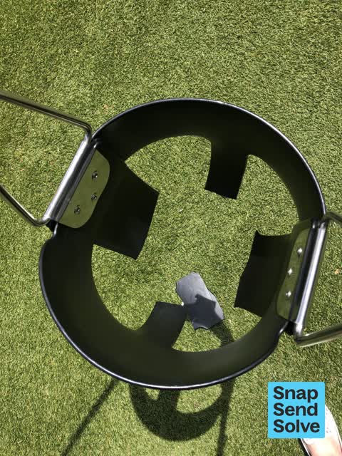
 Slide faces North-west. In summer stainless steel to hit for bare legs Better design would be to face the slide to the south.
 Vandalism - General —
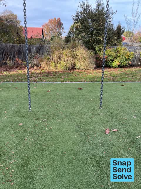
 Swing seat removed
 Trees - General —
  Vandalism - General —
 Swings cut one unusable the other with metal revealed
 Vandalism - General —
 Swings on the Risingholme park playground are cut and unable to be used
 Playground Equipment —
 Vandalism of playground equipment. Dangerous to use and can not use baby swing any longer as they have cut the whole seat off. Also graffiti
- Vandalism - General —
The swings at the Risingholme playground have been damaged. It looks like someone has tried to cut them all off.
 Vandalism - General —
 Baby and adult swings broken at Risingholme park
 Park - General Request —
 Paint bucket in creek
 General Request —
 Swing had come apart - is very dangerous. This swing needs better attachment and lock nut or a swing washer would help. We found the screw o
- Graffiti —
- Graffiti —
- Playground Equipment —
- Park - General Request —
- Facility - General Request —
- Rubbish and Bins - General —
 Graffiti —
 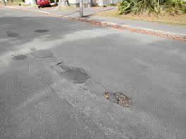 Roading/Streets —
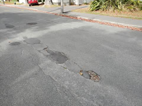
 Small pothole, spreading along crack in road
Parks —
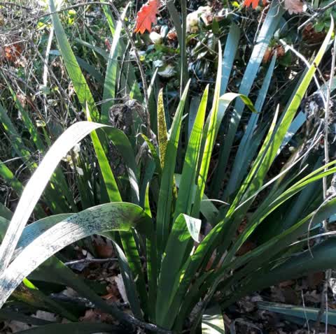
Many clumps of stinking iris in Risingholme Park. The berries are poisonous & the plant is an unwanted noxious weed. please can the maintena
Parks —
Shrubs stolen from riseinghome park st Martins sat 24 April police informed looks as if 2 more have been readied for removal please see pho
Also reported on Ford Road
- 46 Ford Road — 61 reports
- 44 Ford Road — 11 reports
- 77 Ford Road — 7 reports
- 2 Ford Road — 7 reports
- 9 Ford Road — 6 reports
- 75 Ford Road — 6 reports
- 40 Ford Road — 6 reports
- 73 Ford Road — 4 reports
The street’s crash record
NZTA’s record names Ford Road in 4 crashes that hurt somebody since 2006 — 3 seriously hurt, nobody killed.
The green nearby
- Risingholme Park — you are in it · Botanic · 2 ha
- Fifield Reserve — 338 m to the edge
- Acorn Reserve — 390 m to the edge
- Heathcote Riverbank Reserve — 432 m to the edge
- Hansen Park — 452 m to the edge · Sports ground · 12 ha
Parks within half a kilometre, measured to the boundary — the council’s open data.
On the doorstep
- Opawa Tennis — 200 m away · Sports centres
- Opawa Bakery & Cafe — 282 m away · Cafés
- Kowhai Vet — 289 m away · Vets
- Love Me Again Vintage — 289 m away · Clothing
Businesses within four hundred metres, measured at the pin — OpenStreetMap and the council directories.
The bus nearby
- Opawa Rd near Cholmondeley Ave — 321 m away · route 8
- St Martins Rd near Ensors Rd — 339 m away · the Orbiter (clockwise)
The closest Metro stops, within four hundred and fifty metres.
The tracks through here
- Walk and bike track through Opawa — 82 m to the line · walk · bike
- Walk and bike track through Opawa — 118 m to the line · walk · bike
- Walk and bike track through Opawa — 140 m to the line · walk · bike
- Walk and bike track through Opawa — 167 m to the line · walk · bike
- Walk and bike track through Opawa — 344 m to the line · walk · bike
Tracks whose line passes within half a kilometre, measured to the line itself — the council’s open data.
The named ground
Named water within 500 m of this address, measured to the line or the edge; the council’s own structure register — bridges, boardwalks and steps standing nearby — the open map’s record.
The remembered names nearby
- Douglas S. Laird 1925 — 2004 — 27 m away ·
DOUGLAS S. LAIRD 1925 — 2004
· 2009 - Planted by the Children of Risingholme Playcentre — 87 m away ·
PLANTED BY THE CHILDREN OF RISINGHOLME PLAYCENTRE FOR INTERNATIONAL YEAR OF THE CHILD 1979
· 2009 - Ginkgo Biloba This Tree Was Planted to Commemorate the Work — 90 m away ·
GINKGO BILOBA THIS TREE WAS PLANTED TO COMMEMORATE THE WORK OF DOROTHY RANGI CRUMPTON DIRE
· 2009
Inscribed plaques within two hundred and fifty metres — the register’s pins, not surveyed spots. The whole roll is at /plaques.
Renting nearby
new bonds in Opawa ran about $555 a week — about the city median — the suburb page keeps the rent record →.
What was here — Former Dwelling and Setting, Risingholme
72 m away · 22 Cholmondeley Avenue · located to ±17 m · the place’s own record →
On the register. Nothing researched here yet.
What was here — 9 Ford Road
83 m away · 9 Ford Road · located to ±14 m · the place’s own record →
On the register. Nothing researched here yet.
The civic layer
This ground votes in Heathcote ward — the Spreydon-Cashmere-Heathcote community board. Ward lines don’t always follow suburb lines; this one is measured at the pin, not the suburb’s centre.
What stood on this ground → · On the map → · From the air — the Crown’s aerials back to 1936; search the address on RetroLens →
Questions, answered briefly
20 council reports on record since April 2016 — most often vandalism - general (5), playground equipment (3), graffiti (3).
Opawa, Christchurch — on Ford Road.
The heritage register names 2 places at or beside it — Former Dwelling and Setting, Risingholme, 9 Ford Road.
Risingholme Park — the address is inside it, 2 ha.