4 Roderick Alleyn Lane
4 council reports since October 2021, 3 carrying a photograph. The street’s heaviest record is 2 Roderick Alleyn Lane, 5 reports on file.
From the air, then
Sourced from Canterbury Maps and partners. LINZ, CC BY 3.0 NZ. Each frame is cut from Environment Canterbury’s historic imagery MapServer for that decade, only where the Footprints layer names a CC BY survey (NZAM-covered spots stay out). RetroLens holds more Crown aerials →
The green nearby
- Shearer Playground, 139 m to the edge · playground, 6 pieces
- Papanui Stream Esplanade, 185 m to the edge
- Erica Playground, 332 m to the edge · playground, 47 pieces
- Rutland Reserve, 487 m to the edge · 2 ha · playground, 56 pieces
Parks within half a kilometre, measured to the boundary, the council’s open data. The whole roll is at /parks.
On the doorstep
- Ngaio Marsh Retirement Village, 262 m away · Business
- Main North Road Medical Centre, 335 m away · Doctors & clinics
- Burning Needlz Tattoo, 364 m away · Tattoo & piercing
- Tasty Thai, 365 m away · Restaurants
Businesses within four hundred metres, measured at the pin, OpenStreetMap and the council directories.
The bus nearby
- Northlands Platform A, 356 m away · route 1, route 95, route 107
- Northlands Platform B, 365 m away · route 27, route 125, the Orbiter (clockwise)
The closest Metro stops, within four hundred and fifty metres.
The tracks through here
- Walk and bike track through PAPANUI, 371 m to the line · walk · bike
- Walk and bike track through PAPANUI, 371 m to the line · walk · bike
- Walk and bike track through PAPANUI, 488 m to the line · walk · bike
- Walk and bike track through PAPANUI, 494 m to the line · walk · bike
Tracks whose line passes within half a kilometre, the council’s open data.
The named ground
Named water within 500 m of this address, measured to the line or the edge; the council’s own structure register, bridges, boardwalks and steps standing nearby, the open map’s record.
Renting nearby
new bonds in PAPANUI ran about $572 a week, $22 above the city median of $550, the suburb page keeps the rent record →.
What gets reported here
Photographed here 3 on record

What’s on record
 Road Signage, 16 Feb 2024
Hi there.there is signage that our road is closed. mail and couriers are not delivering their parcels for past 3 days to Roderick alleyn Lan
- Water Leak, 8 Aug 2023
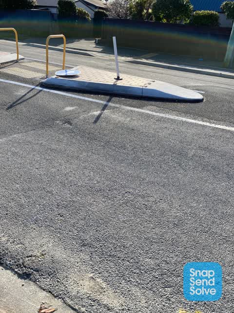
 Roading/Streets, 14 Jul 2022
Broken road sign looks as if it has been run into.
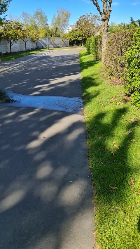
 Water Supply, 18 Oct 2021
Mains water meter is flooded and leaking onto the lane. Can someone please come and have a look and stop leaking?
Elsewhere on Roderick Alleyn Lane
- 2 Roderick Alleyn Lane, 5 reports
- 14 Roderick Alleyn Lane, 1 report
The civic layer
This ground votes in Papanui ward, the Papanui-Innes-Central community board is its local layer. Ward lines don’t always follow suburb lines; this one is measured at the pin, not the suburb’s centre. The whole roll is at /wards.
Roderick Alleyn Lane, the whole record → · Everything about PAPANUI → · What stood on this ground → · On the map → · From the air, RetroLens holds the Crown’s aerials back to 1936; search the address there →
Questions, answered briefly
4 council reports on record since October 2021, most often water supply (1), water leak (1), roading/streets (1).
PAPANUI, Christchurch, on Roderick Alleyn Lane.
Nothing on the heritage register at this exact spot, the record around this ground →
Shearer Playground, 139 m to its edge.