
Pavement - Damaged133 Paparoa St
Recently the asphalt on the Papanui Parallel was cut for underground services. It appears when it was re-asphalted for this the asphalt was too thin and has…
5,940 council reports since June 2015, the 20th busiest suburb in the city. 4,676 photographs on record. 7,740 people at the 2023 Census, 2,738 to the square kilometre across 2.8 km².
The record also holds about $572 a week to rent· 2023 Census snapshot· 4,676 photographs· 48 old photographs· 6 schools· 9 parks· 2 civic facilities· 4 places of worship· 1 marae· 13 tracks· 4 names on the map· 11.8% of the outline mapped liquefied· the record drew water over 4% of the outline· ecological sites over 1% of the outline· noise overlays over the whole outline· setback strips over 7% of the outline· 62% of the outline inside the plan’s density overlays· 955 SCIRT photographs filed on this ground· 18.5 km of cycleway crosses the outline· 11 remembered names on this ground· 11 drawn rules bind this ground· 10 parcels on the dangerous-work register· 67 parcels of made ground· 15 parcels with a cleanup on file· the 2019 model grades this ground mostly medium· 20 council structures on the register· 9 recreation register records· 1,403 trees on the register· the plan’s word on this ground· 7% of the outline reserved· the plan’s exceptions touch 2% of the outline· 4 places on the heritage schedule· 1 epicentre inside the outline· 255 injury crashes· 7,049 recorded victimisations· 22 bus stops· 175 businesses· the council’s fix times· alcohol ban over 32% of the outline· 6 heritage places· 40 documents· 5 mentions on the wire
Link-outs to the source’s own live pages, chch.live does not copy their live values or source text.
New bonds here ran at about $572 a week in the April–June 2026 quarter, the middle half of them between $479 and $638, across 66 bonds lodged, up 3% on a year ago. That’s about $22 a week above the city’s own quarter median of $550. Tenancy Services counts these under the Papanui North, Papanui West, Papanui East and Northlands (Christchurch City) areas combined, approximately this suburb.
Median and quartiles of weekly rents on new private bonds, by quarter; suburb figures are a bond-weighted blend of the areas. New bonds are fresh lodgements, not the whole rental stock; under five bonds the rent is withheld, and counts are randomly rounded. Source: Tenancy Services rental bond data: provisional while the bond system migrates.
The ground: the February 2011 survey drew liquefaction over 12% of it; the flood record drew water over 4% of it, the rest of the watch is drawn further down.
Day to day it holds 6 schools, 9 parks, 2 civic facilities, 4 places of worship, 1 marae, 13 tracks and 22 bus stops, each is counted further down.
Lately the record’s mostly graffiti & vandalism, 795 reports in the year to 12 October 2026, the newest 11 October 2026.
One for the quiz, Its busiest day on record was 30 July 2023, 47 reports in a single day.
About 7,422 people and 2,961 occupied private households in the “Papanui East”, “Papanui North”, “Northlands (Christchurch City)” and “Papanui West” areas, grouped from 53 SA1 areas. Several statistical areas are combined here, so this is a grouped proxy rather than a count for one suburb boundary.
Ethnicity is a multiple-response measure, so those percentages are not meant to add to 100%.
Stats NZ’s 2023 Census uses fixed random rounding to base 3. Unavailable or confidential cells are left out, not treated as zero. individuals · households · geography · CC BY 4.0.
Papanui is a suburb of Christchurch, New Zealand. It is situated five kilometres to the northwest of the city centre. Papanui has a population of 3,645 consisting predominantly of Pākehā 86.9%, Asian 7.6%, Māori 5.3%, Pacific peoples 3.1%, Middle Eastern/Latin American/African 0.7%. The suburb is located at the junction of three busy thoroughfares; Papanui Road leading to the city, the Main North Road that leads to North Canterbury and Harewood Road that leads to Christchurch International Airport. However, as with most Christchurch suburbs, Papanui has no defined borders.
Placed by the record’s locality join or the name in its own title, a lead, not a claim each frame stood here.
Recently the asphalt on the Papanui Parallel was cut for underground services. It appears when it was re-asphalted for this the asphalt was too thin and has…

Directional sign on cycleway/walkway behind Paparoa St school has been ripped out and thrown down by waterway by vandals

Green lights looking like not all green and flickering and some parts are black.

Inadequate signage Instructions are grammatically incorrect and the symbol for dogs under effective control at all times- is incorrect too. There is no…

Someone has set up camp in St James Park right next to walkway. Not sure if they are unhoused or just travelling but have been there for the past week or two…

Thank you so much for setting up this LEGO area in the Papanui Library. My primary agenda kids were so thrilled to find it and had a BLAST!! The library has…

Tent has been here at least a week, looks like someone is living in it. Was there when council mowed lawn at park last week too.

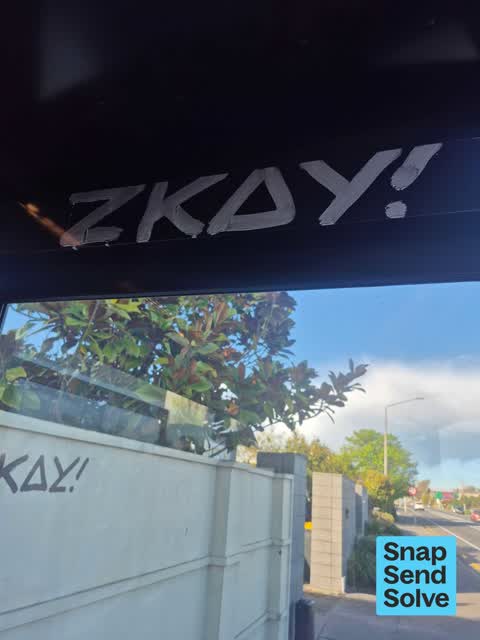
on utility box beside footpath outside Kmart, House of Travel, Savannah, Langdons Rd


on bridge rails along walkway entering Papanui Domain, going north

On fence post outside Papanui high school by pedestrian rail crossing. Start of walkway
The median council work order pinned in PAPANUI took 4 days to resolve, the city-wide median is 3 days, so this ground runs slower than the city as a whole. The slowest tenth waited 3 months or longer. 246 tickets are open here now, the oldest was filed 5 December 2018.
Work orders, not the resident reports above, the council’s MyCouncilTicket stream, and one job can appear in both. A median counts only finished jobs; open ones are named as open, never averaged in. The ticket roll · the whole city’s fix times.
Papanui. A public drinking ban, seven nights a week from 6pm to 6am, covers about 32% of PAPANUI.
3 sensitive sites stand here, Christchurch Adventist School, Papanui High School, Paparoa St School, and the Local Alcohol Policy restricts new off-licences within 200 m of them.
The council’s bylaw zones and the Local Alcohol Policy’s buffer list, read from the Regulatory open-data service. A ban rules drinking in public places; it says nothing about whether a premises may sell, that is the licence register’s job.
 Christchurch Adventist SchoolComposite · decile 5 · EQI 435
 Papanui Primary SchoolContributing · decile 6 · EQI 452
 Paparoa Street SchoolContributing · decile 10 · EQI 398
 St Bede's CollegeSecondary (Year 9-15) · decile 9 · EQI 415
Zoned for Christchurch Adventist School · Emmanuel Christian School · He Tīwai Mātauranga Heaton Normal Intermediate · Marian College · Middleton Grange School · Papanui High School · and 13 more zones, the drawn zone is indicative; the Ministry’s written scheme is the legal boundary.
Decile and EQI describe the community a school draws from, not how well it teaches.
The first eight of 9, Parks and reserves in the council’s open data, a park lands in the suburb its centre falls inside. The whole roll is at /parks.
Libraries, halls, cemeteries and the rest in the council’s open data, a facility lands in the suburb its point or centre falls inside. The whole shelf is at /facilities.
Places of worship in the open map’s record, one lands in the suburb its building stands in. The whole roll is at /worship.
Marae in the region’s roll, a marae stands where it stands; the join names the suburb the roll files it under. The whole roll is at /maraes.
The first eight of 13, Tracks in the council’s open data, a line belongs to every suburb it passes through. The whole network is at /tracks.
The February 2011 survey drew mapped ground failure over 11.8% of this outline, about 33 hectares. A patch is a footprint, not a finding about an address; the count for the whole city is at /liquefaction.
The flood record drew water over 4.2% of this outline, about 12 hectares, across 2 named events. A patch is one event’s observation, not a live hazard finding; the whole record is drawn at /floods.
10 parcels inside this outline sit on the hazardous-activities register, mostly chemical manufacture, application and bulk storage, vehicle refuelling, service and repair, cemeteries and waste recycling, treatment and disposal, 4 still doing the work. A listing records the work, not a soil test; the whole register is drawn at /hazards.
The files record 67 parcels of made or characterised ground inside this outline, about 19 hectares, mostly peat, mixed fill with rubbish, compacted hardfill, 6 carry fill the file can’t vouch for. A record is the file’s word on what was laid, not a fresh survey; the whole layer is drawn at /fill.
15 parcels inside this outline carry a cleanup on the file, 14 marked verified. A cleanup on the file is the register’s word, not a clearance; the whole register is drawn at /remediated.
The 2019 liquefaction study put 97% of this outline in the medium class. A class is the model’s verdict on a patch of ground, not a finding about an address; the whole study is drawn at /vulnerability.
The council’s structure register stands 20 assets on this ground, 9 sets of steps, 6 bridges, 2 shelters, 2 boardwalks, sited at Papanui Stream Esplanade, Erica Playground, Community Library Papanui, Bridgestone Drainage Reserve. The register’s site names are its own labels for the ground an asset stands in; the layer is drawn at the map.
The recreation register keeps 9 records inside this outline, bookable surfaces for 3 cricket, 2 football, 2 rugby, 1 bowls. Seasons and surfaces are the register’s record, not this week’s draw; the layer is drawn at the map.
The register counts 1,403 living trees inside this outline, 15 veterans among them, 136 carrying a protection, mostly Manna Ash, Kobushi Magnolia, Sweet Gum. The file remembers 594 trees felled here. A tree record is the register’s word on what stands or stood; the whole canopy is drawn at /trees.
The plan files 40% of this outline under Medium density residential zone, 68% residential, the rest mostly High density residential zone 23%, Transport 12%. A zone is a permission, not a description, the mix is read from a sampled join of the plan’s polygons; the whole district is drawn at /zones.
The plan reserves about 21 hectares of this outline, 7%, under 4 designations, mostly learning, pipes. A designation is a claim on the ground, not a build date, the mix is read from a sampled join; the whole register is drawn at /designations.
The plan’s exceptions touch 2% of this outline, 3 qualifying matters, mostly heritage. A matter narrows how the density rule applies, it does not forbid; the mix is read from a sampled join, and the cultural-significance areas are the plan’s own unnamed ones. The whole register is drawn at /matters.
The plan’s heritage schedule protects 4 places by name in this suburb, 3 graded highly significant, Former Papanui Railway Station and Setting, St Paul's Church and Setting, St Paul's Church Graveyard among them. A setting is the ground the item stands in, each files under the suburb holding its centroid; the whole schedule is at /heritage.
The plan’s ecological schedules cover 1% of this outline across 1 scheduled site, all protected under Schedule A. Shares read from a sampled join; a recognition overlay, not a survey. The whole ledger is drawn at /ecology.
No high-hazard flood area covers this outline. The broader flood-management watch covers 39% of it, Avon River, Lower Styx River. Shares read from a sampled join; a model’s map, not a promise. The waiting water is drawn at /flood-hazard.
The plan’s noise overlays cover all of this outline, about 283 hectares across 1 mapped overlay, and inside the airport’s bird-strike buffer. Shares read from a sampled join; a planning line, not a meter’s reading. The quiet lines are drawn at /noise.
The plan’s water-margin layers cross this outline, 137 classified reaches, the plan calling Dudley Creek and Papanui Creek by name, 7% of it inside the setback strips, the widest holding 10 m off the bank. The margin is the plan’s drawing, not a survey of the bank; the reaches, strips and held edges are mapped at /water-margin.
The plan’s allowed shape holds this outline, 62% of it inside the residential overlays, the densest standing Medium Density. The shape is the plan’s permission, not a survey of what stands; the allowed shape is drawn at /density.
The rebuild’s cameras filed 955 photographs on this ground, 2001–2016, wastewater work mostly. Each frame is a receipt the dig left behind, a work log, not a survey of what stands now; the whole record is drawn at /rebuild.
The pedal network threads this ground, 18.5 km of cycleway crosses the outline, 1.7 km of it separated from the traffic, Nor'West Arc, Northern Line, Papanui Parallel, Wheels to Wings. A segment counts under every suburb its path enters; the whole network is drawn at /cycleways.
The remembered names stand on this ground, 11 inscribed plaques, Papanui Memorial Reserve, Graham Condon, St James Park among the grounds. The plaque is the register’s pin, not a surveyed spot; the whole roll is kept at /plaques.
The rulebook binds this ground, 11 drawn instruments, 2 of them dog rules, 1 alcohol ban, 8 bottle-store buffers; the outline sits inside the takiwā of Te Ngai Tuahuriri Runanga. The bylaw is the instrument, this the map of it, the whole rulebook is drawn at /rules.
GeoNet’s catalogue puts 1 magnitude-3+ epicentre inside this outline since the sequence opened, the biggest a M3.2 in 2025. An epicentre is where the instruments placed the break, not a measure of the shaking here; the whole catalogue is counted at /sequence, the live record is /quakes, and the story in plain language is the earthquakes explainer.
The named waterways, bays, headlands, monuments, summits and old sites OpenStreetMap puts inside this outline, a pin is the mapper’s own; a waterway belongs to every suburb it crosses. Every roll, counted: /geography.
255 crashes that hurt somebody on record inside PAPANUI's outline, 1 person killed, 47 seriously hurt.
The corner that keeps appearing: Main North Road at Grassmere Street, 15 injury crashes.
7,049 victimisations on the Police record inside PAPANUI’s outline, September 2022–August 2026, mostly theft, about 237 a year per 1,000 residents. Down 7% on the year before. Reported is not all, how much never reaches the record depends on the offence.
22 Metro stops inside PAPANUI's outline, in ECan’s stop record, served by route 27, route 125, route 1, route 95, the Orbiter (anticlockwise), the Orbiter (clockwise), route 107.
175 premises in PAPANUI across 66 kinds, from OpenStreetMap, the council’s licensed-premises register and its 2024 Find Christchurch directory. Each kind below opens at this suburb’s shelf.
Among them, the ones the record says most about:
What the archive’s sources say about PAPANUI, titled for it, turned up by a search for one of its places, or carrying its name in the text. These are leads and citations: the originals live at the provider, linked from each row.
…he shakspeare may be made out a little further to the north the first wood on the left is papanui wood which lies three miles to the n of christchurch beyond this the river courtenay especially when s…Lyttelton Times · Papers Past · National Library of New Zealand · · text held
…the shakspeare maybe made out a lit tie further totho north the first wood on tho left is papanui wood which lies three miles 0 the n of christchurch btynd this tbe river courtenay especially when swo…Wellington Independent · Papers Past · National Library of New Zealand · · text held
…on road 37 chains and numbered 2on the chief surveyor map no 3 ann boioen 50 acre section papanui wood commencing at 3 miles 5 chains on the north road fronting the road 12 chains and proceeding in a…Lyttelton Times · Papers Past · National Library of New Zealand · · text held
…acres in the christchurch district on the north road at 2 miles and about 59 chains near papanui at right angles along a road line between it and section no 440 chains then south 12 chains then back…Lyttelton Times · Papers Past · National Library of New Zealand · · text held
…i river about two miles from christchurch in the immediate neighbourhood of riccarton and papanui bush to be sold in plots or sections of not less than five acres each the purchasers will be permitted…Lyttelton Times · Papers Past · National Library of New Zealand · · text held
…ut riccarton bush to be sold about thirty acres of the besfc timbered part of the bush at papanui also 20 acres of land to he let adjoining in 5 or 10 acre lots apply to mr bowen christchurch rural la…Lyttelton Times · Papers Past · National Library of New Zealand · · text held
…thursday the 6th november prox for making about 2 miles of road between christchurch and papanui the line shall be laid out on the ground and plans and specifications may be seen at the land office c…Lyttelton Times · Papers Past · National Library of New Zealand · · text held
…apply to g fyfe london street lyttelton oct 30th for sale about 20 acres of the timber in papanui wood for particulars apply to mr harman christchurch on sale i f 000 well-burnt bricks lujuvv apply to…Lyttelton Times · Papers Past · National Library of New Zealand · · text held
…timber apply to j v whelpdale christchurch quay for sale a bout 20 acres op the timber ra papanui wood for particulars apply to mr harman christchuich…Lyttelton Times · Papers Past · National Library of New Zealand · · text held
…timber apply to j w whelpdale christchurch quay for sale about 20 acres 03 the timber in papanui wood for particulars apply to mr haeman christchuich for sale an unselected pre-emptive bight of pastu…Lyttelton Times · Papers Past · National Library of New Zealand · · text held
The rest are a search away, the whole shelf, for the name →
122 more documents came up in searches for PAPANUI's places and have not been read yet, a lead is a search result, not a fact, until somebody reads it.
Compare PAPANUI with Northcote · Strowan · Bryndwr · Bishopdale · Redwood · Casebrook, same record, side by side.
Papanui is a suburb of Christchurch, New Zealand. The public record holds 5,940 council reports for it, the first filed in June 2015.
7,740 people at the 2023 Census, 2,738 per square kilometre across 2.8 km².
About 7,422 people and 2,961 occupied private households (combined SA2s): grouped from Stats NZ SA1 areas through this site’s suburb join. Indicative, not a LIM.
5,940 reports on record, most often graffiti & vandalism (1,911), roads & footpaths (1,269), water & drains (1,135). 795 of them in the year to 12 October 2026.
255 injury crashes on the police record inside the suburb’s outline, 1 person killed, 47 seriously hurt. The suburb’s crashes, mapped →
GeoNet’s catalogue puts 1 magnitude-3+ epicentre inside the suburb’s mapped outline since the September 2010 mainshock, the biggest a M3.2 in 2025. An epicentre is where the instruments placed the break, not a measure of the shaking felt here. The whole sequence, counted → · The story, in plain language →
Every suburb in Christchurch → · Its decade, charted → · the whole A–Z →
Work orders, not the resident reports above, the council’s MyCouncilTicket stream, and one job can appear in both. A median counts only finished jobs; open ones are named as open, never averaged in. The ticket roll · the whole city’s fix times.
The council’s bylaw zones and the Local Alcohol Policy’s buffer list, read from the Regulatory open-data service. A ban rules drinking in public places; it says nothing about whether a premises may sell, that is the licence register’s job.
Ministry of Education directory, the final decile and the current Equity Index describe the community a school draws from, not how well it teaches. Zones are indicative; the written enrolment scheme rules.
Parks and reserves in the council’s open data, the park lands in the suburb its centre falls inside; one that straddles the line keeps its own address.
Libraries, halls, cemeteries and the rest in the council’s open data, a facility lands in the suburb its point or centre falls inside.
Places of worship in the open map’s record, one lands in the suburb its building stands in. The whole roll is at /worship.
Marae in the region’s roll, a marae stands where it stands; the join names the suburb the roll files it under. The whole roll is at /maraes.
Walking, biking, horse and off-road tracks in the council’s open data, a line belongs to every suburb it passes through.
OpenStreetMap’s own record, inside this outline, a pin is the mapper’s; a waterway belongs to every suburb it crosses. Every roll, counted: /geography.
Heritage places the council’s district plan or Heritage New Zealand list inside this suburb, each with what is known about it and the document it is known from.
The register’s era records for places in this suburb, what stood on the ground, and when.
Each of these is a decade of reports, the heritage places on the register, what is known about them, and the documents behind it, everything the archive holds about the part of the city it names.