2 Raglan Street, Phillipstown
19 reports on record since November 2022 · 13 with photographs. Indicative rating valuation and school zones, hazards, bin day and what stood here before.
What gets reported here
Photographed here 13 on record




Reported here
 Street Gutters / Storm Water —
 open gutter grate
 Litter —
 General crud piling up
 Graffiti on a fence, building or structure —
  Dumped Rubbish —
 General rubbish dump from the residents of The Lodge further down Essex Street
- Abandoned Vehicle —
GAJ498, Serenity Swift campervan. Has been parked up for weeks and the fuel opening is taped over. Could be abandoned or may have broken dow
 General Request —
 Two issues for wooden pole EV375 by 2 Raglan Street corner of Essex Street: 1/ broken white plastic conduit cover 2/ black paint tag on gra
 Graffiti on a cabinet, pole or railway asset —
 Broken white plastic conduit cover on EV375 wooden pole steel plus a black paint tag on the gray conduit cover, by the corner of 2 Raglan St
 Dumped Rubbish —
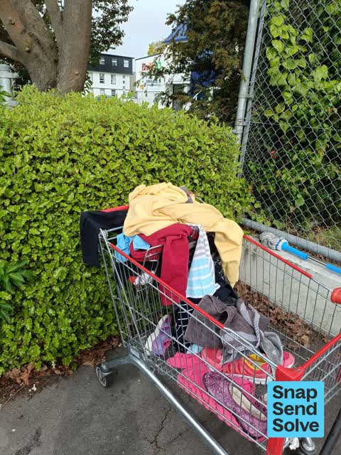
 The trolley has been there for weeks and reported but not picked up but the rubbish was added a few days ago. Thanks
 Graffiti on a cabinet, pole or railway asset —
 Broken white plastic conduit cover on EV375 wooden pole at the corner of Raglan and Essex Streets.
 Graffiti on a cabinet, pole or railway asset —
  Graffiti on a fence, building or structure —
 More from the Essex Street graffiti rampage
 Rubbish and Bins - General —
 Bombay Bazaar trolley. It wasn't an option in the abandoned trolleys menu
 Graffiti on a sign, mural or public art —
  Vandalism - General —
 Broken white plastic conduit cover on EV375 wooden pole at the corner of Raglan and Essex Streets
- Graffiti —
- Graffiti —
- Graffiti —
- Graffiti —
- Graffiti —
The street it is on
The green nearby
- Raglan Reserve — 27 m to the edge
- Essex Reserve — 299 m to the edge
- Worcester Pump Station Park — 333 m to the edge
- Doris Lusk Corner — 358 m to the edge
- Welcome Rest — 359 m to the edge
Parks within half a kilometre, measured to the boundary — the council’s open data.
On the doorstep
- Gary Lee Electrical — 81 m away · Electrical
- Kingdom Clinic — 138 m away · Doctors & clinics
- Vinyl Cafe — 157 m away · Cafés
- Cashel Health Centre — 160 m away · Doctors & clinics
Businesses within four hundred metres, measured at the pin — OpenStreetMap and the council directories.
The bus nearby
The closest Metro stops, within four hundred and fifty metres.
The tracks through here
- Walk and bike track through Phillipstown — 246 m to the line · walk · bike
- Walk and bike track through Phillipstown — 281 m to the line · walk · bike
- Walk and bike track through Phillipstown — 281 m to the line · walk · bike
- Walk and bike track through Phillipstown — 353 m to the line · walk · bike
Tracks whose line passes within half a kilometre, measured to the line itself — the council’s open data.
Renting nearby
new bonds in Phillipstown ran about $490 a week — $60 below the city median of $550 — the suburb page keeps the rent record →.
The civic layer
This ground votes in Central ward — the Papanui-Innes-Central community board. Ward lines don’t always follow suburb lines; this one is measured at the pin, not the suburb’s centre.
What stood on this ground → · On the map → · From the air — the Crown’s aerials back to 1936; search the address on RetroLens →
Questions, answered briefly
19 council reports on record since November 2022 — most often graffiti (5), graffiti on a cabinet, pole or railway asset (3), graffiti on a fence, building or structure (2).
Phillipstown, Christchurch — on Raglan Street.
Nothing on the heritage register at this exact spot — the record around this ground →
Raglan Reserve — 27 m to its edge.