
Phillipstown, Christchurch
11,860 council reports since May 2015, the 8th busiest suburb in the city. 9,666 photographs on record. 4,510 people at the 2023 Census, 3,632 to the square kilometre across 1.2 km².
The record also holds about $490 a week to rent· 2023 Census snapshot· 9,666 photographs· 27 old photographs· 2 schools· 6 parks· 1 marae· 11 tracks· 58.7% of the outline mapped liquefied· graded mostly TC3 in 2011· the record drew water over 20% of the outline· inside a managed flood catchment· setback strips over 3% of the outline· 48% of the outline inside the plan’s density overlays· 1,968 SCIRT photographs filed on this ground· 4.5 km of cycleway crosses the outline· 1 remembered name on this ground· 7 drawn rules bind this ground· 21 parcels on the dangerous-work register· 21 parcels of made ground· 1 parcels with a cleanup on file· the 2019 model grades this ground mostly medium· 6 council structures on the register· 11 recreation register records· 733 trees on the register· the plan’s word on this ground· 5% of the outline reserved· the plan’s exceptions touch 3% of the outline· 2 places on the heritage schedule· 4 epicentres inside the outline· 137 injury crashes· 1,873 recorded victimisations· 19 bus stops· 46 businesses· the council’s fix times· 3 heritage places· 40 documents· 5 mentions on the wire
Live source links
Link-outs to the source’s own live pages, chch.live does not copy their live values or source text.
Living here rent · the ground · the day-to-day
$490/week
middle half $399–$520
New bonds here ran at about $490 a week in the April–June 2026 quarter, the middle half of them between $399 and $520, across 81 bonds lodged, up 2% on a year ago. That’s about $60 a week below the city’s own quarter median of $550. Tenancy Services counts these under the “Phillipstown” statistical area, close to this suburb’s outline, not exactly it.
By dwelling type and bedrooms, April–June 2026 quarter
- 1-bedroom house, $500 a week · 45 new bonds
- 1-bedroom flat/unit, $102 a week · 9 new bonds
- 3-bedroom house, $620 a week · 9 new bonds
- 2-bedroom flat/unit, $415 a week · 6 new bonds
- 2-bedroom house, $500 a week · 6 new bonds
Median and quartiles of weekly rents on new private bonds, by quarter. New bonds are fresh lodgements, not the whole rental stock; under five bonds the rent is withheld, and counts are randomly rounded. Source: Tenancy Services rental bond data: provisional while the bond system migrates.
The ground: the February 2011 survey drew liquefaction over 59% of it; the 2011 grading filed it mostly TC3, the rest of the watch is drawn further down.
Day to day it holds 2 schools, 6 parks, 1 marae, 11 tracks and 19 bus stops, each is counted further down.
Lately the record’s mostly rubbish & dumping, 1,442 reports in the year to 12 October 2026, the newest 11 October 2026.
One for the quiz, Its busiest day on record was 19 June 2021, 69 reports in a single day.
2023 Census snapshot SA1 areas grouped here
About 4,098 people and 1,761 occupied private households in the “Phillipstown” statistical area, grouped from 30 SA1 areas. This exact statistical-area match is close to this suburb’s outline, not exactly it.
More of the 2023 Census
- Born overseas32% of stated birthplace
- European ethnicity61% of ethnicity responses
- Māori ethnicity18% of ethnicity responses
- Pacific Peoples ethnicity9% of ethnicity responses
- Asian ethnicity24% of ethnicity responses
- Households with internet75% of stated households
- Households with two or more vehicles33% of stated households
Ethnicity is a multiple-response measure, so those percentages are not meant to add to 100%.
Stats NZ’s 2023 Census uses fixed random rounding to base 3. Unavailable or confidential cells are left out, not treated as zero. individuals · households · geography · CC BY 4.0.
About the suburb
Phillipstown is a small inner city suburb of the city of Christchurch, New Zealand. It lies south-east of the city centre being bordered by Cashel Street to the north, Aldwins Road to the east, Ferry Road to the south, and Fitzgerald Avenue to the west. Phillipstown contains residential, commercial and industrial activity, and is recognised as a lower socio-economic area.
As reported 9,666 on record
The suburb, back then 27 in the archive
Placed by the record’s locality join or the name in its own title, a lead, not a claim each frame stood here.
The shape of it outline © OpenStreetMap · recent reports, pinned
The record on Phillipstown
- Phillipstown enters the written record on 7 February 1876, “CHRISTCHURCH DISTRIOT DRAINAGE BOARD. (Star, 07 February 1876)”, Papers Past.
- “Phillipstown” appears somewhere in 542 of the archive’s records, title, description or body.
- A Papers Past search for the name surfaced 30 records, leads by provenance, not by phrase.
- The first report the feed ever carried here: graffiti, 26 May 2015, at 13 Bordesley St.
- Its busiest day on record was 19 June 2021, 69 reports in a single day.
- The street that keeps coming up is Olliviers Road, reported on 693 separate days.
- For elections the suburb’s centre falls inside Central ward, the Papanui-Innes-Central community board is its local layer. The whole roll is at /wards.
Lately the newest reports

Dumped Rubbish77 Bordesley Street
tenants moving out of 80 Bordesley Street dumped their excess rubbish out on the roadside in front of 76 and 77 Bordesley Street.
Dumped Rubbish76 Bordesley Street
Tenants moving out of 80 Bordesley Street have dumped their unwanted stuff on the side of the road.


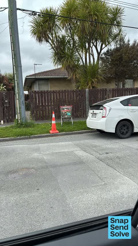


Graffiti on a fence, building or structure442A Saint Asaph Street
graffiti on water back flow preventer box
Reports per year down 3% 2024→2025
15
63
16
415
17
587
18
544
19
802
20
844
21
1.4K
22
1.5K
23
1.6K
24
1.5K
25
1.5K
What gets reported
Exactly what people say
How fast the council fixes things here 12,198 finished jobs on record
The median council work order pinned in Phillipstown took 3 days to resolve, the city-wide median is 3 days, so this ground runs faster than the city as a whole. The slowest tenth waited 5 weeks or longer. 180 tickets are open here now, the oldest was filed 23 February 2021.
Work orders, not the resident reports above, the council’s MyCouncilTicket stream, and one job can appear in both. A median counts only finished jobs; open ones are named as open, never averaged in. The ticket roll · the whole city’s fix times.
Alcohol rules on this ground
One sensitive site stands here, Te Aratai College, and the Local Alcohol Policy restricts new off-licences within 200 m of it.
The council’s bylaw zones and the Local Alcohol Policy’s buffer list, read from the Regulatory open-data service. A ban rules drinking in public places; it says nothing about whether a premises may sell, that is the licence register’s job.
The suburb today
Schools here 2
 Catholic Cathedral CollegeSecondary (Year 7-15) · decile 4 · EQI 448
- Te Aratai CollegeSecondary (Year 7-15) · decile 3 · EQI 507
Zoned for Christchurch Adventist School · Hillview Christian School · Marian College · Middleton Grange School · Te Aratai College · Te Puna Wai o Waipapa - Hagley College · and 4 more zones, the drawn zone is indicative; the Ministry’s written scheme is the legal boundary.
Decile and EQI describe the community a school draws from, not how well it teaches.
The green here 6
- Linwood ParkSports ground · 9 ha · playground, 83 pieces
- Cross Reserveplayground, 22 pieces
- Olliviers Reserveplayground, 33 pieces
- Buccleugh Reserve
- Essex Reserve
- Welcome Rest
Parks and reserves in the council’s open data, a park lands in the suburb its centre falls inside. The whole roll is at /parks.
The marae standing here 1
- Te Hepara Pai Maraeinstitutional whare · wharenui Te Whakaruruhau · 290 Ferry Road
Marae in the region’s roll, a marae stands where it stands; the join names the suburb the roll files it under. The whole roll is at /maraes.
The tracks through here 11
- Walk and bike track through Phillipstown3.5 km · Christchurch · walk · bike
- Walk and bike track through Phillipstown1.2 km · Christchurch · walk · bike
- Walk and bike track through Phillipstown561 m · Christchurch · walk · bike
- Walk and bike track through Phillipstown557 m · Christchurch · walk · bike
- Walk and bike track through Phillipstown447 m · Christchurch · walk · bike
- Walk and bike track through Phillipstown355 m · Christchurch · walk · bike
- Walk and bike track through Phillipstown354 m · Christchurch · walk · bike
- Walk and bike track through Phillipstown227 m · Christchurch · walk · bike
The first eight of 11, Tracks in the council’s open data, a line belongs to every suburb it passes through. The whole network is at /tracks.
The ground that moved
The February 2011 survey drew mapped ground failure over 58.7% of this outline, about 73 hectares. A patch is a footprint, not a finding about an address; the count for the whole city is at /liquefaction.
The 2011 grading filed 8.7% of this outline, about 11 hectares, mostly TC3, with TC3 8 ha · TC2 3 ha. A graded area files under the suburb its middle sits in, and a category is a verdict for a patch of ground, not a finding about an address; the grades are drawn at /technical-categories.
The flood record drew water over 20.5% of this outline, about 25 hectares, across 1 named event. A patch is one event’s observation, not a live hazard finding; the whole record is drawn at /floods.
21 parcels inside this outline sit on the hazardous-activities register, mostly chemical manufacture, application and bulk storage, vehicle refuelling, service and repair, any other land that has been subject to the intentional or accidental release of a hazardous substance in sufficient quantity that it could be a risk to human health or the environment, 15 still doing the work. A listing records the work, not a soil test; the whole register is drawn at /hazards.
The files record 21 parcels of made or characterised ground inside this outline, mostly compacted hardfill, pitrun, mixed fill with rubbish, 1 carry fill the file can’t vouch for. A record is the file’s word on what was laid, not a fresh survey; the whole layer is drawn at /fill.
1 parcel inside this outline carries a cleanup on the file. A cleanup on the file is the register’s word, not a clearance; the whole register is drawn at /remediated.
The 2019 liquefaction study put 95% of this outline in the medium class. A class is the model’s verdict on a patch of ground, not a finding about an address; the whole study is drawn at /vulnerability.
The council’s structure register stands 6 assets on this ground, 4 boardwalks, 2 bridges, sited at Edmonds Park, Linwood Park. The register’s site names are its own labels for the ground an asset stands in; the layer is drawn at the map.
The recreation register keeps 11 records inside this outline, bookable surfaces for 6 tag football, 3 rugby league, 1 basketball, 1 skateboard. Seasons and surfaces are the register’s record, not this week’s draw; the layer is drawn at the map.
The register counts 733 living trees inside this outline, 22 veterans among them, 18 carrying a protection, mostly Ash, Painted Mona Maple, English Elm. The file remembers 386 trees felled here. A tree record is the register’s word on what stands or stood; the whole canopy is drawn at /trees.
The plan files 38% of this outline under Medium density residential zone, 52% residential, the rest mostly Transport 19%, Industrial General 16%. A zone is a permission, not a description, the mix is read from a sampled join of the plan’s polygons; the whole district is drawn at /zones.
The plan reserves about 6 hectares of this outline, 5%, under 2 designations, mostly learning. A designation is a claim on the ground, not a build date, the mix is read from a sampled join; the whole register is drawn at /designations.
The plan’s exceptions touch 3% of this outline, 8 qualifying matters, mostly residential, section 6, heritage. A matter narrows how the density rule applies, it does not forbid; the mix is read from a sampled join, and the cultural-significance areas are the plan’s own unnamed ones. The whole register is drawn at /matters.
The plan’s heritage schedule protects 2 places by name in this suburb, 1 graded highly significant, Former Waterworks Pumping Station and Setting, No. 1 Pumphouse, Dwelling and Setting. A setting is the ground the item stands in, each files under the suburb holding its centroid; the whole schedule is at /heritage.
No high-hazard flood area covers this outline. The broader flood-management watch covers 77% of it, Bells Creek, Heathcote River. Shares read from a sampled join; a model’s map, not a promise. The waiting water is drawn at /flood-hazard.
The plan’s water-margin layers cross this outline, 13 classified reaches, the plan calling Bells Creek and Outfall Drain by name, 3% of it inside the setback strips, the widest holding 5 m off the bank. The margin is the plan’s drawing, not a survey of the bank; the reaches, strips and held edges are mapped at /water-margin.
The plan’s allowed shape holds this outline, 48% of it inside the residential overlays, the densest standing Medium Density. The shape is the plan’s permission, not a survey of what stands; the allowed shape is drawn at /density.
The rebuild’s cameras filed 1,968 photographs on this ground, 2007–2016, wastewater work mostly. Each frame is a receipt the dig left behind, a work log, not a survey of what stands now; the whole record is drawn at /rebuild.
The pedal network threads this ground, 4.5 km of cycleway crosses the outline, 0.1 km of it separated from the traffic, Rapanui Shag Rock. A segment counts under every suburb its path enters; the whole network is drawn at /cycleways.
The remembered names stand on this ground, 1 inscribed plaque, Linwood Park among the grounds. The plaque is the register’s pin, not a surveyed spot; the whole roll is kept at /plaques.
The rulebook binds this ground, 7 drawn instruments, 2 of them dog rules, 1 alcohol ban, 1 camping zone, a certified self-contained van can stay the night at Christchurch Urban Restricted Area, 3 bottle-store buffers; the outline sits inside the takiwā of Te Ngai Tuahuriri Runanga. The bylaw is the instrument, this the map of it, the whole rulebook is drawn at /rules.
GeoNet’s catalogue puts 4 magnitude-3+ epicentres inside this outline since the sequence opened, the biggest a M3.8 in 2010. An epicentre is where the instruments placed the break, not a measure of the shaking here; the whole catalogue is counted at /sequence, the live record is /quakes, and the story in plain language is the earthquakes explainer.
The crash record 137 injury crashes
137 crashes that hurt somebody on record inside Phillipstown's outline, 2 people killed, 26 seriously hurt.
The corner that keeps appearing: Aldwins Road at Marlborough Street, 12 injury crashes.
The crime record 1,873 recorded victimisations
1,873 victimisations on the Police record inside Phillipstown’s outline, September 2022–August 2026, mostly theft, about 114 a year per 1,000 residents. Up 5% on the year before. Reported is not all, how much never reaches the record depends on the offence.
The buses through it 19 stops
19 Metro stops inside Phillipstown's outline, in ECan’s stop record, served by route 80, route 140, the Orbiter (anticlockwise), the Orbiter (clockwise), the Orbiter.
- Aldwins Rd near Bass St near Aldwins Rd
- Aldwins Rd near Bass St near Aldwins Rd
- Aldwins Rd near Edmond St
- Aldwins Rd near Harrow St near Aldwins Rd
- Aldwins Rd near Harrow St near Aldwins Rd
- Aldwins Rd near Marlborough St near Aldwins Rd
- Aldwins Rd near Marlborough St near Aldwins Rd
- Aldwins Rd near Matlock St
- Harrow St near Bordesley St near Harrow St
- Harrow St near Bordesley St near Harrow St
- Harrow St near Glasgow St
- St Asaph St near Phillips St
- Tuam St near England St
- Tuam St near Fitzgerald Ave
- Tuam St near Nursery Rd
- Tuam St near Olliviers Rd
Businesses here 46 in the directory
46 premises in Phillipstown across 34 kinds, from OpenStreetMap, the council’s licensed-premises register and its 2024 Find Christchurch directory. Each kind below opens at this suburb’s shelf.
- Car repair3
- Electrical3
- Bottle stores2
- Cafés2
- Car dealers2
- Government2
- Gyms & fitness2
- Pet shops2
- Tyre shops2
- Alternative1
- Bakeries1
- Car parts1
- Carpet1
- Caterers1
- Clubs1
- Coworking spaces1
- Curtain1
- Delis1
- Electricians1
- Fast food1
- Flooring1
- Furniture1
- Galleries1
- Guide1
- Hostels1
- Houseware1
- Joiner1
- Laundromats1
- Pastry1
- Restaurants1
- Saunas & day spas1
- Signwriters1
- Upholsterer1
- Vets1
Among them, the ones the record says most about:
Before any of that
On the register here
Documents 40
What the archive’s sources say about Phillipstown, titled for it, turned up by a search for one of its places, or carrying its name in the text. These are leads and citations: the originals live at the provider, linked from each row.
241870s
2541880s
861890s
1081900s
131910s
191920s
311930s
61940s
1950s
1990s
182000s
282010s
52020s
CHRISTCHURCH DISTRIOT DRAINAGE BOARD. (Star, 07 February 1876)
…jones drew attention to the great necessity for provision boing made for the drainage of phillipstown before next wintor mr oarruthers was now in ohristohuroh and he would move that the consideration…Star · Papers Past · National Library of New Zealand · · text held
Page 3 Advertisements Column 1 (Star, 22 June 1876)
…more than two acres having frontage on main road in the suburban districts of knightstown phillipstown and waltham or the immediate neighbourhood men stating lowest price exact locality nature of titl…Star · Papers Past · National Library of New Zealand · · text held
Phillipstown RS 175 and 69
Plan showing properties of rural sections 175 and 69 in Phillipstown. Heathcote Road Board rural sections…Heathcote Road Board rural sections · Canterbury Stories · Christchurch City Libraries ·
Mountfort Line Drawing: Anglican Church of the Good Shepherd, Phillipstown, 1877 [?]
…n framed landscape line drawing by Benjamin Mountfort of the Church of the Good Shepherd, Phillipstown, Christchurch, 1877 [?]. The Church of the Good Shepherd in Phillipstown was consecrated in 1885…Canterbury Museum · Canterbury Museum ·
DEPUTATION TO THE DRAINAGE BOARD. (Star, 13 March 1877)
…s within it 3 urea the foi lowing districts christchurch proper addington newtown waltham phillipstown ferry road avonville bingsland tho district between the l north town belt and the edgovaro road k…Star · Papers Past · National Library of New Zealand · · text held
CHRISTCHURCH. (Star, 19 June 1877)
…must be provided before next lioensing day or the lioenses would be taken away t d jones phillipstown mr john olhvier handed in a protest sighed by a large number of the inhabitants of philiipstownag…Star · Papers Past · National Library of New Zealand · · text held
LAND FUND. (West Coast Times, 27 November 1877)
land fund christchurch november 26 a public meeting is to be held at phillipstown a suburb of christchurch to morrow to consider the proposed action of the government with respect…West Coast Times · Papers Past · National Library of New Zealand · · text held
POLITICAL MEETING. (Grey River Argus, 27 November 1877)
political meeting christchurch nov 26 a public meeting is to be held at phillipstown a suburb of christchurch to-morrow to consider the proposed action of the government with respect…Grey River Argus · Papers Past · National Library of New Zealand · · text held
Page 2 Advertisements Column 3 (Star, 06 July 1878)
…ch in this church the morning sermon will be by mr habens 1341 primitive methodist church phillipstown in connection with the church shortly to be erected a religious service will be held to-morrow su…Star · Papers Past · National Library of New Zealand · · text held
EDUCATION RETURNS. (Star, 24 March 1879)
…cheh east biugsland 1 172 156 328 72 64 136 gloucester street 1 1041 904 1045 473 359 832 phillipstown 1 106 105 211 44 43 87 south town belt 1 151 176 327 63 62 125 christchurch west 1 814 s2l 1635 3…Star · Papers Past · National Library of New Zealand · · text held
The rest are a search away, the whole shelf, for the name →
The wire on Phillipstown 5 lately
‘Very historical’ gang links in Phillipstown double murderThe news · The Press ·
Christchurch man charged with two murders after Phillipstown deathsThe news · The Press ·
OPINION: Sprawling from Redwood to Opawa and Spreydon to Phillipstown, boundary changes have reshaped the electorate of Christchurch Central. It is anything but central now, rather a cross-shaped…The Press · Mike Yardley ·
Field woundwort seen — Ferry Rd near Phillipstown Cts, Waltham, Christchurch 8011, New ZealandiNaturalist · brrosello ·
Slater Spider seen — Ferry Rd near Phillipstown Cts, Waltham, Christchurch 8011, New ZealandiNaturalist · brrosello ·
61 more documents came up in searches for Phillipstown's places and have not been read yet, a lead is a search result, not a fact, until somebody reads it.
Next door
Compare Phillipstown with Linwood · Waltham · Avonside · Woolston · Richmond · Christchurch Central City, same record, side by side.
Questions, answered briefly
What is Phillipstown?
Phillipstown is a small inner city suburb of the city of Christchurch, New Zealand. The public record holds 11,860 council reports for it, the first filed in May 2015.
How many people live in Phillipstown?
4,510 people at the 2023 Census, 3,632 per square kilometre across 1.2 km².
How many people does the 2023 Census count for Phillipstown?
About 4,098 people and 1,761 occupied private households: grouped from Stats NZ SA1 areas through this site’s suburb join. Indicative, not a LIM.
What gets reported in Phillipstown?
11,860 reports on record, most often rubbish & dumping (4,673), graffiti & vandalism (4,335), roads & footpaths (924). 1,442 of them in the year to 12 October 2026.
How many crashes has Phillipstown had?
137 injury crashes on the police record inside the suburb’s outline, 2 people killed, 26 seriously hurt. The suburb’s crashes, mapped →
Did earthquakes strike under Phillipstown?
GeoNet’s catalogue puts 4 magnitude-3+ epicentres inside the suburb’s mapped outline since the September 2010 mainshock, the biggest a M3.8 in 2010. An epicentre is where the instruments placed the break, not a measure of the shaking felt here. The whole sequence, counted → · The story, in plain language →
Every suburb in Christchurch → · Its decade, charted → · the whole A–Z →