300 Linwood Avenue, Phillipstown
34 reports on record since December 2018 · 26 with photographs. The street’s heaviest record is 260 Linwood Avenue, 57 reports on file. Indicative rating valuation and school zones, hazards, bin day and what stood here before.
What gets reported here
Photographed here 26 on record


Reported here
 Park - General Request,
 light bollard has fallen or been knocked down
 Litter,
 Bins full. also, there aren't enough bins in this park. it's crazy!
 Graffiti on a playground or in a park,
 graffiti on skate park in Linwood Park.
 Accessibility,
 door handle missing
 Public Toilet,
 the door knob and lock have been removed from a public toilet at the new changing facilities in Linwood Park. The door knob has been handed
 Graffiti on a playground or in a park,
 graffiti on skate park in Linwood Park
 Graffiti on a playground or in a park,
 Graffiti on skate board ramp in Linwood Park.
 Facility - General Request,
 This trolley isn't on the list
 Graffiti on a playground or in a park,
 graffiti on skatepark in Linwood Park near pool.
 Graffiti on a playground or in a park,
 Graffiti on skate ramp in Linwood Park
 Graffiti on a playground or in a park,
 graffiti
 Fallen Tree,
 tree brach broken in the wind
 Graffiti on a fence, building or structure,
 graffiti on club room Linwood park
 Graffiti on a fence, building or structure,
 Graffiti on back of sign see pics
 Park - General Request,
 Overhanging branch and grass edges not cleared
 Trees - General,
 Hanging branch over path
- Park - General Request,
- Park - General Request,
- Water Leak,
- Water General,
- Fallen Tree,
- Park - General Request,
 Graffiti,
 Tagging on park bench closest to skate ramp (near swimming pool)
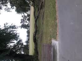 Parks,
 - Parks,
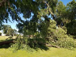 Parks,
 tree down
Parks,
pipe stolen underneath mens basin in public toilet
Graffiti,
On skatepark and seat
Graffiti,
2 Seats in middle of field
Parks,
Again men's toilet locked again why
- Roading/Streets,
Gravel in northbound cycle lane beside Linwood Park. Cyclists are biking in the vehicle lanes to avoid it.
Parks,
There are two piles of leaves from the skatepark need to be taken away
Parks,
Broken tree branch blocking cycle path in Linwood park.
Graffiti,
Skatepark
Also reported on Linwood Avenue
- 260 Linwood Avenue, 57 reports
- 252 Linwood Avenue, 31 reports
- 320 Linwood Avenue, 23 reports
- 250A Linwood Avenue, 18 reports
- 248 Linwood Avenue, 15 reports
- 250 Linwood Avenue, 3 reports
- 244 Linwood Avenue, 3 reports
- 236 Linwood Avenue, 3 reports
From the air, then
Sourced from Canterbury Maps and partners. LINZ, CC BY 3.0 NZ. Each frame is cut from Environment Canterbury’s historic imagery MapServer for that decade, only where the Footprints layer names a CC BY survey (NZAM-covered spots stay out). RetroLens holds more Crown aerials →
The street’s crash record
NZTA’s record names Linwood Avenue in 2 crashes that hurt somebody since 2006, 1 seriously hurt, nobody killed.
The green nearby
- Linwood Park, you are in it · Sports ground · 9 ha
- Linwood Nursery, 54 m to the edge · 1 ha
- Linwood Esplanade Reserve, 358 m to the edge
Parks within half a kilometre, measured to the boundary, the council’s open data.
The civic shelf nearby
- Linwood Service Centre, 281 m away · Service centre
- Linwood Library, 458 m away · Library · First Floor, Eastgate Mall, Buckleys Rd, Christchurch 8062
Libraries, halls and the rest within half a kilometre, the council’s open data.
On the doorstep
- Linwood Pool: Te Pou Toetoe, 93 m away · Sports centres
- Linwood Ave Rotary Market, 154 m away · Markets
- On The Go, 217 m away · Car repair
- KFC, 232 m away · Fast food
Businesses within four hundred metres, measured at the pin: OpenStreetMap and the council directories.
The bus nearby
The closest Metro stops, within four hundred and fifty metres.
The tracks through here
- Walk and bike track through Phillipstown, 9 m to the line · walk · bike
- Walk and bike track through Phillipstown, 48 m to the line · walk · bike
- Walk and bike track through Phillipstown, 96 m to the line · walk · bike
- Walk and bike track through Phillipstown, 162 m to the line · walk · bike
- Walk and bike track through Phillipstown, 209 m to the line · walk · bike
Tracks whose line passes within half a kilometre, measured to the line itself, the council’s open data.
The named ground
the council’s own structure register, bridges, boardwalks and steps standing nearby, the open map’s record.
The remembered names nearby
- This Tree Was Planted to Commemorate the Coronation, 34 m away ·
This tree was planted to commemorate the coronation of H.M. Elizabeth II 1953
· 2009 - Christchurch City Council / Parks and Recreation Depot, 157 m away ·
CHRISTCHURCH CITY COUNCIL / PARKS AND RECREATION DEPOT / OFFICIALLY OPENED BY / THE MAYOR
· 1899
Inscribed plaques within two hundred and fifty metres, the register’s pins, not surveyed spots. The whole roll is at /plaques.
Renting nearby
new bonds in Phillipstown ran about $490 a week, $60 below the city median of $550, the suburb page keeps the rent record →.
The civic layer
This ground votes in Linwood ward, the Coastal-Burwood-Linwood community board. Ward lines don’t always follow suburb lines; this one is measured at the pin, not the suburb’s centre.
What stood on this ground → · On the map → · From the air, the Crown’s aerials back to 1936; search the address on RetroLens →
Questions, answered briefly
34 council reports on record since December 2018, most often parks (7), graffiti on a playground or in a park (6), park - general request (5).
Phillipstown, Christchurch, on Linwood Avenue.
Nothing on the heritage register at this exact spot, the record around this ground →
Linwood Park, the address is inside it, 9 ha.