867 Governors Bay Road
4 council reports since January 2020, 3 carrying a photograph. The street’s heaviest record is 283 Governors Bay Road, 5 reports on file.
On the register here
From the air, then
Sourced from Canterbury Maps and partners. LINZ, CC BY 3.0 NZ. Each frame is cut from Environment Canterbury’s historic imagery MapServer for that decade, only where the Footprints layer names a CC BY survey (NZAM-covered spots stay out). RetroLens holds more Crown aerials →
The green nearby
- Sandy Beach Road Reserve, 215 m to the edge
- Reuter Park, 219 m to the edge · Regional · 23 ha
- Stream Reserve, 413 m to the edge
- Sandy Beach Reserve, 451 m to the edge
Parks within half a kilometre, measured to the boundary, the council’s open data. The whole roll is at /parks.
On the doorstep
- Governors Bay Bed and Breakfast, 149 m away · B&Bs
Businesses within four hundred metres, measured at the pin, OpenStreetMap and the council directories.
The named ground
Named places within 1.5 km of this address; the council’s own structure register, bridges, boardwalks and steps standing nearby, the open map’s record.
Renting nearby
new bonds in Rapaki ran about $600 a week, $50 above the city median of $550, the suburb page keeps the rent record →.
What gets reported here
Photographed here 3 on record


What’s on record
 Water Leak, 12 Jan 2025
Leak coming from water main Toby box. Photo of power pole only as reference for location.
 Roads - General, 17 May 2024
Recent road reconstruction on Governors Bay Road has left a steep and rough junction with our driveway and the elevated level of the road cr
- Damaged Road, 4 Apr 2024
This part of the road has recently had works undertaken but it is now a lot worse on the side of the road when coming from Lyttelton. I slow
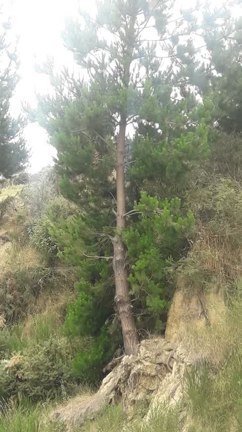
Roading/Streets, 1 Jan 2020
the tree just above the road has got severe erosion around the roots system leaving it 'pearched', ready to fall
Elsewhere on Governors Bay Road
- 283 Governors Bay Road, 5 reports
- 207 Governors Bay Road, 5 reports
- 892A Governors Bay Road, 4 reports
- 892 Governors Bay Road, 4 reports
- 279 Governors Bay Road, 4 reports
- 191 Governors Bay Road, 4 reports
- 869 Governors Bay Road, 3 reports
- 445 Governors Bay Road, 3 reports
The civic layer
This ground votes in Banks Peninsula ward, the Banks Peninsula community board is its local layer. Ward lines don’t always follow suburb lines; this one is measured at the pin, not the suburb’s centre. The whole roll is at /wards.
Governors Bay Road, the whole record → · Everything about Rapaki → · What stood on this ground → · On the map → · From the air, RetroLens holds the Crown’s aerials back to 1936; search the address there →
Questions, answered briefly
4 council reports on record since January 2020, most often water leak (1), roads - general (1), roading/streets (1).
Rapaki, Christchurch, on Governors Bay Road.
The heritage register names a place at or beside it, Governors Bay Road Bridge/Culvert and Setting.
Sandy Beach Road Reserve, 215 m to its edge.