41 Main Road, Redcliffs
15 reports on record since April 2016 · 6 with photographs. The street’s heaviest record is 202A Main Road — 69 reports on file. Indicative rating valuation and school zones, hazards, bin day and what stood here before.
What gets reported here
Photographed here 6 on record


Reported here
 Water Leak —
  Damaged Road —
 Very wet tar on the road. Has caused gravel to stick to tyres. Making driving very noisy and uneven. I’m concerned about the damage this wi
 Graffiti somewhere else —
  Overgrown Vegetation —
 Park and carpark full of weeds. Needs work and more bark
- General Request —
- Litter —
- Facility - General Request —
- Rubbish and Bins - General —
- Water Leak —
- Park - General Request —
- Vandalism - General —
- Overgrown Vegetation —
- Overgrown Vegetation —
 Parks —
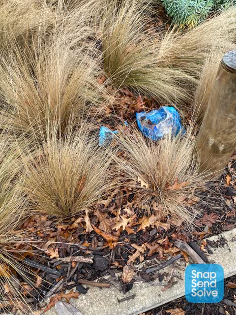
 No rubbish bin. People leaving dog poo.
Graffiti —
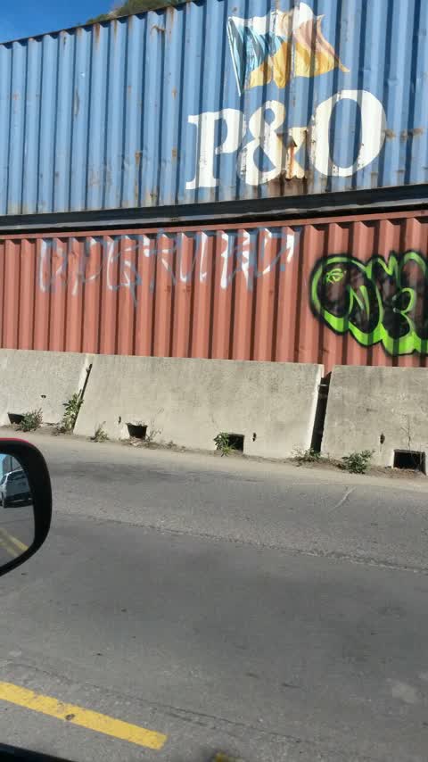
Containers with graffiti. Maersk
Also reported on Main Road
- 202A Main Road — 69 reports
- 202 Main Road — 23 reports
- 1 Main Road — 22 reports
- 81 Main Road — 21 reports
- 200A Main Road — 20 reports
- 59 Main Road — 13 reports
- 150 Main Road — 13 reports
- 128 Main Road — 12 reports
The street’s crash record
NZTA’s record names Main Road in 38 crashes that hurt somebody since 2006 — 1 person killed, 11 seriously hurt.
The green nearby
- Redcliffs Park — 110 m to the edge · Sports ground · 2 ha
- Balmoral Hill Reserve — 275 m to the edge
- Mccormacks Bay — 350 m to the edge · Sports ground · 22 ha
- Beachville Reserve — 487 m to the edge
Parks within half a kilometre, measured to the boundary — the council’s open data.
On the doorstep
- Redcliffs Mt Pleasant Bowling Club — 385 m away · Clubs
- BP2Go Redcliffs — 390 m away · Petrol stations
Businesses within four hundred metres, measured at the pin — OpenStreetMap and the council directories.
The bus nearby
The closest Metro stops, within four hundred and fifty metres.
The tracks through here
- Walk and bike track through Redcliffs — 11 m to the line · walk · bike
Tracks whose line passes within half a kilometre, measured to the line itself — the council’s open data.
The named ground
Named water within 500 m of this address, measured to the line or the edge; Named places within 1.5 km of this address; the council’s own structure register — bridges, boardwalks and steps standing nearby — the open map’s record.
The remembered names nearby
- These Swings Are a Gift From Reuben, for Everyone to Enjoy — 114 m away ·
These swings are a gift from Reuben, for everyone to enjoy. / Reuben Murray Smith / 24.1.2
· 1899
Inscribed plaques within two hundred and fifty metres — the register’s pins, not surveyed spots. The whole roll is at /plaques.
Renting nearby
new bonds in Redcliffs ran about $700 a week — $150 above the city median of $550 — the suburb page keeps the rent record →.
What was here — Te Ana o Hineraki/Moa Bone Point Cave and Setting
200 m away · 8A Balmoral Lane · located to ±58 m · the place’s own record →
On the register. Nothing researched here yet.
The civic layer
This ground votes in Heathcote ward — the Spreydon-Cashmere-Heathcote community board. Ward lines don’t always follow suburb lines; this one is measured at the pin, not the suburb’s centre.
What stood on this ground → · On the map → · From the air — the Crown’s aerials back to 1936; search the address on RetroLens →
Questions, answered briefly
15 council reports on record since April 2016 — most often overgrown vegetation (3), water leak (2), vandalism - general (1).
Redcliffs, Christchurch — on Main Road.
The heritage register names a place at or beside it — Te Ana o Hineraki/Moa Bone Point Cave and Setting.
Redcliffs Park — 110 m to its edge, 2 ha.