5 Aldgate Street, Redwood
23 reports on record since March 2016 · 19 with photographs. The most-reported address on Aldgate Street. Indicative rating valuation and school zones, hazards, bin day and what stood here before.
What gets reported here
- Roading/Streets — 15
- Street Cleaning — 3
- Rubbish/Recycling — 2
- Parks — 2
- Roads - General — 1
Photographed here 19 on record


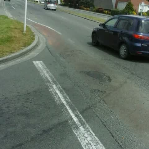
Reported here
 Street Cleaning —
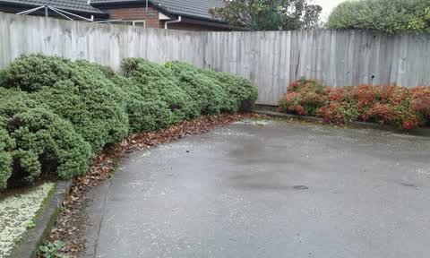
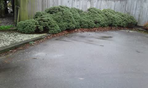
 I've raked the leaves together for easy truck sweeper access.
 Street Cleaning —
 I'll raked all the leaf left together to give sweeper truck access.
- Roads - General —
 Street Cleaning —
 Last week the seet sweeper 'missed' most of the leaf material at the col-de-sac of Aldgate street. I have now swept it all out from the corn
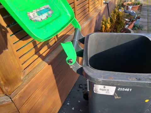
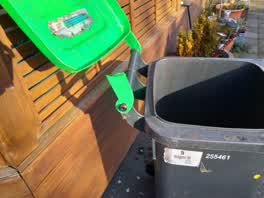 Rubbish/Recycling —
 My green bin lid hinge was unfortunately broken by Waste Management when emptying my bin into their truck this morning :-( Can I please have
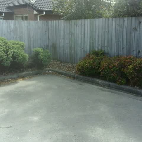
Roading/Streets —
Missing vegetation. Dead plants/scrubs/vegetation have not been replaced since they were removed
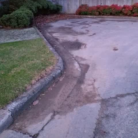
Roading/Streets —
Mud, dirt and debris needs cleaning up after major water burst repairs outside 8 Aldgate st (impressive 8m fountain!) more than 2 weeks ago.
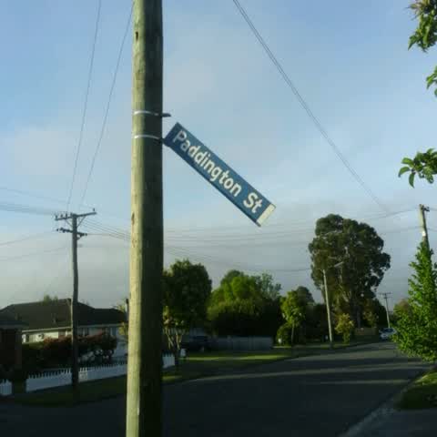
Roading/Streets —
Loose Street sign. Corner Paddington St + Uxbridge St
Parks —
Assume someone has a contract to care for councils and of street planting on Aldgate st? These bushes have long been in great need of being
Roading/Streets —
The street sweeping trick came last our little cul-de-sac this morning and missed the entire end of the street. There was no attempt to swee
Parks —
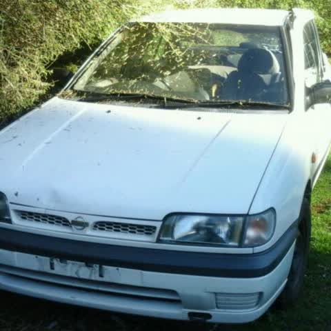
Abandoned car adjacent to toilet block and Hussey's Rd carpark of Styx Mil Reserve.
Roading/Streets —
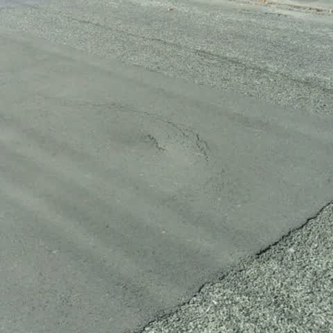
Developing pothole in middle of road btw 36+39 Uxbridge Rd, Casebrook. Previous hole repaired in same location. ...? , sub-surface erosion/d
- Roading/Streets —
Northern Cyclepath light NOT working. 1st light on northern side of Glendovey Rd.
- Roading/Streets —
Large Pothole in Sawyers Arms Rd at West bound exit from Johns Rd
Roading/Streets —
Damaged road surface/potholes at the junction of the left turning lane from Anzac drive onto Main North Rd southbound carriageway in the cyc
- Roading/Streets —
Cnr Sissons Drive-Sawyers Arms Rd-cyclepath control lights NOT being triggered automatically by cycle mvt. All other control lights includin
Roading/Streets —
Overgrown vegetation and uncleared shared pathway restricting mvt and causing narrowing on QE2 drive btw Main North Rd and Innes Rd. Needs h
Rubbish/Recycling —
Several yellow bins left upturned and not properly emptied by rubbish collection trick operator.
Roading/Streets —
Broken signage corner Uxbridge street/Tuckers Rd outside 61 Uxbridge Rd.
Roading/Streets —
Xs vegetation-needs pruning. Northern cycleway/Railtrail btw Mona Vale and Harewood rd
Roading/Streets —
Railway cycle path-NorthernLine btw Sawyers arms rd and Langdons. Bushes/Branches need trimming and roots in asphalt.
Roading/Streets —
Street signage repair-cnr Paddington/Uxbridge,Casebrook NB- alternative locator function not working properly
Roading/Streets —
QEII Cycle/walkway opp St. Bed's college 2/3 overgrown and low hanging branches on a long stretch. On the pic my mintgreen bike is parked pa
Also reported on Aldgate Street
- 8 Aldgate Street — 6 reports
- 1 Aldgate Street — 6 reports
- 3 Aldgate Street — 5 reports
- 2 Aldgate Street — 3 reports
- 4A Aldgate Street — 1 report
- 4 Aldgate Street — 1 report
- 2/1 Aldgate Street — 1 report
The street’s crash record
NZTA’s record names Aldgate Street in 1 crash that hurt somebody since 2006 — 0 seriously hurt, nobody killed.
The green nearby
- Paddington Playground — 181 m to the edge · 1 ha
- Redwood Park — 324 m to the edge · Sports ground · 7 ha
- Grampian Reserve — 398 m to the edge · 1 ha
- Marlene Reserve — 402 m to the edge
- Heaphy Reserve — 435 m to the edge
Parks within half a kilometre, measured to the boundary — the council’s open data.
On the doorstep
- Northcote Community Dental Clinic — 273 m away · Dentists
Businesses within four hundred metres, measured at the pin — OpenStreetMap and the council directories.
The bus nearby
- Veitches Rd near Cavendish Rd — 392 m away · route 107
- Veitches Rd near Cavendish Rd — 417 m away · route 107
The closest Metro stops, within four hundred and fifty metres.
The tracks through here
- Walk and bike track through Redwood — 66 m to the line · walk · bike
- Walk and bike track through Redwood — 153 m to the line · walk · bike
- Walk and bike track through Redwood — 301 m to the line · walk · bike
- Walk and bike track through Redwood — 325 m to the line · walk · bike
- Walk and bike track through Redwood — 439 m to the line · walk · bike
Tracks whose line passes within half a kilometre, measured to the line itself — the council’s open data.
The named ground
Named water within 500 m of this address, measured to the line or the edge — the open map’s record.
Renting nearby
new bonds in Redwood ran about $542 a week — about the city median — the suburb page keeps the rent record →.
The civic layer
This ground votes in Papanui ward — the Papanui-Innes-Central community board. Ward lines don’t always follow suburb lines; this one is measured at the pin, not the suburb’s centre.
What stood on this ground → · On the map → · From the air — the Crown’s aerials back to 1936; search the address on RetroLens →
Questions, answered briefly
23 council reports on record since March 2016 — most often roading/streets (15), street cleaning (3), rubbish/recycling (2).
Redwood, Christchurch — on Aldgate Street.
Nothing on the heritage register at this exact spot — the record around this ground →
Paddington Playground — 181 m to its edge, 1 ha.