Roading/Streets
Reported Monday, 16 March 2020 at 11:50 am, 352 Worcester Street, Linwood, Christchurch 8011, New Zealand.
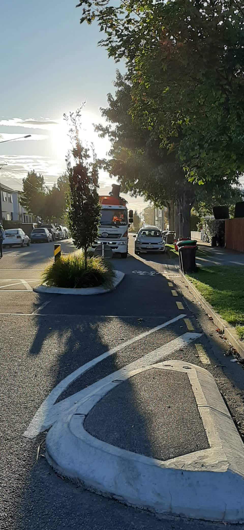
The reporter’s words
poor layout causes rubbish truck to completly block the speed hump and therefore forcing cyclists into vehicles path putting them at risk. this is a clear fault of the layout and occurs at every speed hump along the street. this is supposed to be a safe cycle route yet issues like this occur post construction to this day due to not being identified during design or review. this issue would not occur if it was a separated like colombo street.
The filing
- Filed
- Monday, 16 March 2020 at 11:50 am
- Report number
- #1,023,018
- Filed under
- roads
- Coordinates
- the pin on the map →
Also at this address one of 19
 Hazard, vehicle14 Sept 2026
 Flooding18 Apr 2025
 Flooding19 Mar 2025
 Graffiti on a fence, building or structure3 Mar 2025
 Dumped Rubbish19 Feb 2024
- Graffiti24 Nov 2023
The council’s work orders, near this pin
- Road Layout0 m away · open, filed 16 Mar 2020 · probably the same job, filed through both doors
- Road Layout70 m away · resolved 11 Mar 2020, took 16 hours · probably the same job, filed through both doors
- Litter (Road)1 m away · resolved 23 Feb 2021, took 5 days
- Road Layout1 m away · resolved 26 Nov 2019, took 6 weeks
- Litter2 m away · resolved 8 Jul 2026, took 8 months
- Litter3 m away · resolved 8 Jul 2026, took 8 months
- Litter4 m away · resolved 8 Jul 2026, took 13 months
- Sweeping4 m away · resolved 2 Jul 2024, took 5 weeks
MyCouncilTicket is the council’s own work-order stream, a different door from the public report above, and the same job can stand in both. The whole ticket roll →
Where this sits
The address352 Worcester Streetone of 19 reports at this address, the address’s whole recordThe streetWorcester Streetthe street’s record, every report on itThe suburbLinwoodthe suburb, in depthThe problemRoading/Streetsevery filing of its kind on the city’s booksThe date16 Marchthis date in the archive, across the yearsThe year2020the year’s shelf and ledgerThe mapOn the mapthe pin, among its neighboursBeforeWhat stood herewhat the archive knows of this ground
The feed listed this report when a sweep caught it 5 Sept 2026, it has not been listed since. The record here does not move.